4

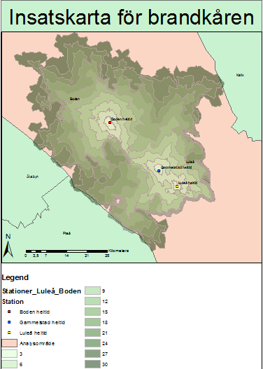
I have a layer with locations for 3 different fire stations and one hospital with a helipad. I have created a network dataset to calculate how long it takes for the firemen to arrive to various locations around the map layer.

Now I want to calculate the rescue time for the chopper from the helipad assuming it flies at a speed of 100 knots. However I'm unable to find a way to do this. I have googled and found ways to calculate flight times but none that involves the network analysis tool.

Any ideas?

EDIT: Example for what I want to do, but with chopper times instead.

Example

3
  • 1
    This is less a "network" analysis then a cost surface model. If you don't have Spatial Analyst you could model with a very fine triangle tessellation (hexagons with inner inverted triangles), but it would be less accurate...
    – Vince
    Commented Jan 9, 2016 at 22:16
  • This is not really a network. If you are looking for network approach you may be barking up the wrong tree. I second Ericas approach. Commented Jan 10, 2016 at 1:23
  • I added attributes to the layer like "maximum speed", "minutes", "seconds" "oneway". Then i used network analysis and chose 3 minutes interval all the way up to 30. And then i got the rescue times for different locations. Isn't this a network approach? I calculated road links also...
    – Kangaroo
    Commented Jan 10, 2016 at 17:41

2 Answers 2

7

Network Analyst uses a network of roads, because straight-line distance does not accurately represent the roads that a fire truck must drive on. This is especially true if there are geographic barriers (rivers or streams) or in a rural area with fewer roads.

In contrast, flight time analysis would not use a network because planes or helicopters can travel in straight lines. A simple Euclidean Distance raster will give you a representation of a rescue helicopter's travel time.

If there are obstacles to helicopter travel (flight exclusion zones, large skyscraper buildings, mountains), Cost Path may be a better approach, but that is likely more complex than necessary for most situations.

5
  • Thanks for your response. Well I used euclidean distance and got flight distance. But I need to get calculations for how long it takes for the chopper to reach different distances when it travels at a speed of 100 knots. Is it possible to do this? Maybe i can do a network analysis with the euclidean distance results? Is that possible?
    – Kangaroo
    Commented Jan 10, 2016 at 17:36
  • 1
    No, network analysis requires a network. Just Divide the distance raster (e.g. miles) by speed (e.g. 120 knots = 138 miles per hour) and you'll get the travel time (in hours). That can all be done with Spatial Analyst tools.
    – Erica
    Commented Jan 10, 2016 at 17:40
  • Okay i guess that's why i was unable to solve this, because i was working it from the wrong angle. I was trying ways to get it to work with the network analysis tools. Is there some tool to display what locations is faster for the fire truck and what locations that are faster with the helicopter? I got the rescue times for the fire truck on the pic on original post. Sorry for the noobness, I just started using ArcGIS.
    – Kangaroo
    Commented Jan 10, 2016 at 17:54
  • 1
    Hmm. If you can get your fire truck travel times into a raster as well (Polygon to Raster) then you could do a comparison (Con) to see whether the value of the Helicopter or Truck raster was smaller (e.g. shorter travel time), that ought to work :)
    – Erica
    Commented Jan 10, 2016 at 17:56
  • Ok, I did this. I converted the fire truck travel times to a raster. Then I tried doing a Con but i get "ERROR 010067: Error in executing grid expression. Failed to execute (Con)." Any idea what's wrong?
    – Kangaroo
    Commented Jan 11, 2016 at 19:17
1

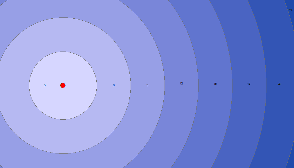
Here is a workflow you can use if you want distance rings as polygon features (instead of a raster).


Step 1: Calculate Distances

For 3 minute intervals, with 100 knots = 3086.66667 m/min:

  • d1 = 3086.66667 * 3 = 9260 [m]
  • d2 = 3086.66667 * 6 = 18520

  • dN = 3086.66667 * 3 * N


Step 2: Buffer Geometry

Run the Multiple Ring Buffer tool with your calculated distance values. Use your helipad point as input feature.


Step 3: Add Minutes Field

Add an integer field called Minutes to the distance ring feature class.

Run Field Calculator with the following VBScript expression:

Minutes = Round([distance] / 3086.66667)


Result

Result

Your Answer

By clicking “Post Your Answer”, you agree to our terms of service and acknowledge you have read our privacy policy.

Not the answer you're looking for? Browse other questions tagged or ask your own question.