For euclidean distance:
You can use Near Tool to calculate the closest points to your input features.
This tool will calculate the closest point for each features in your input layer (it can be line or point type).
You need to pass:
Input features - highway;
Nearest features - points and set radius;
than optionally you can mark location and angle.
After that you'll get in highway layers attribute table new columns: Near FID (id of the nearest point to this feature from point layer) and few others.
If you need do this with network:
Check out the Closest Facility tool. First create the network from your roads (highways or whatever), then click Network Analyst -> New Closest Facility then few layers will show in your Table of Contents.
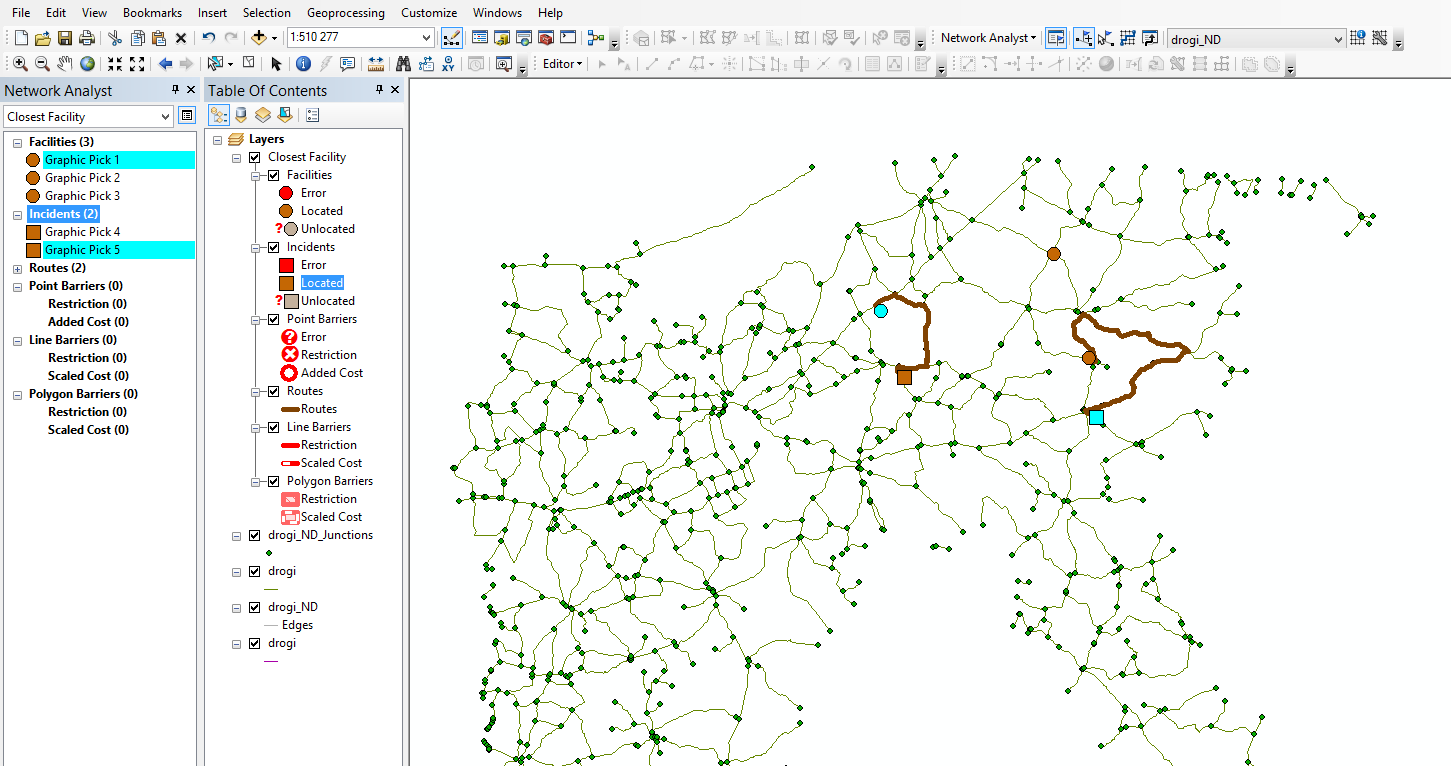
Now all you need to do is load your enterance ramps to the Facilities layer and points to Incidents layer. Now on your map you should have marked all ramps as circles and all points as squares as default.
If you click to solve button, you'll get polylines between closest object in both layers. You can also set the options like number of closest points or other useful things by click on the closest facility properties at network analysis frame.

Picture above shows all that I described.

