5

A typical coordinate is given as 68 35 067 N 123 54 817 W.

I thought maybe some old timers could help me out. The author says in his report of the time that they were using a GPS, but I contacted him and he doesn’t remember any of the details. The points can be located on a map using the first two pairs of two digits, so I’m pretty sure it’s degrees minutes, but the last three digits don’t make sense. Since some are greater than 600 it’s not seconds with another significant figure, i.e, a missing decimal point.

Any ideas? I’m thinking there was some “convention” early in the personal GPS receiver days. The original information is scattered throughout the text at http://traditionalarctickayaks.com/horton_trip_journal.htm

I'd like to use his info but without knowing how to interpret the last three digits I'm left with a ±2km precision.

5
  • Decimals of a minute?
    – FelixIP
    Commented Jul 1, 2016 at 17:10
  • 1
    My guess would be a decimal of a minute. I have run into that notation on older records. With the text you have and the fact it should be located on the river, could you try it out this way and see if it makes sense?
    – Tangnar
    Commented Jul 1, 2016 at 17:17
  • Why didn't I think of that? It's even an option in GoogleEarth which I just noticed. I'll try some of the points and see if they make sense. The first one I tried made sense—I'll have to see if others work out. Thanks
    – Greg
    Commented Jul 1, 2016 at 17:22
  • FelixIP is right, but I can't mark it so. And Spacedman pointed out why the coordinates were the way they were..
    – Greg
    Commented Jul 1, 2016 at 19:53
  • 1
    FWIW, this format isn't "old", just less commonly used.
    – Dan C
    Commented Jul 1, 2016 at 20:27

1 Answer 1

9

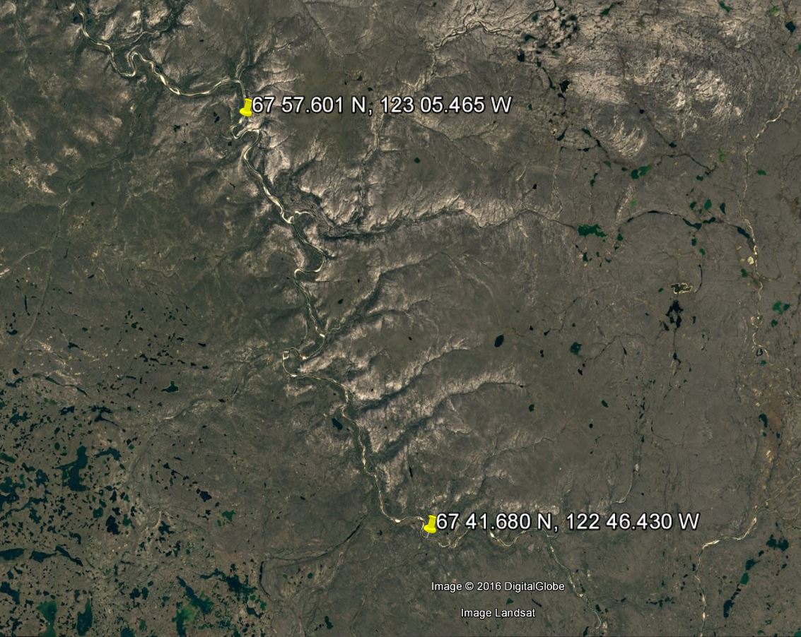
It appears to be decimals of a minute, as FelixIP suggested. So it could be written 68 35.067 N, 123 54.817 W and recognized in Google Earth. It's actually not too uncommon to see this notation.

I plugged in a couple of points this way, and they appear on the river course.

enter image description here

1
  • 1
    Data from early GPS units used the NMEA standard, which was degrees, minutes, and decimal minutes. So I suspect this is right.
    – Spacedman
    Commented Jul 1, 2016 at 18:18

Your Answer

By clicking “Post Your Answer”, you agree to our terms of service and acknowledge you have read our privacy policy.

Not the answer you're looking for? Browse other questions tagged or ask your own question.