3

When you go to a web map, the map server serves a set of tiles that control the detail displayed and the font size of feature labels based on the zoom level.

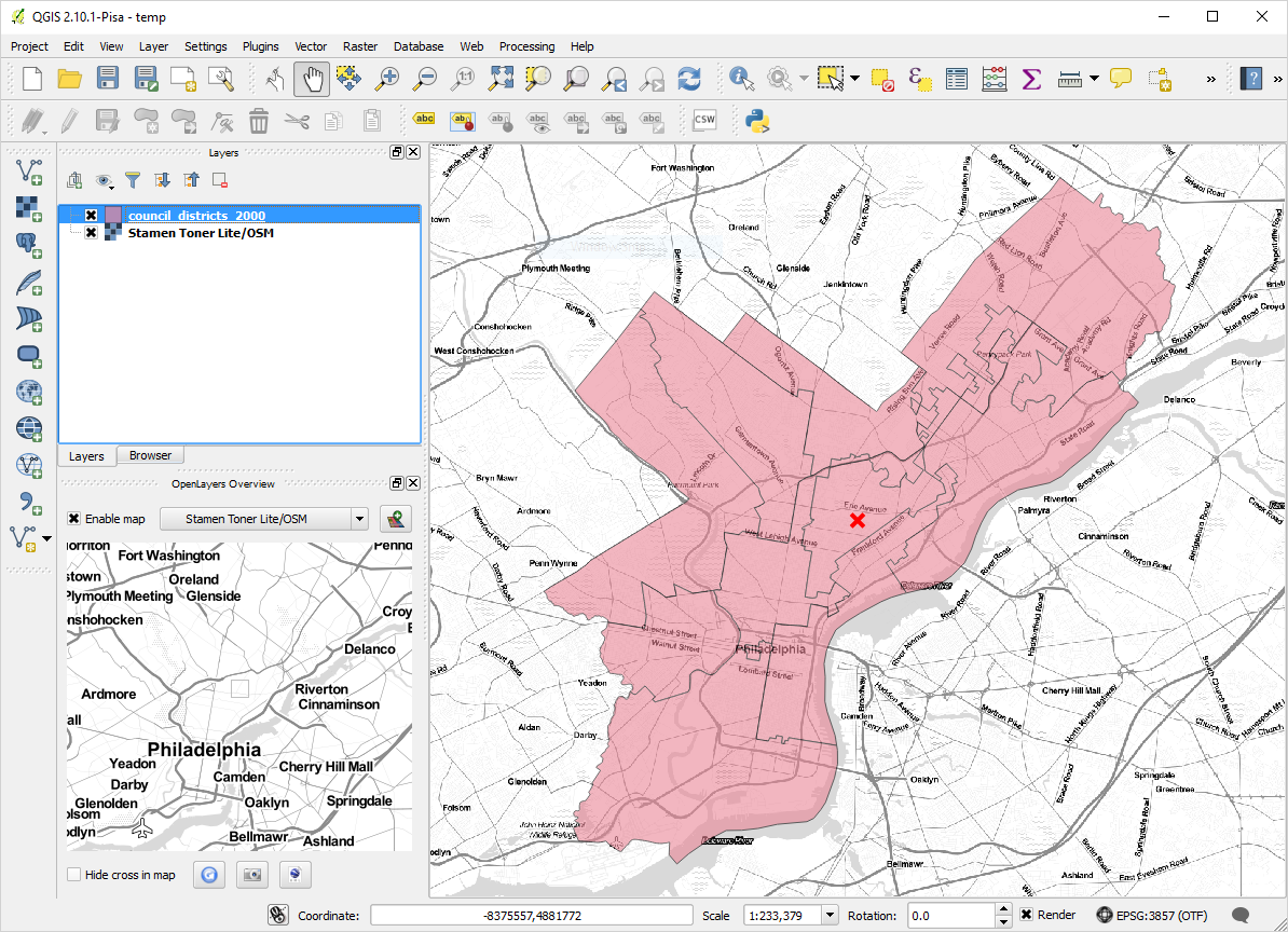
I am using the QGIS OpenLayers plugin to add a basemap in a project. The plugin must be choosing some zoom level to request for display. However, the zoom level chosen seems inappropriate to the area I am trying to create a print layout for. There are too many features labelled and the font sizes are too small (in some cases to the point of illegibility). See for example the difference between the zoom level chosen in the OpenLayers Overview pane (lower left), which seems reasonable for the area of interest, and the zoom level that appears in the main map (right).

enter image description here

How can the zoom level be adjusted when using the QGIS OpenLayers plugin?

2
  • OpenLayers plugin is more or less depricated. Did you try QuickMapServices plugin? To add more services Web/QuickMapServices/Settings and on the More Services tab push Get contributed pack button.
    – Zoltan
    Commented Sep 21, 2016 at 19:32
  • Thanks! I notice this also has a "Set proper scale" option, which seems to work, although it doesn't give fine-grained control. Please consider turning into an answer so I can accept it. Commented Sep 21, 2016 at 20:33

1 Answer 1

1

OpenLayers plugin is more or less deprecated. Did you try QuickMapServices plugin? To add more services Web/QuickMapServices/Settings and on the More Services tab push Get contributed pack button.

Your Answer

By clicking “Post Your Answer”, you agree to our terms of service and acknowledge you have read our privacy policy.

Not the answer you're looking for? Browse other questions tagged or ask your own question.