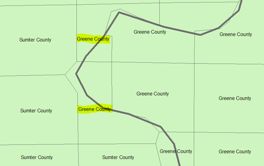
I am trying to spatially join characteristics from a larger unit (here: county) to a smaller unit (say, local district), such that for every local district I will also know in which county it is in.
The problem arises when a district lies in two (or more) different counties. In this case, I would like the local district to take the attributes from the county that covers most of the district's area. In the screenshot below,
the two local districts marked yellow were assigned attributes from the Greene County despite the fact that most of their area is within the Sumter County. The reason is that I used standard code
target_features = "district.shp"
join_features = "county.shp"
arcpy.SpatialJoin_analysis(target_features, join_features, out_feature_class)
and without any further options specified ArcPy (I guess) simply used the first county information it got hold off.
Is there an option that allows me to account for the area that a district shares with a county?
I have looked at the match_option CLOSEST but I think it does not do the job, because - depending on Green County's total size - its center might very well be closer to a borderline district even if that should be part of Sumter County (like the two yellow districts above).
I am new to ArcPy/GIS.

