I propose a solution using PyQGIS. Since we are dealing with bearings and directions, I preferred to preliminarily work on a Projected Coordinate System and then reproject the results in a Geographic Coordinate System.
For your case, I think that this projected CRS should be correct:
Azores Central 1995 / UTM zone 26N (EPSG 3063)
So, the first task is converting your two input shapefiles to this CRS (simply right click on the layer, set the above CRS and select "Save As").
Once you have done this, you only need to run the following code as a new script from Processing:
##Points=vector point
##Polygons=vector polygon
##Search_distance=number 500

from qgis.core import *
import math

p_layer = processing.getObject(Points)
crs = p_layer.crs().toWkt()
poly_layer = processing.getObject(Polygons)

# Create the output layer
outLayer = QgsVectorLayer('Point?crs='+ crs, 'land' , 'memory')
prov = outLayer.dataProvider()
fields = p_layer.pendingFields()
prov.addAttributes(fields)
outLayer.updateFields()

all_polygons = {}
index = QgsSpatialIndex()
for ft in poly_layer.getFeatures():
    index.insertFeature(ft)
    all_polygons[ft.id()] = ft

for feat in p_layer.getFeatures():
    attrs = feat.attributes()
    point = feat.geometry().asPoint()
    points = [feat.geometry().asPoint()]
    angle = math.radians(90-(feat["bearing"]))
    dist_x, dist_y = (Search_distance * math.cos(angle), Search_distance * math.sin(angle))
    tmp_point = QgsPoint(point[0] + dist_x, point[1] + dist_y)
    points.append(tmp_point)
    tmp = QgsFeature()
    tmp.setGeometry(QgsGeometry.fromPolyline(points))
    line_geom = tmp.geometry()
    idsList = index.intersects(line_geom.boundingBox())

    for id in idsList:
        tmp_feat = all_polygons[id]
        if line_geom.intersects(tmp_feat.geometry()):
            diff = line_geom.difference(all_polygons[id].geometry())
            t_test= diff.asMultiPolyline()
            if t_test: # it's a MultiLineString
                final_point = QgsPoint(t_test[0][1][0],t_test[0][1][1])
            else: # it's a LineSring
                t_test=diff.asPolyline()
                final_point = QgsPoint(t_test[1][0],t_test[1][1])

    outFeat = QgsFeature()
    outFeat.setAttributes(attrs)
    outFeat.setGeometry(QgsGeometry.fromPoint(final_point))
    prov.addFeatures([outFeat])

# Add the layer to the Layers panel
QgsMapLayerRegistry.instance().addMapLayer(outLayer)
Two remarks:
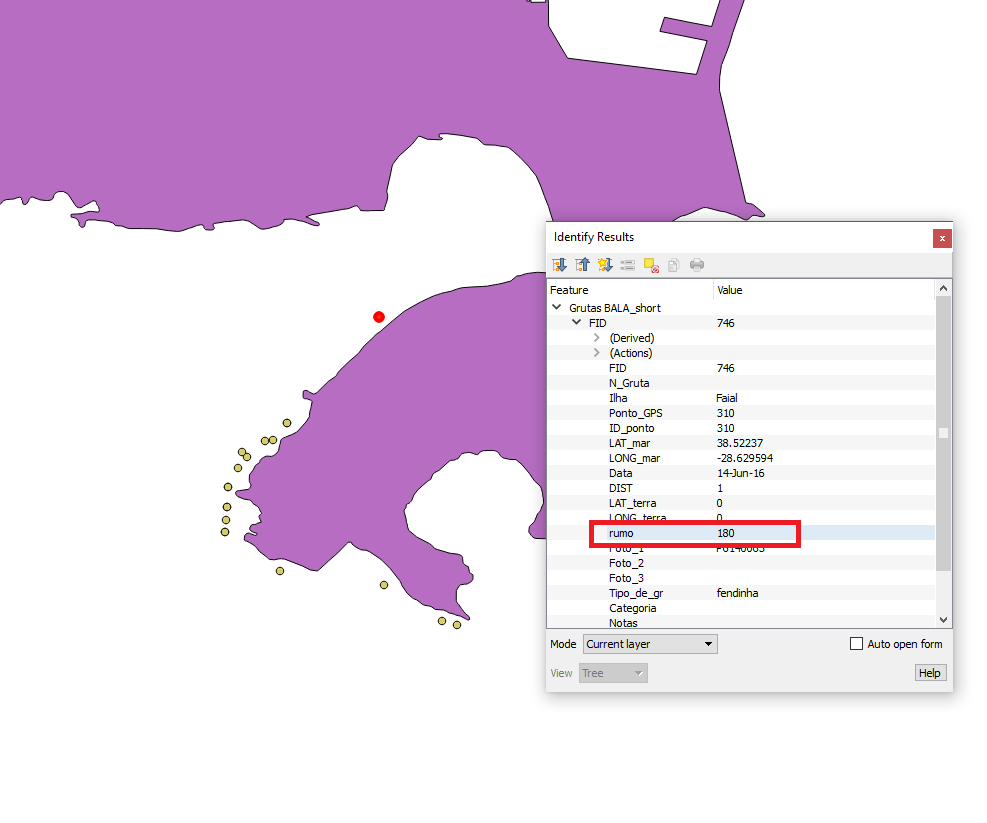
- In the above code, remember to adapt the name for the field which
stores the bearings (so, change
feat["bearing"] to feat["<name_of_the_field>"]);
- As you can see, there is an additional parameter to insert (
Search_distance): ideally, it is an infinite line from the point towards the desired direction, but I set it to 500 m which should be enough. Setting distances which lead the infinite line to intersect a polygon feature for many times may lead to the creation of the new point in the wrong location (I think you don't need to set distances bigger than mine, but you are advised).
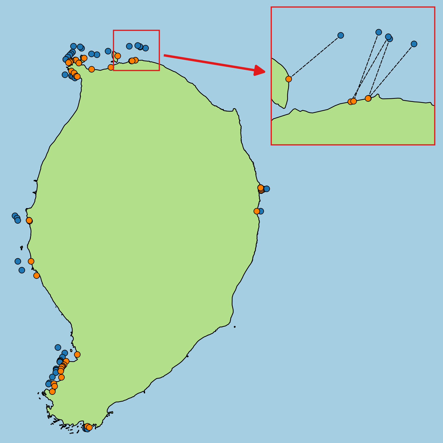
With these premises, this will be the result (the black dashed lines are not a result, but they help to understand it):

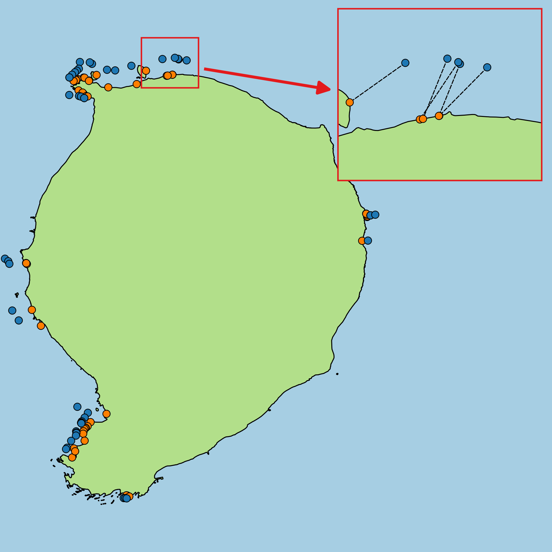
The result is still in the projected CRS, but you can simply turn back to WGS84 if you right click on the output layer, set the desired CRS and select "Save As" (the result will be still correct):


