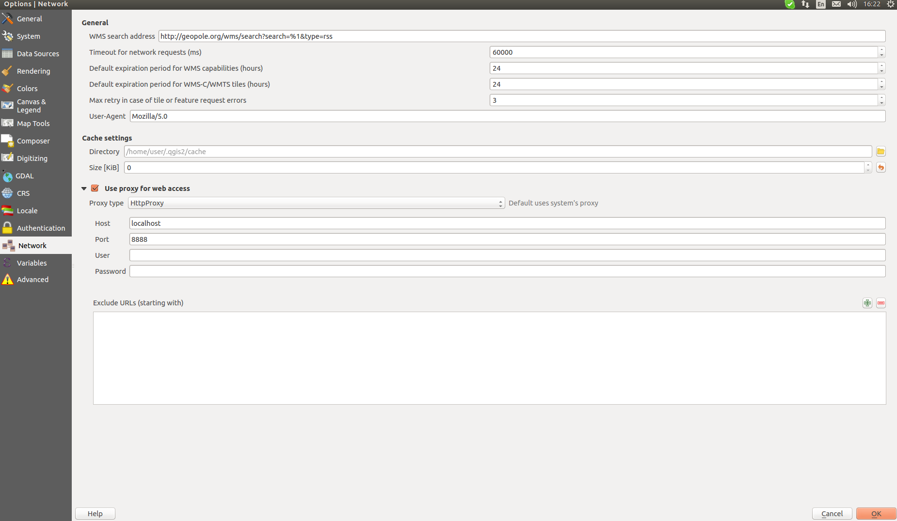
I want to capture requests from QGIS WMS. So I set up Tinyproxy and configured QGIS: Settings\Options\Network and checked Use proxy for web access, set up localhost for Host, 8888 for Port and HttpProxy for Proxy type.
sudo tail -f /var/log/tinyproxy/tinyproxy.log
That's what I got in the log when loading new WMS layer taken from example:
CONNECT   May 23 16:26:21 [9237]: Connect (file descriptor 6): localhost [127.0.0.1]
CONNECT   May 23 16:26:21 [9237]: Request (file descriptor 6): GET http://mrdata.usgs.gov/services/ca?version=1.1.1&SERVICE=WMS&REQUEST=GetCapabilities HTTP/1.1
INFO      May 23 16:26:21 [9237]: No upstream proxy for mrdata.usgs.gov
CONNECT   May 23 16:26:21 [9237]: Established connection to host "mrdata.usgs.gov" using file descriptor 7.
INFO      May 23 16:26:22 [9237]: Closed connection between local client (fd:6) and remote client (fd:7)
CONNECT   May 23 16:26:22 [8787]: Connect (file descriptor 6): localhost [127.0.0.1]
CONNECT   May 23 16:26:22 [8787]: Request (file descriptor 6): CONNECT mrdata.usgs.gov:443 HTTP/1.1
INFO      May 23 16:26:22 [8787]: No upstream proxy for mrdata.usgs.gov
CONNECT   May 23 16:26:22 [8787]: Established connection to host "mrdata.usgs.gov" using file descriptor 7.
INFO      May 23 16:26:22 [8787]: Not sending client headers to remote machine
CONNECT   May 23 16:26:29 [8788]: Connect (file descriptor 6): localhost [127.0.0.1]
CONNECT   May 23 16:26:29 [8788]: Request (file descriptor 6): GET http://mrdata.usgs.gov/services/ca?version=1.1.1&SERVICE=WMS&REQUEST=GetCapabilities HTTP/1.1
INFO      May 23 16:26:29 [8788]: No upstream proxy for mrdata.usgs.gov
CONNECT   May 23 16:26:30 [8788]: Established connection to host "mrdata.usgs.gov" using file descriptor 7.
INFO      May 23 16:26:30 [8788]: Closed connection between local client (fd:6) and remote client (fd:7)
CONNECT   May 23 16:26:31 [8785]: Connect (file descriptor 6): localhost [127.0.0.1]
CONNECT   May 23 16:26:31 [8785]: Request (file descriptor 6): CONNECT mrdata.usgs.gov:443 HTTP/1.1
INFO      May 23 16:26:31 [8785]: No upstream proxy for mrdata.usgs.gov
CONNECT   May 23 16:26:32 [8785]: Established connection to host "mrdata.usgs.gov" using file descriptor 7.
INFO      May 23 16:26:32 [8785]: Not sending client headers to remote machine
CONNECT   May 23 16:26:32 [8793]: Connect (file descriptor 6): localhost [127.0.0.1]
CONNECT   May 23 16:26:32 [8793]: Request (file descriptor 6): CONNECT mrdata.usgs.gov:443 HTTP/1.1
INFO      May 23 16:26:32 [8793]: No upstream proxy for mrdata.usgs.gov
CONNECT   May 23 16:26:32 [8793]: Established connection to host "mrdata.usgs.gov" using file descriptor 7.
INFO      May 23 16:26:32 [8793]: Not sending client headers to remote machine
INFO      May 23 16:27:02 [8785]: Closed connection between local client (fd:6) and remote client (fd:7)
The layer is loaded and displayed. When I begin to move the map or zoom in the image is successfully reloaded, but that's all I have in the log:
CONNECT   May 23 16:29:32 [8789]: Connect (file descriptor 6): localhost [127.0.0.1]
CONNECT   May 23 16:29:32 [8789]: Request (file descriptor 6): CONNECT mrdata.usgs.gov:443 HTTP/1.1
INFO      May 23 16:29:32 [8789]: No upstream proxy for mrdata.usgs.gov
CONNECT   May 23 16:29:32 [8789]: Established connection to host "mrdata.usgs.gov" using file descriptor 7.
INFO      May 23 16:29:32 [8789]: Not sending client headers to remote machine
Why are there no GetMap requests in tinyproxy log? How can I trace all the requests?
QGIS 2.18.4

