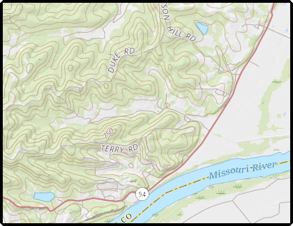
I have a simple OpenLayers 3 map with a topo layer that is cascaded from a USGS WMS through my GeoServer / GeoWebCache system. The tile zoom level resolution is correct when the GeoWebCache is turned off, but I get the wrong resolution tiles from the cascaded USGS link when I turn on the caching with the GeoServer GeoWebCache. For example, at zoom level 13, the tiles should show 50-foot contours like this:
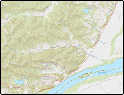
When the caching for the layer with GeoWebCache is turn on, the tiles showing 20-foot contours for level 14 are rendered into level 13 like this:
It is the same for all zoom levels. When caching is turned on, the current zoom level gets the tiles for the next zoom level.
The zoom level tile resolution problem started when the USGS moved this layer and their other cached layers to Amazon Cloud on July 1, 2017.
Why does this happen just when the caching is turned on for the integrated GeoWebCache or when going through the separate stand alone GeoWebCahce?


