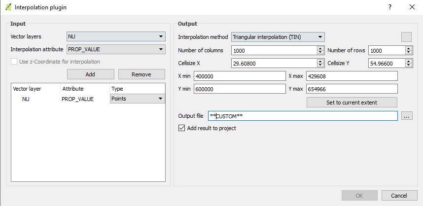
When using the interpolation plugin over the OS terrain data for national grid square NU, the pixels of the resultant raster are not square, but rectangular. Furthermore, I'm not able to produce viewsheds from the interpolated terrain data. I've conducted multiple tests against other national grid squares which work perfectly well.
I've shared the contours for you to have a go at interpolating. Settings are shown below.
If you are able to produce terrain data from my shared shapefile with square pixels, please could you share the result and mention any ideas as to what I might be doing wrong?

