1

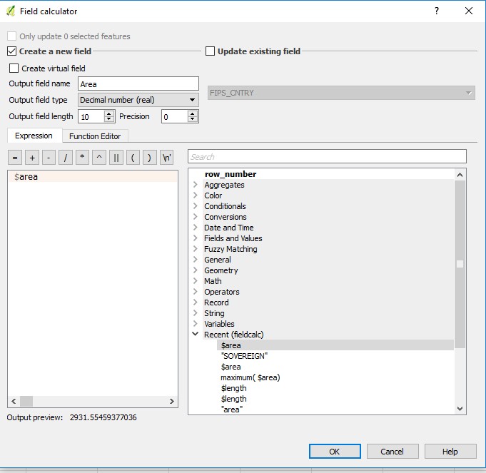
I have calculated the area of polygons in my map in the Attribute Table with the Field calculator

enter image description here

This command gives me a new column with the area for each polygon

enter image description here

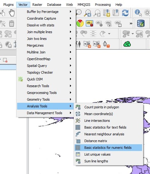
Then I go to the "Basic Statistics for numeric fields" option in the Analysis Tools at the vector toolbar.

enter image description here

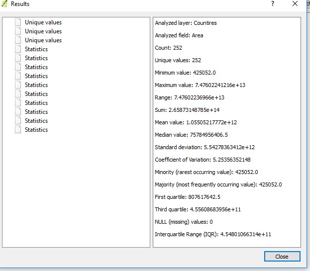
Unfortunately the statistics is displayed with the "e" coefficient

enter image description here

How can I have it as a full number and not in this short version?

1 Answer 1

1

I have spent some time and figured it out.

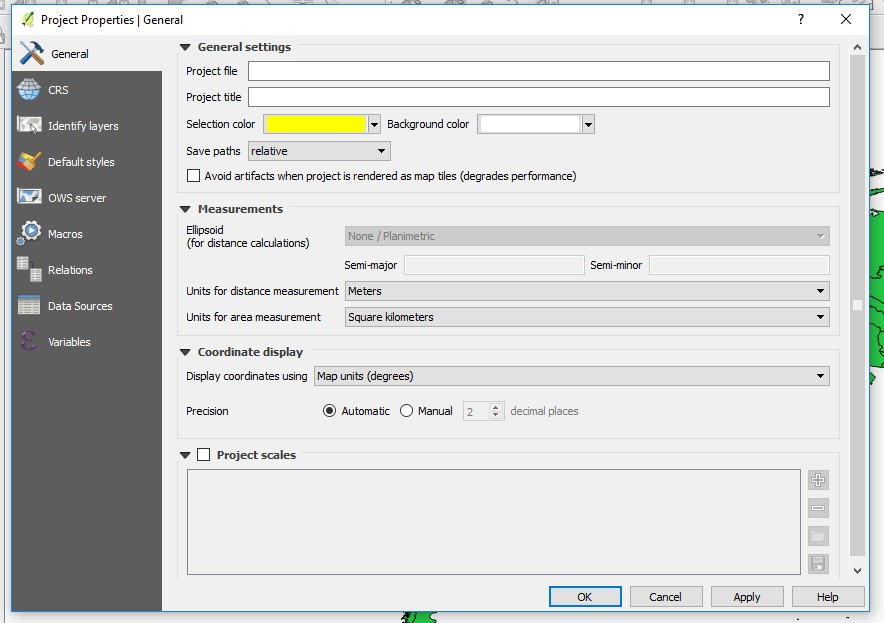
I went to the "Measurements" in the project properties and change the area measurements to square kilometers, so me numbers will be much shorter as the calculate for square meters. enter image description here

Then I calculated the area output field type as a "Decimal number (real)" enter image description here

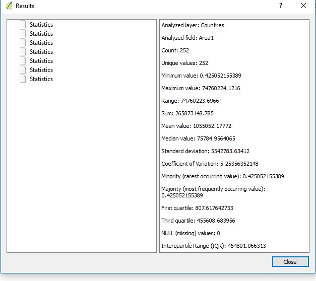
And when I want back to the "Basic Statistics for numeric fields" the display was as almost as I wanted enter image description here

2
  • 1
    What country has the maximum value? Is that the largest country? You are getting pretty close to the maximum for a integer: 2147483647
    – HeikkiVesanto
    Commented Aug 9, 2017 at 12:50
  • 1
    @Vesanto you are right to ask this question there was some kind of mix up with the print screen and I have make it right. To your question: the country is Antarctica with 74760224 Square kilometers Commented Aug 9, 2017 at 13:58

Your Answer

By clicking “Post Your Answer”, you agree to our terms of service and acknowledge you have read our privacy policy.

Not the answer you're looking for? Browse other questions tagged or ask your own question.