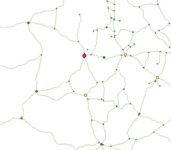
I have three tables ==> ways, nodes and cities (OpenStreetMap)
ways : Edges with required attributes for routing (source, target, cost, etc.)
nodes : Each and every nodes linking the edges
cities : The actual nodes I'll use to compute shortest ways
I need to have the shortest way between each adjacent cities, which means I don't want to calculate the shortest way between each and every cities (this will take too much time and needs to be usable on a large dataset).
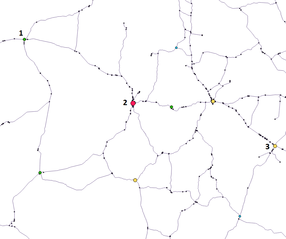
Below is a picture to have a better understanding of the problem. Keep in mind those numbers are arbitrary and I'm looking for a method that would be working on a large set of data (1000+ cities).
What I want is to find a way to compute the shortest way between [2, 1], [2, 3] but NOT [1, 3] as it will just be the addition of the two others.
For now, I've tried pgr_dijkstra MANY-TO-MANY with pgRouting, the problem is that when I supply the same array as source and target, it takes too much time and can't even display the results because of some memory issue. [id_node from the table cities has been extracted from the source/target of the road sections]
SELECT * FROM pgr_dijkstra('SELECT id, source, target, cost, reverse_cost FROM ways',
array(SELECT id_node FROM cities), array(SELECT id_node FROM cities), TRUE);
The main goal is to build a graph with cities as nodes, and ways (weighted by the time needed) as edges.
Is it possible to realize that using pgRouting or do I need to make a python script ? And in that case, are they some resources I can use ?
Edit 1: Network simplification
Following @ThingumaBob advice, I drastically simplified the network by removing unecessary nodes. This was actually harder as I thought because of underpasses/overpasses. I first tried to treat them as well but I just end up inserting them without simplification (I could have done it with a recursive function or else, but it was too much time for a small improvement).
I guess my code will speak of itself :
CREATE TABLE network (
  id serial NOT NULL,
  source integer,
  target integer,
  cost double precision,
  geom geometry(LineString,4326),
  CONSTRAINT network_pkey PRIMARY KEY (id))
  WITH (OIDS=FALSE);
ALTER TABLE network
  OWNER TO "Me";

--Inserting reconstructed network
INSERT INTO network (
--Merging the network and returning simple geometry without bridges (ST_Crosses)
WITH nobridges AS (SELECT (ST_Dump(ST_LineMerge(ST_Union(lines.geom)))).geom
          FROM ways AS lines
          WHERE NOT EXISTS (SELECT 1 FROM ways w
              WHERE ST_Crosses(w.geom, lines.geom))),
--Retrieval of bridges
    bridges AS (SELECT DISTINCT w1.geom
          FROM ways w1, ways w2
          WHERE ST_Crosses(w1.geom, w2.geom)),
--Union of the two geometries and adding an ID
    merged AS (SELECT (ROW_NUMBER() OVER ())::int AS id, tb.geom
          FROM (SELECT nb.geom FROM nobridges nb
                UNION
                SELECT b.geom FROM bridges b) AS tb),
--Re-computation of costs for each edges
     costs AS (SELECT m.id, sum(ST_Length(w.geom::geography)/1000)/
               avg(w.kmh::double precision) AS cost, m.geom
          FROM ways w, merged m
          WHERE ST_Contains(m.geom, w.geom)
          GROUP BY m.id, m.geom),
--Creation of nodes and adding an ID
     nodes AS (SELECT (ROW_NUMBER() OVER ())::int as id, nd.geom
          FROM (SELECT DISTINCT geom
                FROM (SELECT ST_StartPoint(m.geom) as geom
                      FROM merged m
                           UNION
                           (SELECT ST_EndPoint(m.geom) as geom
                           FROM merged m)) AS node_all) AS nd)
 --Creation of the final table by assigning a source and a target to each edges, thus, having a functional network system
SELECT c.id, n1.id as source, n2.id as target, c.cost, c.geom
    FROM costs c
    LEFT JOIN nodes n1
        ON ST_Intersects(n1.geom, ST_StartPoint (c.geom))
    LEFT JOIN nodes n2
        ON ST_Intersects(n2.geom, ST_EndPoint (c.geom))
);
In the end, I found myself reconstructing the graph from scratch but I guess this was a better solution as it was quite fast. I don't if it's properly optimized but it works...
It gives me this :

As it doesn't fix my problem, it still reduce potential shortest way calculation. I'm still open for any suggestions on how to calculate only directly-connected cities

