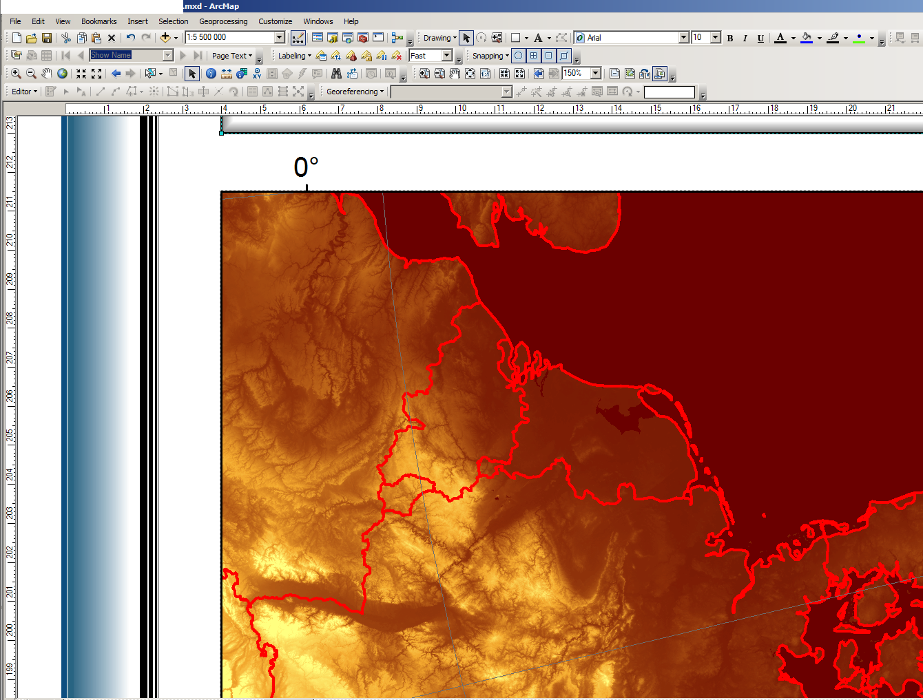
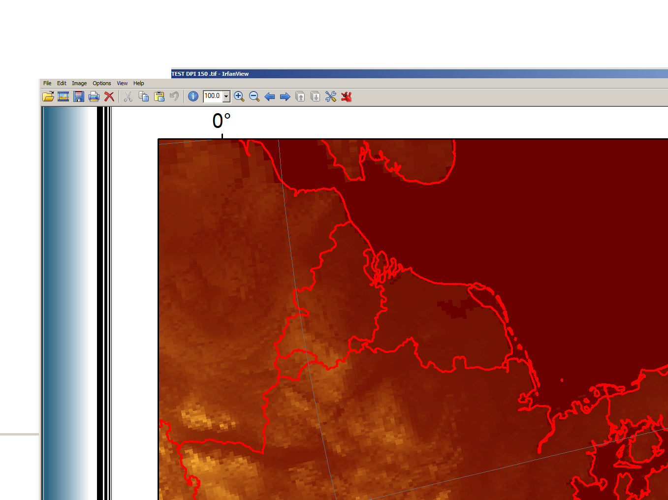
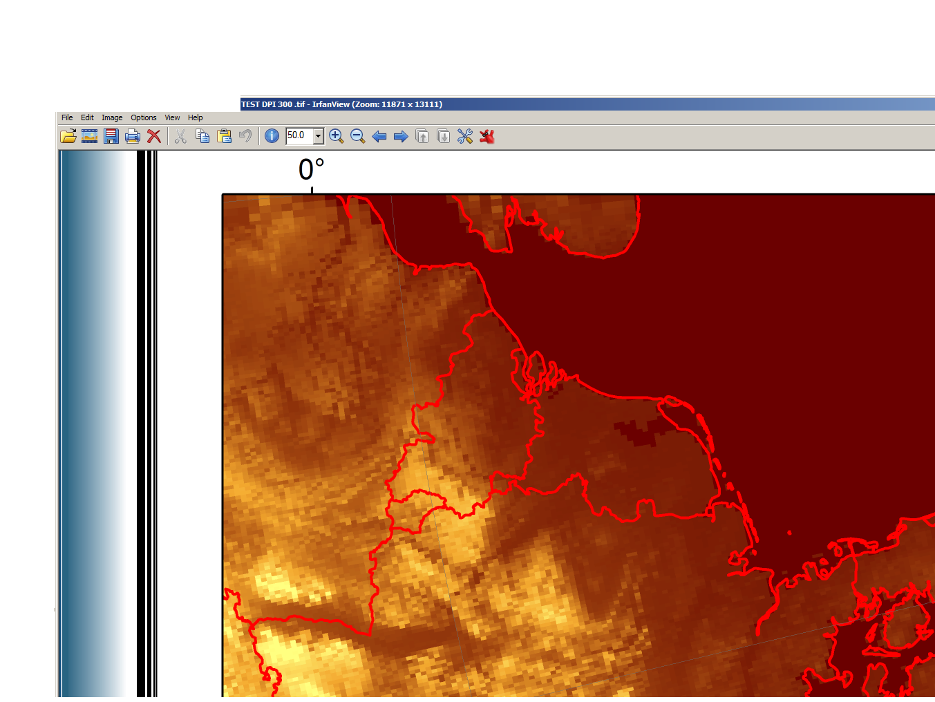
I have an ArcGIS project with raster and vector layers. I use the function Export map ... to export layout view to a tiff file with different DPI values (150 and 300). The resulting image is very different from what is displayed in the ArcGIS. The resolution of the raster layer is highly distorted regardless of the DPI option.
How to fix this issue?
 Pic 1. ArcGIS layout view (natural raster layer resolution).
 Pic 2. Export result - DPI 150 (raster layer resolution reduced).
 Pic 3. Export result - DPI 300 (raster layer resolution reduced same way as with DPI 150).

