0

I have a problem to convert UTM datasets in to a .gpx file. The dataset (800 sets) is like this:Name Number (Zone East North for UTM) Adam-Riese-Strasse 40 (32U 5550307,25 475061, 14). After importing from text file, I would like to convert the Layer, the problem is that I must select a field that contains MGRS coordinates. But I have 3 fields with coordinates. I have no idea how to continue. File:
Name Number Zone East North
Adam-Riese-Strasse 36 32U 5550231,21 474947,80
Adam-Riese-Strasse 37 32U 5550232,80 474949,70
Adam-Riese-Strasse 38 32U 5550290,58 475033,05
Adam-Riese-Strasse 39 32U 5550298,99 475047,33
Adam-Riese-Strasse 40 32U 5550307,25 475061,14

http://up.picr.de/32303039ss.jpg
I believe in the import I'm still doing something wrong. my layer has a different icon than yours. It looks like a word document icon in front of the name. in your picture it is a dot in front of the name I do not get anything in the map

4
  • You only need the "East" and the "Nord". What is the delimiter? For better help, you should upload the text file. Commented Apr 3, 2018 at 17:43
  • how do I upload the file?
    – Mani
    Commented Apr 3, 2018 at 17:59
  • the original is .xls. I exported it as a text file. I can choose the separator myself. Here I chose the blank
    – Mani
    Commented Apr 3, 2018 at 18:05
  • Ok that looks better. Where is your specific problem now? Space is a bad Separator. Commented Apr 3, 2018 at 18:32

1 Answer 1

2
Name;Number;Zone;North;East
Adam-Riese-Strasse;36;32U;5550231,21;474947,80
Adam-Riese-Strasse;37;32U;5550232,80;474949,70
Adam-Riese-Strasse;38;32U;5550290,58;475033,05
Adam-Riese-Strasse;39;32U;5550298,99;475047,33
Adam-Riese-Strasse;40;32U;5550307,25;475061,14

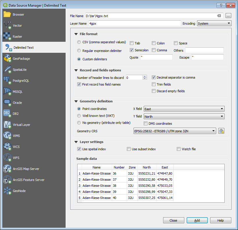
1) Import csv with EPSG: 25832 enter image description here

Choose EPSG:25832 for 32U

enter image description here

Note: North and East are reversed.

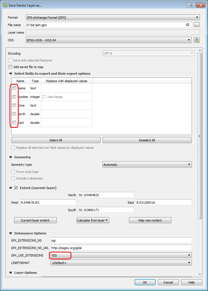
2) Export gpx with EPSG: 4326

enter image description here enter image description here

16
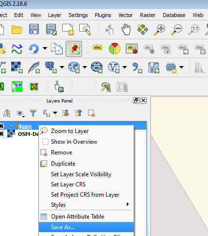
  • Right Click -> Layer Save as -> Format GPX Commented Apr 3, 2018 at 19:26
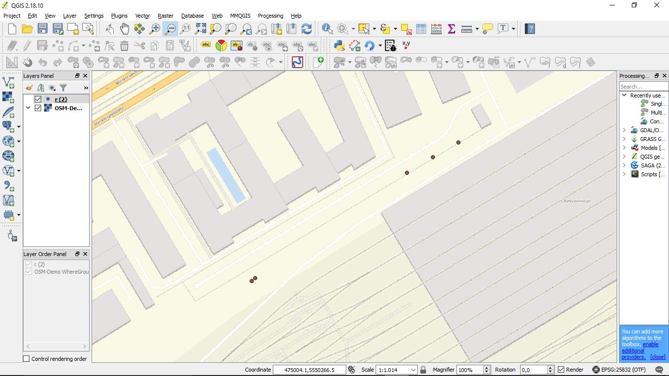
  • I believe in the import I'm still doing something wrong. my layer has a different icon than yours. It looks like a word document icon in front of the name. in your picture it is a dot in front of the name I do not get anything in the map
    – Mani
    Commented Apr 3, 2018 at 19:36
  • if I want to convert the file I use the extension: Lat Log Tools. I go to MGRS to Geometry. I only have 1 Field for Coordinates to choose from. How did you do the transformation?
    – Mani
    Commented Apr 3, 2018 at 20:22
  • I do not understand why you need the LatLonTools? 1) Import csv with EPSG: 25832 2) Export gpx with EPSG: 4326 Commented Apr 4, 2018 at 8:26
  • I've pasted a link to a picture. As you can see, I do the import just like you. But I do not create a dot file. What am I doing wrong?
    – Mani
    Commented Apr 4, 2018 at 12:15

Your Answer

By clicking “Post Your Answer”, you agree to our terms of service and acknowledge you have read our privacy policy.

Not the answer you're looking for? Browse other questions tagged or ask your own question.