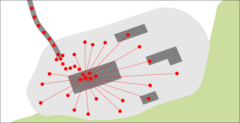
I have a GPS data including static measurements and would like to look more in detail on those static ones.
Is it possible to take the point cluster from one measurement (I can extract it by time attribute), manually specify a "central" point or "real position" (as I know where the GPS was placed) and relatively easily to calculate distances between this central point and the measured ones?
Or at least basic distance statistics (max, min, average). I would like to know this without need to calculate distance for each point pair.
Is there any easy way to do it in QGIS?
I prefer GUI if possible.

