0

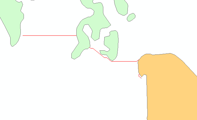
I have a polyline that is non-continuous (please see picture, polyline is in red). I am looking to separate the polyline based on this geographic discontinuity so that I can calculate the length of each portion individually. Unfortunately I do not know how to separate the polyline in this manner, i have tried multiple things with no success. My best thought so far was to split the line at the vertices (each time the line changes angle) and then unsplit them, but that does not work for some reason. Thoughts? I am using ArcGis 10.5.1.

Note: the the dataset is large and contains quite a bit of variation. The Lines will often converge forming what looks to be a single line, though they each will independently follow the same path. These polylines are the result of a Least Cost Path analysis.

enter image description here

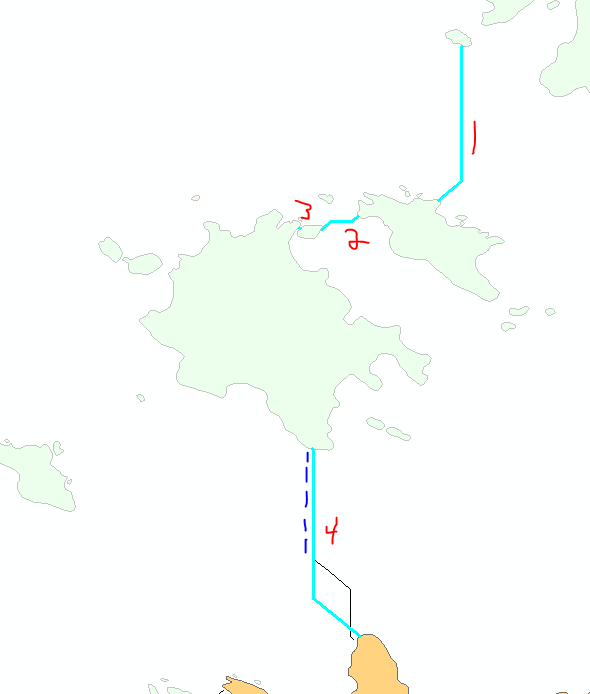
The Red numbers indicate the four different segments I am looking to individually calculate the length of. The Blue dotted line adjacent to segment 4 indicates a partial overlap from a different polyline that separates roughly half way through segment 4.

The overall goal of this analysis is to determine the longest polyline segment.

6
  • 2
    Is the polyline a multipart feature? Does it continue underneath the polygons? What license level do you have? Commented Jun 20, 2018 at 5:39
  • 2
    You say splitting the line doesn't work? What, specifically, are you trying that doesn't work? What tools? Do you have python experience?
    – Fezter
    Commented Jun 20, 2018 at 5:55
  • Make the polygons transparent and show in a new screenshot exactly the lengths you want to calculate.
    – Bera
    Commented Jun 20, 2018 at 7:11
  • Assign unique id to your lines. Explode to single part and sort descending using length. Delete identical using unique id.
    – FelixIP
    Commented Jun 20, 2018 at 19:04
  • @Michael Stimson The polylines do not continue underneath the polygons (I intersected the polylines with the polygons). As for licensing, I have access to most everything in Arc: spatial analyst, geostatistical analyst, etc. Hopefully that helps!
    – Zach
    Commented Jun 20, 2018 at 22:36

1 Answer 1

1
  1. Erase with lines as in features, polygons as erase features.
  2. Dissolve output with Multipart unchecked. Dissolve will probably dissolve together your blue-dotted-example unless you have some attribute separating them which you can use as Dissolve field. You can also try Multipart to Singlepart instead of Dissolve.

If the data is in a file geodatabase you will have a shape length column.

2
  • The lines actually do occasionally overlap. This is a large dataset and the lines will often converge to form a single line.
    – Zach
    Commented Jun 20, 2018 at 6:57
  • Because the lines often converge, using the explode feature or the multipart to singlepart will not work for every line.
    – Zach
    Commented Jun 20, 2018 at 7:01

Your Answer

By clicking “Post Your Answer”, you agree to our terms of service and acknowledge you have read our privacy policy.

Not the answer you're looking for? Browse other questions tagged or ask your own question.