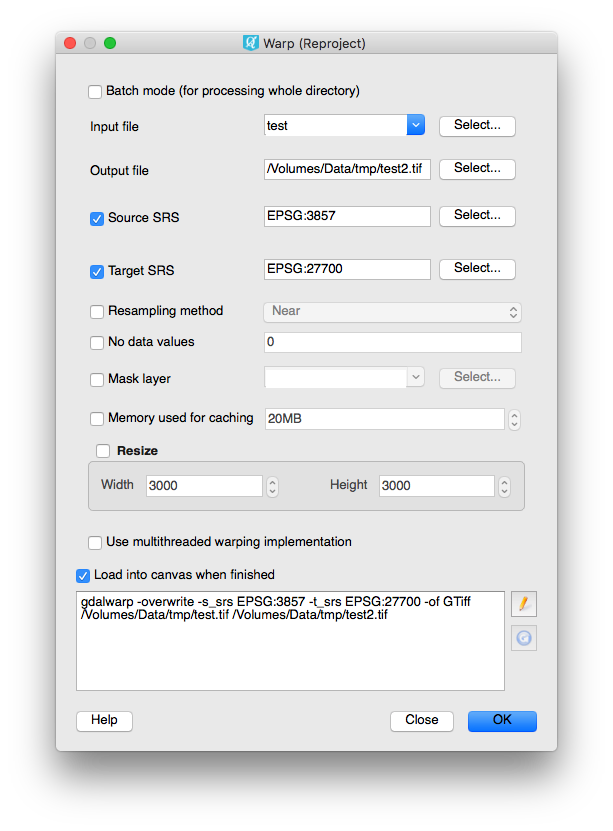
I am trying to reproject a raster image from 3857 to 27700 using QGIS 2.18.2 Las Palmas.
I loaded the OpenLayers Bing Maps Aerial (3857) and zoomed to my site, then saved the map as an image (TIFF).
I then tried to reproject the file to 27700 using Raster - Projections - Warp (Reproject)
I set my input file as the TIFF and Source CRS as 3857, the output file as a new fie and Target CRS as 27700. Resampling method "Near".
I get this error message each time:
Output driver `GMT' not recognised or does not support
direct output file creation. The following format drivers are configured
and support direct output:
GeoRaster: Oracle Spatial GeoRaster
VRT: Virtual Raster
GTiff: GeoTIFF
NITF: National Imagery Transmission Format
HFA: Erdas Imagine Images (.img)
ELAS: ELAS
MEM: In Memory Raster
BMP: MS Windows Device Independent Bitmap
PCIDSK: PCIDSK Database File
PCRaster: PCRaster Raster File
ILWIS: ILWIS Raster Map
SGI: SGI Image File Format 1.0
Leveller: Leveller heightfield
Terragen: Terragen heightfield
netCDF: Network Common Data Format
HDF4Image: HDF4 Dataset
ISIS2: USGS Astrogeology ISIS cube (Version 2)
ERS: ERMapper .ers Labelled
RMF: Raster Matrix Format
RST: Idrisi Raster A.1
INGR: Intergraph Raster
GSBG: Golden Software Binary Grid (.grd)
GS7BG: Golden Software 7 Binary Grid (.grd)
PDF: Geospatial PDF
MBTiles: MBTiles
MRF: Meta Raster Format
PNM: Portable Pixmap Format (netpbm)
PAux: PCI .aux Labelled
MFF: Vexcel MFF Raster
MFF2: Vexcel MFF2 (HKV) Raster
BT: VTP .bt (Binary Terrain) 1.3 Format
LAN: Erdas .LAN/.GIS
IDA: Image Data and Analysis
GTX: NOAA Vertical Datum .GTX
NTv2: NTv2 Datum Grid Shift
CTable2: CTable2 Datum Grid Shift
KRO: KOLOR Raw
ROI_PAC: ROI_PAC raster
ENVI: ENVI .hdr Labelled
EHdr: ESRI .hdr Labelled
ISCE: ISCE raster
ADRG: ARC Digitized Raster Graphics
SAGA: SAGA GIS Binary Grid (.sdat)
DB2ODBC: IBM DB2 Spatial Database
GPKG: GeoPackage

