2

I am trying to do the following things using ArcGIS model builder.

  1. select by expression to output feature class.
  2. use output feature class as spatial extent
  3. raster to point

The main goal is to reduce loading of computer, because the original raster is super large. If I convert all raster to point, the point shape file clashes.

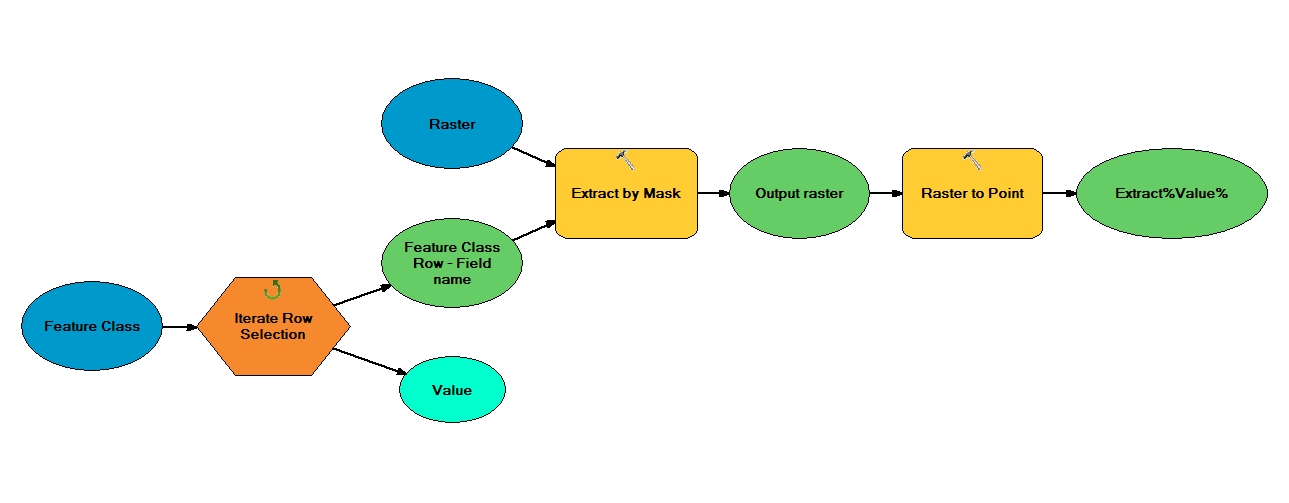
The problem is: how can I iterate the select function? In my model, it just exports one file. I have 15 shapes in a file, and I want to export each shape automatically. How can I revise my model?

2
  • Can we see a screen shot of your model, preferably accompanied by an export of it to Python code? What you describe sounds like it should be straightforward using a an Iterator tool within your model.
    – PolyGeo
    Commented Jul 23, 2012 at 6:35
  • Thanks! Finally, I used split shape files as spatial extent and iterator tool to figure it out. Originally, I tried to use select functions to export files as spatial extents, but I do not succeed.
    – Vicky Liau
    Commented Jul 23, 2012 at 21:13

2 Answers 2

1

The issue of this question is that I need to separate a single shapefile into several shapefiles and use them as spatial extents. (Sorry, I can not post pictures) Here are the steps I used to figure it out.

  1. Split function (analysis tool → Extract → split): based on a specific field, a single shapfile will be split to shapefiles in a geodatabase.

  2. iterate feature class using this geodatabase

  3. set each feature class as extent for raster data processing

0
1

enter image description here
I've created the following model according to what I've understood from your question and it works as I tested:

1
  • The question asks for an iterative approach.
    – Aaron
    Commented Aug 23, 2012 at 14:29

Your Answer

By clicking “Post Your Answer”, you agree to our terms of service and acknowledge you have read our privacy policy.

Not the answer you're looking for? Browse other questions tagged or ask your own question.