0

I am currently working with some shapefiles of congressional precincts of the US.

One of my objectives is to get a list of the "Neighboring" precincts for each of the precincts. For example, if precinct X shares a border with YZ then I know that X has neighbors Y and Z.

I saw that ArcMap is a very powerful tool for working with shapefiles and analyzing data.

What tool can I use to get this done?

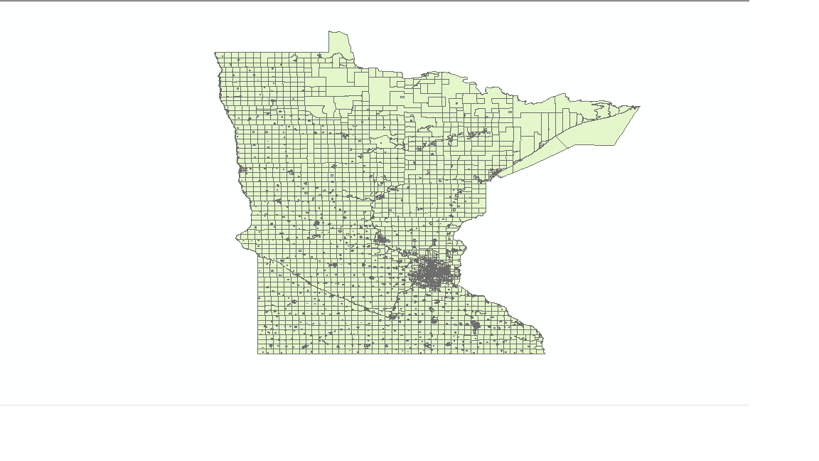
This is how my map looks like:

enter image description here

0

1 Answer 1

0

I think this is a tool which might help you.

I tested it with sample data within ArcMap 10.5 using links below.

PolygonNeighbors_analysis

http://pro.arcgis.com/en/pro-app/tool-reference/analysis/polygon-neighbors.htm

How it works:

http://pro.arcgis.com/en/pro-app/tool-reference/analysis/how-polygonneighbors-analysis-works.htm

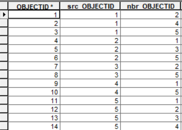
Output is a table which will have two main coulumns src_OBJECTID (with id of polygon) and nbr_OBJECTID (ids of polygons near).

enter image description here

4
  • You've linked to ArcGIS Pro documentation when the question is about ArcMap, but Polygon Neighbors is the right tool to look at.
    – PolyGeo
    Commented Nov 16, 2018 at 8:08
  • Yes, but I tested it within ArcMap. Could not find ArcMap docs. Commented Nov 16, 2018 at 8:11
  • 1
    To find Desktop help links I search using a Google search string like 'ArcGIS polygon neighbors 10.6'.
    – PolyGeo
    Commented Nov 16, 2018 at 8:13
  • thank you so much this is exactly what i was looking for
    – tony
    Commented Nov 16, 2018 at 15:31

Not the answer you're looking for? Browse other questions tagged or ask your own question.