1

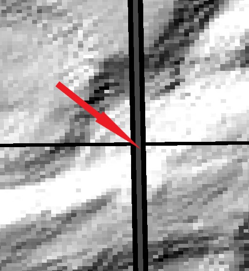
I merged several rasters, but there is a problem with lines between sheets.

Raster is created from LiDAR datasets. Rasters were produced from different datasets via this application: https://iaps.zrc-sazu.si/en/rvt#v and then merged.

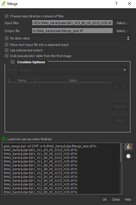
For merging I used Raster > Miscellaneous > Merge in QGis 2.18.15.

Please see snapshot of a problem:

enter image description here

And the Merge function pop-up:

enter image description here

I found that even between unmerged sheets there is some minimal space:

enter image description here

How do I get rid of those lines?

Probably the original sin is already in the input.

3
  • What GIS software are you using?
    – PolyGeo
    Commented Nov 20, 2018 at 18:20
  • while merging your rasters, which option did you use? (sum, mean, first etc..)
    – Vale
    Commented Nov 21, 2018 at 16:07
  • .@PolyGeo - I am using QGis 2.18.15 @vale: I merged rasters in QGis via Raster>Miscellaneous>Merge. I have added additional information in the original post.
    – Nejc
    Commented Nov 21, 2018 at 20:51

1 Answer 1

1

It is possible that the black lines are pixels with missing data (no data). In this case, some options are:

Your Answer

By clicking “Post Your Answer”, you agree to our terms of service and acknowledge you have read our privacy policy.

Not the answer you're looking for? Browse other questions tagged or ask your own question.