I am having some weird output by the UTF grid provider in Tilestache on specific shapefiles; Specifically shapefiles reprojected from Census TIGER files. I know my server is configured correctly because one of my grid layers is working perfectly, which is using a shapefile which did not come from TIGER data.
The weird grid looks like this.
{"keys": ["6", "5"], "data": {"5": {"DIVISION": "9", "INTPTLAT": "+37.1551773", "STATENS": "01779778", "NAME": "California", "STUSPS": "CA", "LSAD": "00", "INTPTLON": "-119.5434183", "FUNCSTAT": "A", "AWATER": -2147483648, "REGION": "4", "MTFCC": "G4000", "GEOID": "06", "STATEFP": "06", "ALAND": -2147483648}, "6": {"DIVISION": "8", "INTPTLAT": "+34.2039240", "STATENS": "01779777", "NAME": "Arizona", "STUSPS": "AZ", "LSAD": "00", "INTPTLON": "-111.6064072", "FUNCSTAT": "A", "AWATER": 1026196456, "REGION": "4", "MTFCC": "G4000", "GEOID": "04", "STATEFP": "04", "ALAND": -2147483648}}, "grid": [" \u0000\u0000\u0000\u0000\u0000\u0000\u0000\u0000\u0000\u0000\u0000\udb6a\udf1f\ud929\udc96\uda63\udf00\u7f8d\udad2\udeb8\u7f8d", " 9/138/212.json.\u0000\u0000", " 9/138/212.json.\u0000\u0000", " 9/138/212.json.\u0000\u0000", " 9/138/212.json.\u0000\u0000", " 9/138/212.json.\u0000\u0000", " 9/138/212.json.\u0000\u0000", " 9/138/212.json.\u0000\u0000", " 9/138/212.json.\u0000\u0000", " 9/138/212.json.\u0000\u0000", " 9/138/212.json.\u0000\u0000", " 9/138/212.json.\u0000\u0000", " 9/138/212.json.\u0000\u0000", " 9/138/212.json.\u0000\u0000", " 9/138/212.json.\u0000\u0000", " 9/138/212.json.\u0000\u0000", " 9/138/212.json.\u0000\u0000", " 9/138/212.json.\u0000\u0000", " 9/138/212.json.\u0000\u0000", " 9/138/212.json.\u0000\u0000", " 9/138/212.json.\u0000\u0000", " 9/138/212.json.\u0000\u0000", " 9/138/212.json.\u0000\u0000", " 9/138/212.json.\u0000\u0000", " 9/138/212.json.\u0000\u0000", " 9/138/212.json.\u0000\u0000", " 9/138/212.json.\u0000\u0000", " 9/138/212.json.\u0000\u0000", " 9/138/212.json.\u0000\u0000", " 9/138/212.json.\u0000\u0000", " 9/138/212.json.\u0000\u0000", " 9/138/212.json.\u0000\u0000", " 9/138/212.json.\u0000\u0000", " 9/138/212.json.\u0000\u0000", " 9/138/212.json.\u0000\u0000", " 9/138/212.json.\u0000\u0000", " 9/138/212.json.\u0000\u0000", " 9/138/212.json.\u0000\u0000", " 9/138/212.json.\u0000\u0000", " 9/138/212.json.\u0000\u0000", " 9/138/212.json.\u0000\u0000", " 9/138/212.json.\u0000\u0000", " 9/138/212.json.\u0000\u0000", " 9/138/212.json.\u0000\u0000", " 9/138/212.json.\u0000\u0000", " 9/138/212.json.\u0000\u0000", " 9/138/212.json.\u0000\u0000", " 9/138/212.json.\u0000\u0000", " 9/138/212.json.\u0000\u0000", " 9/138/212.json.\u0000\u0000", " 9/138/212.json.\u0000\u0000", " 9/138/212.json.\u0000\u0000", " 9/138/212.json.\u0000\u0000", " 9/138/212.json.\u0000\u0000", " 9/138/212.json.\u0000\u0000", " 9/138/212.json.\u0000\u0000", " 9/138/212.json.\u0000\u0000", " 9/138/212.json.\u0000\u0000", " 9/138/212.json.\u0000\u0000", " !!!!!!!!!!!!!!!!!212.json.\u0000\u0000", " !!!!!!!!!!!!!!!!!!212.json.\u0000\u0000", " !!!!!!!!!!!!!!!!!!!!212.json.\u0000\u0000", " !!!!!!!!!!!!!!!!!!!!!212.json.\u0000\u0000", " !!!!!!!!!!!!!!!!!!!!!!212.json.\u0000\u0000"]}
Notice the "\u0000\u0000\u0000\u0000\u0000\u0000\u0000\u0000" and "!212.json.\u0000\u0000". Totally weird.
I think this must have something to do with the shapefiles. However, when I compare a shapefile that works fine with a shapefile that does not the projection is the same. Does anyone have any ideas what else could cause the grid to be incorrect?
To convert the TIGER files I used: ogr2ogr -f "ESRI Shapefile" -nlt POLYGON -t_srs EPSG:900913 us-states.shp tl_2011_us_state.shp
+proj=merc +lon_0=0 +lat_ts=0 +x_0=0 +y_0=0 +ellps=WGS84 +towgs84=0,0,0,0,0,0,0 +units=m +no_defs
Is the projection for both files.
Update: Every time I clear the cache and refresh the page on a single tile the UTF Grid changes.
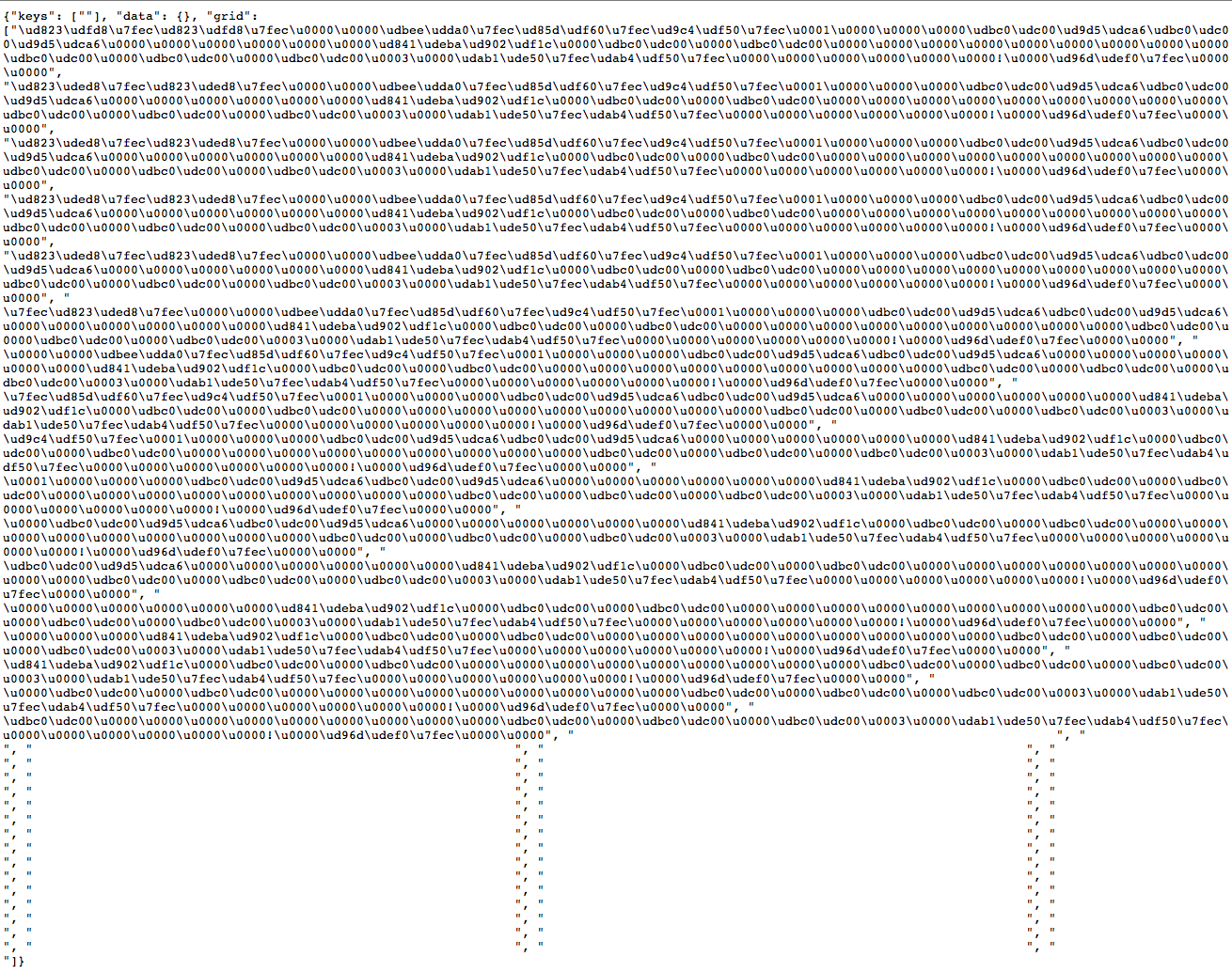
Here is a screenshot of one of the tiles. Notice that there are no keys or data but utf information.

Thanks!
