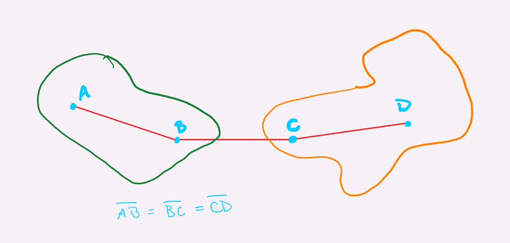
I am trying to generate a point feature class of possible plot centers for a research project. The plot centers will be inside of defined forest stand polygons which are aggregated in various ways across the landscape. What I am trying to achieve is this: approximately (+/- 100 m) equidistant points within and between forest polygons, so each polygon has two points inside and then one or both points are the same distance from a point in a separate polygon so that each pair looks something like this (the green/orange shapes are supposed to be two forest polygons, the blue points are the plot centers, and the red lines are just to show equal distance between points-I don't need to actually create a line class connecting the points, the euclidean distance between them just needs to be similar.
I would also like to be able to define a minimum buffer distance between the points and the polygon edges. I have lots and lots of polygons, but for most of them this configuration will not be possible, so I'm looking for a way to identify potentially usable polygon pairs. I have access to ArcGIS Pro and I use ArcMap over Citrix if that's relevant. I have limited experience with Python but am not afraid to learn if that's the best solution.


