1

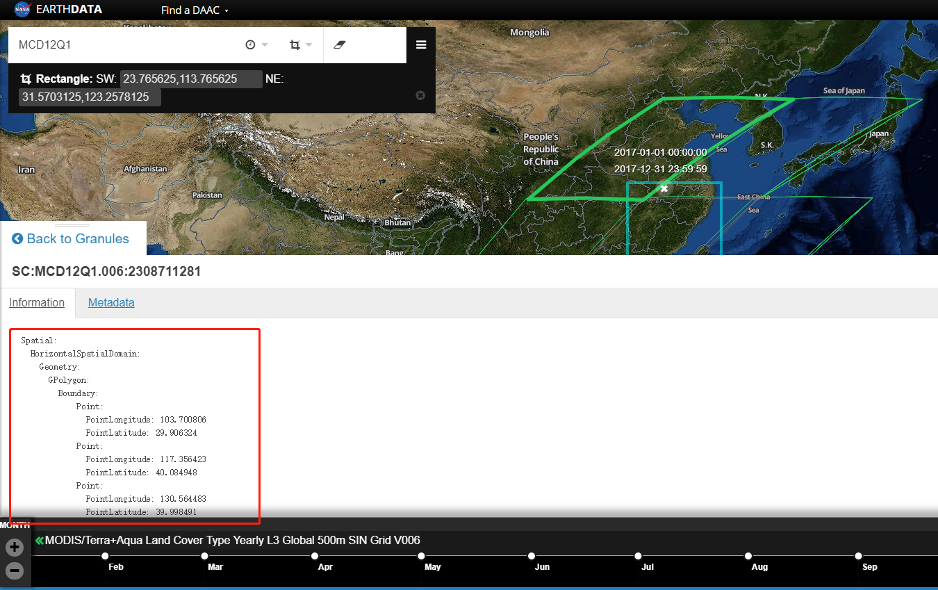
I was using MOIDS data MCD12Q1 (MODIS/Terra+Aqua Land Cover Type Yearly L3 Global 500m SIN Grid V00). I try to use PyProj in Python to transform the Sinusoidal projection to lat/lon. It actually worked, but I mentioned that the the lat/lon boundary I have transformed is not consistent with the boundary information supplied in the Eathdata website.

Details:

tile h27v05, in file MCD12Q1.A2017001.h27v05.006.2018257173250.hdf, it own metadata:

UpperLeftPointMtrs=(10007554.677000,4447802.078667)             
LowerRightMtrs=(11119505.196667,3335851.559000)

according to the mcd12 user guide, I set proj4 to
"+proj=sinu +a=6371007.181 +b=6371007.181 +units=m" then get the upperleft and lower right corners' lat/lon. But they are different from the boundary in the website. As shown below:

https://search.earthdata.nasa.gov/search/granules/granule-details?p=C186286578-LPDAAC_ECS&g=G1552253044-LPDAAC_ECS&m=22.11328125!108.703125!3!1!0!0%2C2&tl=1531459844!4!!&q=MCD12&ok=MCD12&sb=113.765625%2C23.765625%2C123.2578125%2C31.5703125&ac=true

enter image description here

Why do the tiles in the web site seem to be overlapping?

1 Answer 1

0

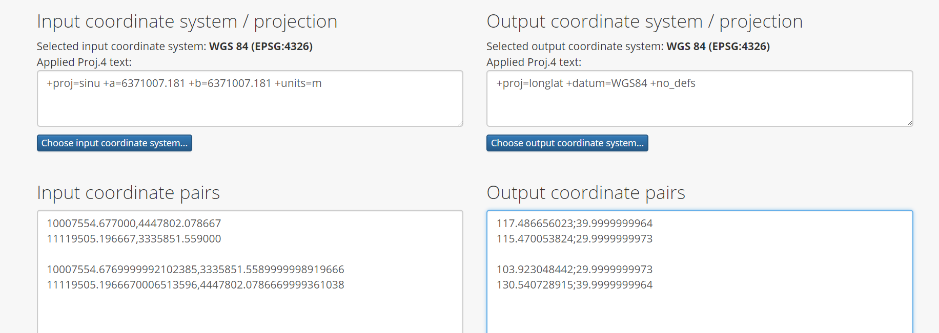
I would think something is not right with your longitude and latitude calculation.

The UpperLeft and LowerRight limits return here other long/lat.

In QGIS that layer shows the LowerLeft and UpperRight limits, I copy the calculation of those coordinates as well.

calculate

The vertices coincide on the site.

3
  • Thank you, actully I've got exactlly the same result as yours. However, the output coordinate is a little different from the given point in the site. For the upperLeft point, we got (117.486656023, 39.9999999964), but in the site it is (117.356423, 40.084948), which is shown above in the picture. Can this be neglected?
    – Roadelse
    Commented Jan 14, 2019 at 7:40
  • @张峻溪. Oh I see. I thought your question was about your polygon drawn on the map. Well, we do not know how they calculate the boundary they show on the site. I think it is not important and that it does not accurately reflect the spatial coverage of the data set. Commented Jan 14, 2019 at 13:39
  • Really thank you. Actually, I was to ignoring the polygon in the site but i noticed the site even gave the lat/lon of the polygon, which made me believe that it may have some secrets that i didn't know.
    – Roadelse
    Commented Feb 1, 2019 at 15:26

Your Answer

By clicking “Post Your Answer”, you agree to our terms of service and acknowledge you have read our privacy policy.

Not the answer you're looking for? Browse other questions tagged or ask your own question.