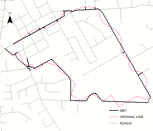
I'm looking for a tool that'll help create a GPX file which will help me run a track and create "GPS Art" or "GPS Drawing".
I would like to draw simple shapes, like animals or texts by following a GPX path on my runs. I need a tool that'll take a lines, and given a specific area, will match these lines to a real world road, sidewalk or path network. The tool needs to best match the drawing to the road network as possible to maintain the idea of the shape.
Does such a tool already exists? If not, is there an existing API or algorithm that would help me create the tool?
I'd prefer to write this in Python. I'm not asking for code, but help finding the right existing tool, or algorithm.

