I have a polyline that I split in 5000 m sections and I made it to generate an Atlas for the first step, but since the sections that I want to show are long and not wide I would like to add sections, e.g. Atlas Map page1 shows section 1 and 2 (instead of the same green section1, the second panel should show orange section2. 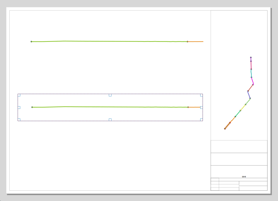 I tested filtering the Atlas, but I got stuck and wasnt sucessfull. I created 2 virtual layers containing every second section, but after I added the second panel I could not find out if it is possible to let the panels be controlled by different layers for Atlas generation. Any idea how to get 2 panels with continuing sections?
-
1Related to this question.– GabrielCommented Feb 11, 2019 at 16:37
1 Answer
You can do that like here:
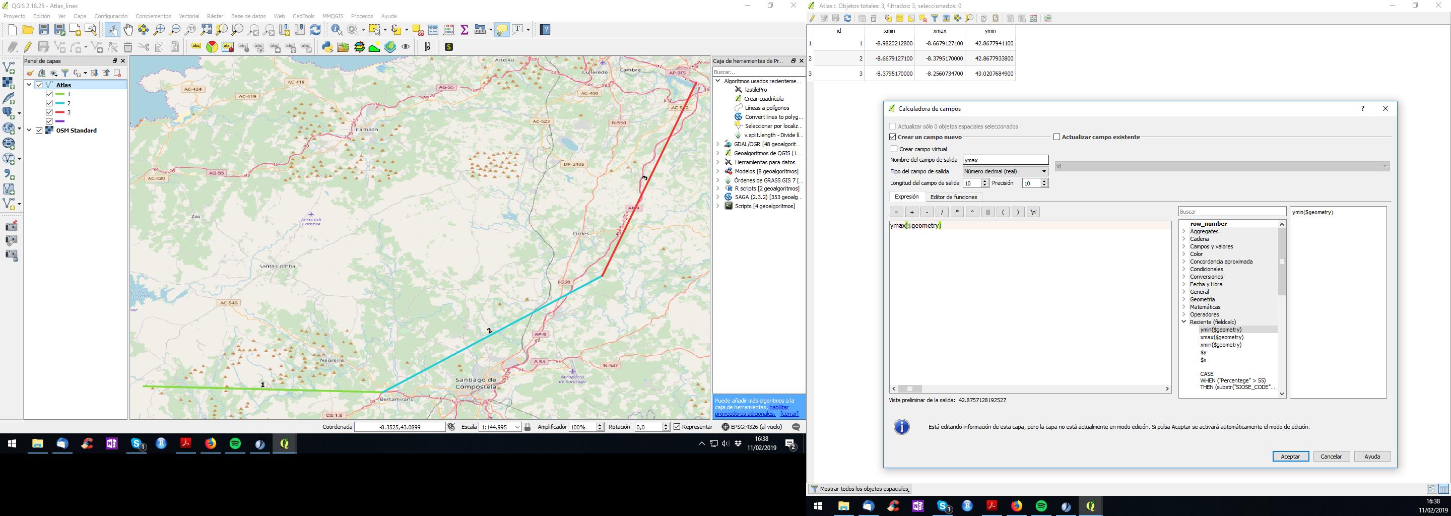
- Add xmin/xmax/ymin/ymax to each feature of your atlas layer. Your can do it with the function:
xmax($geometry)
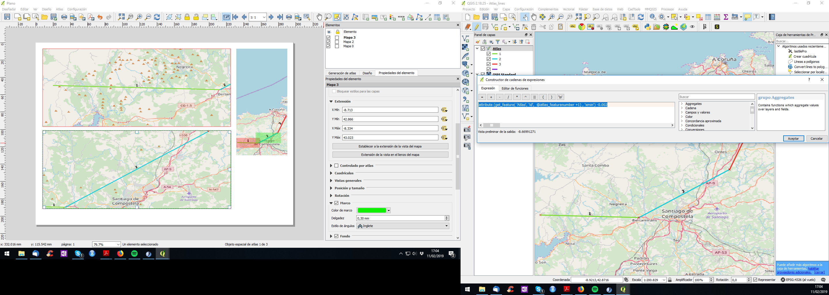
- Control your atlas by extentension, defining a functions inside thouse xmin/xmax/ymin/ymax in composer (here, as you can figure it out, that -0.002 creates an small margin around the feature):
attribute (get_feature( 'Atlas', 'id', @atlas_featurenumber +1) , 'xmin') -0.002
If you use this system don't mark "controlled by atlas".
Be creative and you will get a perfect atlas.
Edit:
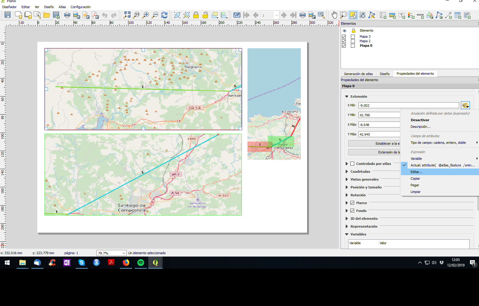
HOW TO EDIT EXTENSION BY ATRIBUTE IN COMPOSER
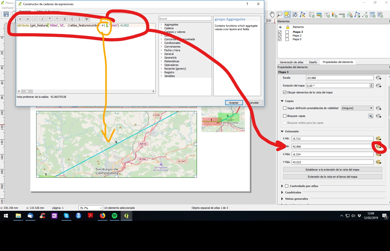
Select the square of map --> properties --> extension --> xmin/xmax/ymin/ymax: edit... (sorry, my QGIS is in spanish, but can get the position):
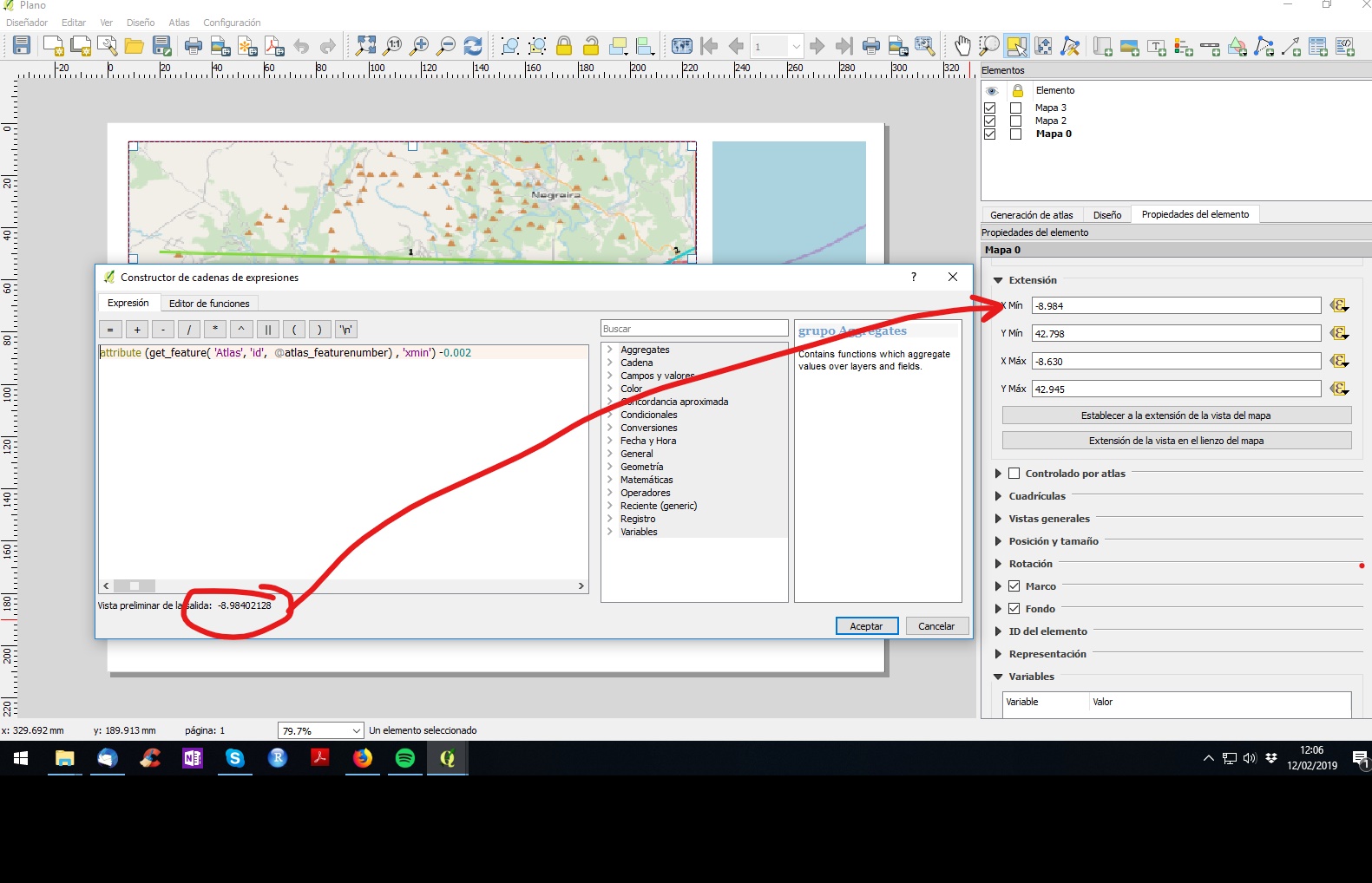
If you write the function properly you will get the xmin/xmax/ymin/ymax value of the desired feature of your atlas:
Same for each xy of square 2: Here "+1" means "go to the following feature from your atlas layer". Do the same for each xmin/xmax/ymin/ymax and adapt the function.
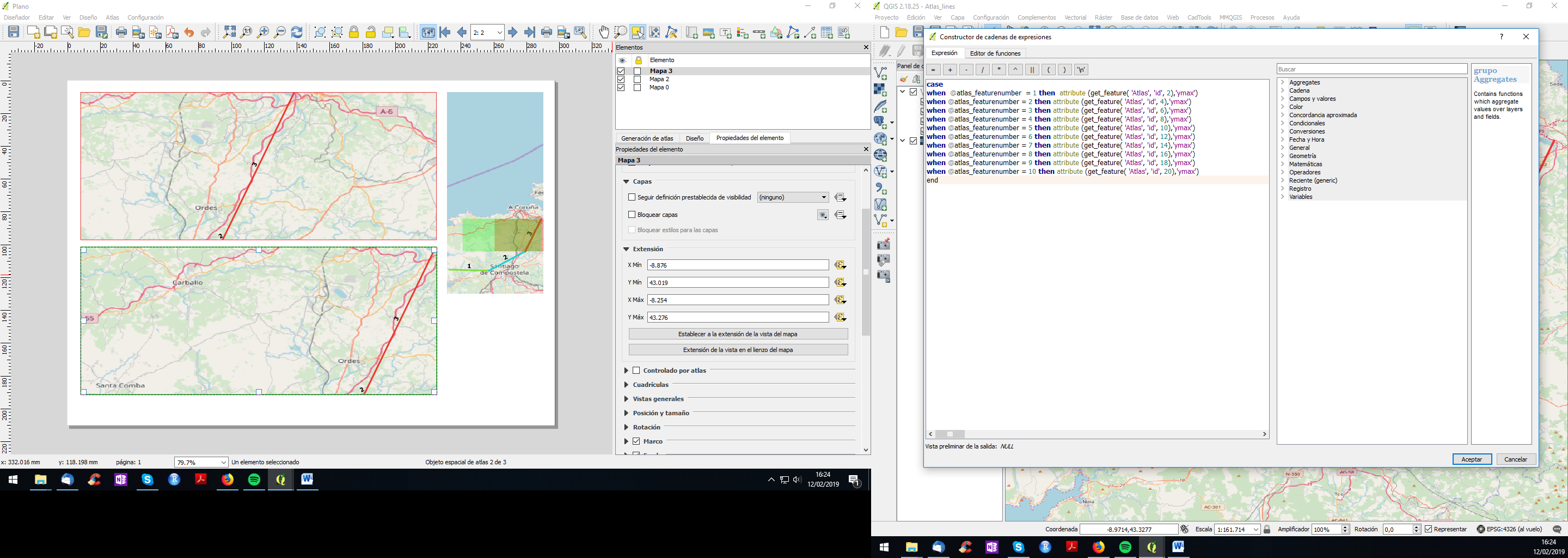
Update to avoid repeated features:
Here is the code for the upper map xmin:
case
when @atlas_featurenumber = 1 then  attribute (get_feature( 'Atlas', 'id', 1),'xmin')
when @atlas_featurenumber = 2 then attribute (get_feature( 'Atlas', 'id', 3),'xmin')
when @atlas_featurenumber = 3 then attribute (get_feature( 'Atlas', 'id', 5),'xmin')
when @atlas_featurenumber = 4 then attribute (get_feature( 'Atlas', 'id', 7),'xmin')
when @atlas_featurenumber = 5 then attribute (get_feature( 'Atlas', 'id', 9),'xmin')
when @atlas_featurenumber = 6 then attribute (get_feature( 'Atlas', 'id', 11),'xmin')
when @atlas_featurenumber = 7 then attribute (get_feature( 'Atlas', 'id', 13),'xmin')
when @atlas_featurenumber = 8 then attribute (get_feature( 'Atlas', 'id', 15),'xmin')
when @atlas_featurenumber = 9 then attribute (get_feature( 'Atlas', 'id', 17),'xmin')
when @atlas_featurenumber = 10 then attribute (get_feature( 'Atlas', 'id', 19),'xmin')
end
This code allows you to go from feature 1 to 3 to 5... in the upper square. Do the same for xmax/ymin/ymax. Then copy the code, go to lower map and paste it replacing those 1,3,5... by 2,4,6...
As you may have noticed this code allows you to create a consequent map with 10 pages as much. If it has more page, you just need to add lines with the same logic.
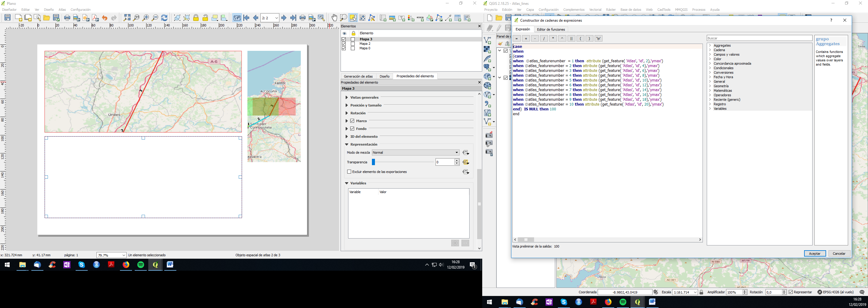
And if you have odd number of segments you can make invisible the lower map by, also, adding a function to make it transparent like (when Atlas feature is null then make it 100% transparent):
-
1I was in the process of writing the exact same answer, you beat me to it.– GabrielCommented Feb 11, 2019 at 16:36
-
Sorry mate. Anyway, post your answer if you find a finest path to do it. Commented Feb 11, 2019 at 17:00
-
1Thanks a lot César, that sounds brilliant, but I have problems to follow, sorry. Step1 is clear. I added xmin/xmax/ymin/ymax in my Attribute table. but step2...."Control your atlas by extentension" here I am a little bit puzzled. In my Atlas generation tab I still choose my layer for generating the atlas, right? underneath it I could check "filter" or "sort" is this on of the windows where I input "attribute (get_feature( 'Atlas', 'id', @atlas_featurenumber +1) , 'xmin') -0.002"? No, right? I am not sure where I put this. Commented Feb 12, 2019 at 9:51
-
I hope now you repeat the process for each extension coords and map square. Regards. Commented Feb 12, 2019 at 11:24
-
1Perfect. It works now roughly. First it did not, because I also told the map to rotate according to an attribute. I just start understand the single expressions in the expression string you gave (sorry this is quite new for me). So I added in Map rotation that it should also take the next rotation angle. Also I had some trouble with scale first. All solved. Thanks again for all your effort, I would have never get these ideas on my own. Altas page 1 is perfekt showing section 1 and 2, but on page 2 is currently section2 and 3. I dont want duplicates. Here section 3 and 4 should shown. Commented Feb 12, 2019 at 14:32

