0

I want to define with ArcGis Pro the right spatial reference for a layer, which has no coordinate system asigned, but coordinates - 300.040,40940 Top and 424.407,907900 Right. I am not really certain, how can I recognise with the given coordinates the real projection or CS.

Do you have any idea, or does my question make sense?

8
  • 1
    It looks like a local datum, too big to be geographic, too small to be projected. You will need to find out what the datum and projection are from the place you got the data from... your only other choice is to use the spatial adjustment toolbar to warp to known to be accurate data in the same area. Commented Apr 3, 2019 at 5:10
  • 1
    But you probably know at least country location od this layer?
    – TomazicM
    Commented Apr 3, 2019 at 7:56
  • what are the four coordinates ? Do you know where it should be ?
    – radouxju
    Commented Apr 3, 2019 at 9:20
  • Hi @TomazicM yes, the country is Austria and the layer should be on the border between Germany and Austria near by Salzburg (Saalach).
    – MoRu02
    Commented Apr 4, 2019 at 5:06
  • Hi @radouxju the four other coordinates are: Top 300.040,409400 Bottom: 298.970,669300 Left: 424.407,188200 Right: 425.163,907900
    – MoRu02
    Commented Apr 4, 2019 at 5:07

1 Answer 1

1

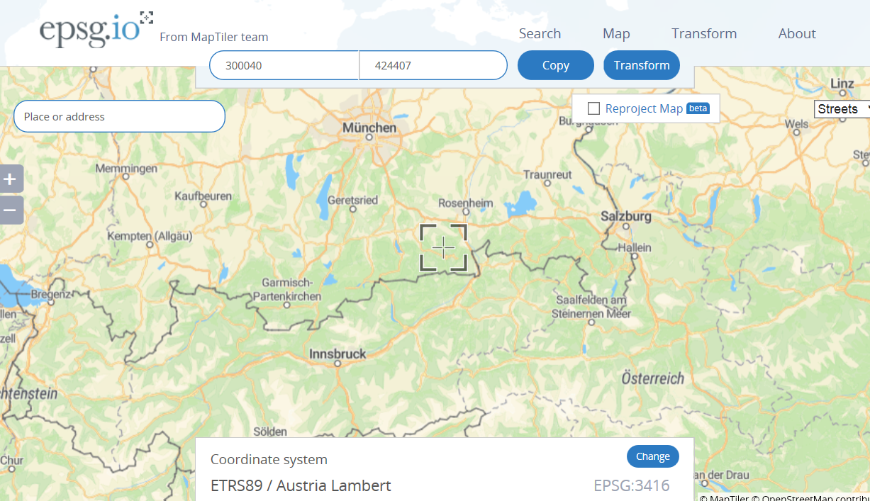
If you go to https://epsg.io/, select CRS EPSG:3416 and input top left coordinates, this is what you get:

enter image description here If this CRS is not the right one, you can try also some other CRSs that cover Austria, just search for Austria on https://epsg.io/

Your Answer

By clicking “Post Your Answer”, you agree to our terms of service and acknowledge you have read our privacy policy.

Not the answer you're looking for? Browse other questions tagged or ask your own question.