1

In one of my weekly QA tasks using ArcMap 10.3, I receive a table of parcel changes that have occurred. I need to review the parcels for polygons that overlap the parcel line. I use a tedious combination of reshape, cut, and clip editing tools. Using Clip is the quickest but here's my problem:

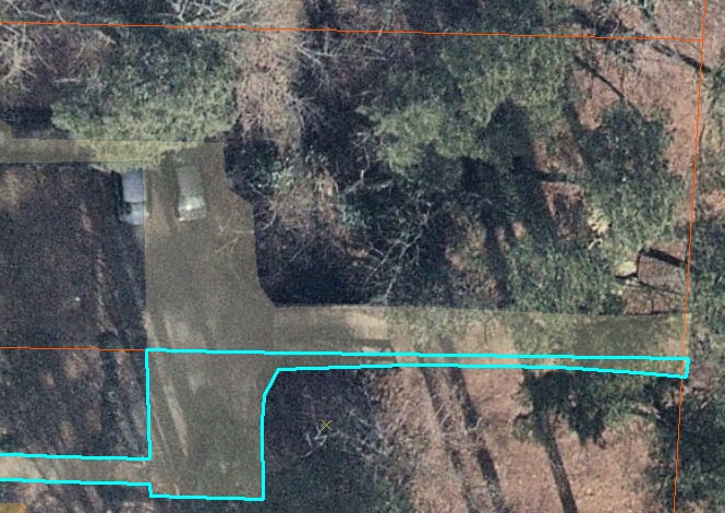
The polygons are snapped to the parcel line. When I clip a polygon to the parcel with "Preserve the area that intersects" selected, another polygon in the neighboring parcel that shares the same boundary will then be deleted.

enter image description here

I want to know if

a) Outside of code, is there a quicker way to do this without deleting neighboring features? Perhaps within ModelBuilder?

b) How simple would it be to write a code to bulk clip selected features based on their corresponding ParcelID ?

4
  • Can you clarify: the polygons share the ParcelID of the parcel layer? And in the Clip situation you describe, do you want the polygon to basically be split and assigned to each parcel? Or should it be entirely within a single parcel?
    – jcarlson
    Commented May 13, 2019 at 17:57
  • @JoshC Yes the polygons share the ParcelID of the parcel layer. While there are some instances where one large polygon needs to be split between two parcels, the majority of the edits look like the image I added above. I only want that small portion that enters the ROW to be clipped, but when I do it also clips the unselected polygon since they are both snapped to the same boundary.
    – arrozmoro
    Commented May 13, 2019 at 18:39
  • Have a look at gis.stackexchange.com/questions/293433/…
    – FelixIP
    Commented May 13, 2019 at 20:07
  • As per the Tour there should be only one question asked per question. The answer to the second one will depend on your coding skill level.
    – PolyGeo
    Commented May 14, 2019 at 10:14

0

Browse other questions tagged or ask your own question.