2

I'm trying to program a GPS style tracker for a simulation game but I'm having a hard time figuring out how to transform the game's coordinates into Google Earth's.

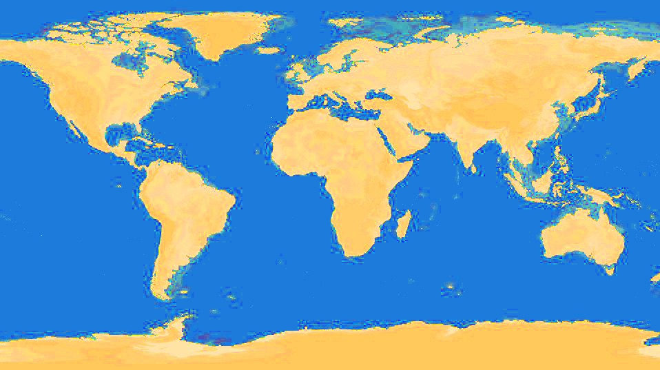
The game's world is flat and has the following map projection:

http://postimage.org/image/czoi8rxgn/

The game's current position data is:

Long: from -21,600,000 m to +21,600,000 m

Lat: from -10,800,000 m to +10,800,000 m

Centered at 0m, 0m (0,0 degrees)

Distance between degrees is the same everywhere (120,000 m) for latitudes or longitudes.

I believe this is called an equidistant projection?

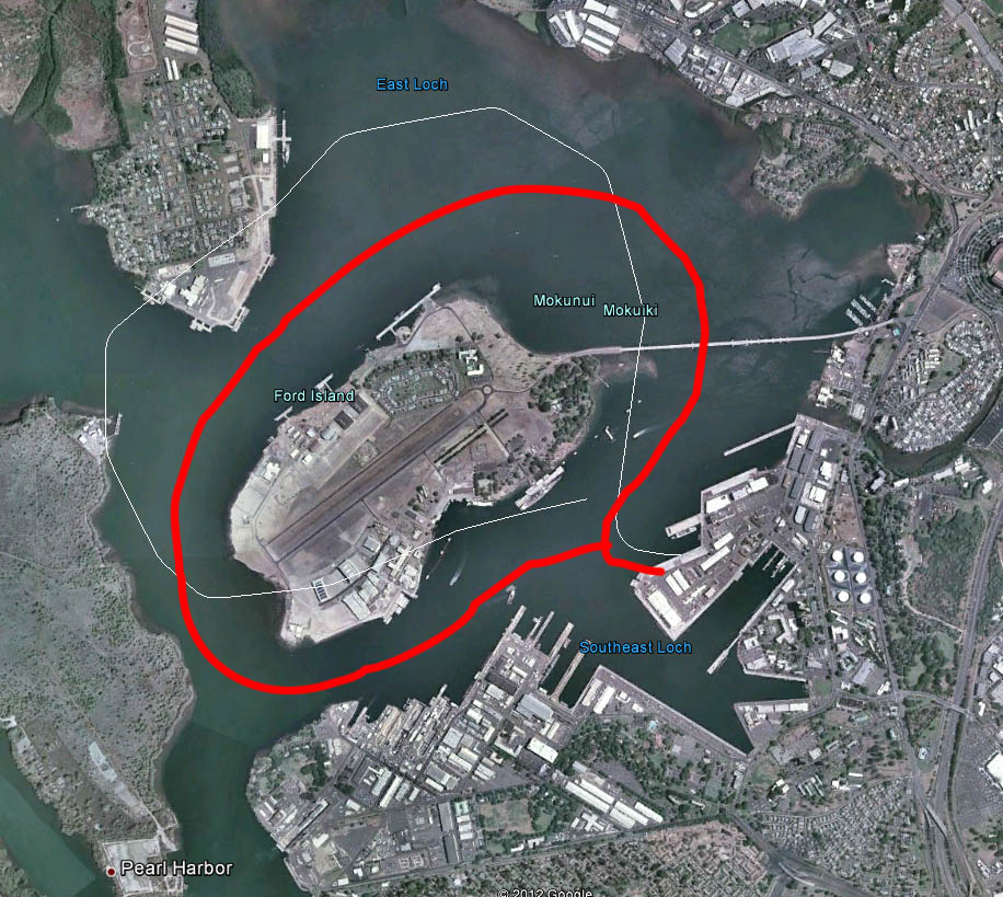
My problem is this, when using the formulas (180/21,600,000 * X position) and (90/10,800,000 * Y position) the game's coordinates don't translate correctly to Google Earth (like in this picture where red is the actual path in game, white is the path exported to GE)

http://postimage.org/image/im67likq3

I realize that the world in Google Earth is a 3D sphere so there's probably some more factors I need to take into account but since I'm a completely beginner when it comes to cartography/GIS, I'm kind of lost.

Is there a conversion formula I should be using to match the coordinates?

4
  • I am having trouble getting beyond the second line: if the world is flat, then there's no need for a "projection" at all! (In a discworld, GPS coordinates would probably be polar--distance from the hub and angle from a prime meridian--or perhaps Cartesian. In a ringworld, the coordinates would perhaps be distance from a designated edge of the ring and spinwise distance from a "prime transect" across the ring.) So what are you really trying to accomplish?
    – whuber
    Commented Oct 19, 2012 at 13:59
  • You might also be interested in the closely related thread at gis.stackexchange.com/questions/27699.
    – whuber
    Commented Oct 19, 2012 at 14:54
  • whuber, thanks for the answer. Sorry the question wasn't clear, what I want to do is: given a world map with the above data, if I have a point at coordinates x=-15540324.324, y=1213212.384 for example, how do I get the correct latitude/longitude of that point on Google Earth? Using the formula I mentioned, I get errors ranging from 100m to 500m depending on location. I'm starting to suspect that the game's map is not very accurate. If that's the case, is there a way to correct this error by measuring geographic features inside the game(say an island) and comparing them to the real world?
    – Mark B.
    Commented Oct 20, 2012 at 22:13
  • Hi Mark: The answer to that last question is yes, there are many ways. Why don't you edit your problem statement to reflect this, so that readers will know what you're really looking for without having to go through all these comments?
    – whuber
    Commented Oct 23, 2012 at 13:26

1 Answer 1

-1

Try subtracting large portions from the oceans of your azimuthal equidistant model by condensing them into three equilateral triangles near the equator on faces which would be equidistant in a geospheric earth model, then designating the triangles "spooky anomalous no go zones" ingame to explain away the gps failings, hide easter eggs there or something.. that's how they do it in the atlas and it has us all fooled...

Your Answer

By clicking “Post Your Answer”, you agree to our terms of service and acknowledge you have read our privacy policy.

Not the answer you're looking for? Browse other questions tagged or ask your own question.