I am working with two digital elevation model data sets: LiDar and UAV DEMs. Both flights were conducted in the same location along a coastal shoreline showing the intertidal area with lots of bare rock and sand. The UAV layer is older and has poor accuracy compared to the LiDar file which is a newly conducted flight. The UAV digital elevation model is inaccurate by ~5-10m. The photos below show the logarithmic error of the UAV DEM.
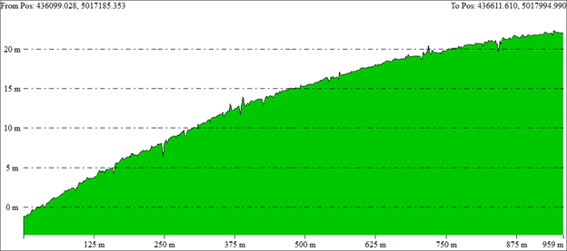
SW-NE cross-section over the figure above, showing a logarithmic increase in bias from West to East:

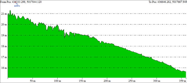
NW-SE cross section, showing not as strong but still considerable gradient:
Is there a tool in QGIS, Global Mapper, or Pix4D that can modify this UAV layer to improve the accuracy? I have tried the 'rubber sheeting' method in both QGIS 3.1 and Global Mapper, but did not have any luck. My assumption about the UAV DEM is there were issues during the pre-processing stage, perhaps with the flight overlap % or the qualities of the GCPs used to process it. I don't have access to the older files so cannot go back and add anything to the project to improve the model, unfortunately.
I am new to remote sensing, and have yet to work with python, CAD, or postgis.

