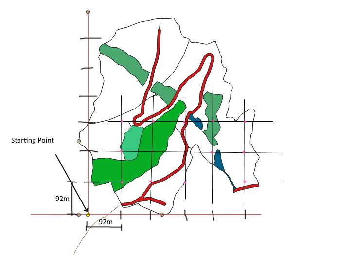
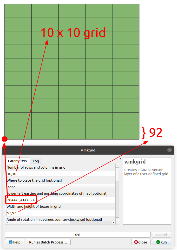
I need to create grids using QGIS with specific intervals 'anchored' to, or beginning at, a specific UTM coordinate. This is for a survey sampling procedure. For example: a point was determined - UTM 0561111, 6111111, as the starting point and I must create a grid with 92m spacing extending north and east for the extent of the polygon. The intersection of those gridlines will be unbiased sample points.
I can't seem to 'anchor' the grid to the starting point using "Create Grid" or MMQGIS "Create Grid Layer". I'd like to be able to do this with QGIS 3.4. Here's a sketch of what is needed.

