ArcGIS Pro / ArcMap Licenses: Spatial Analyst, 3D Analyst
I'm working on a project in the Daniel Boone National Forest to create critical habitat areas in order to keep roadside pesticide applicators away from sensitive areas.
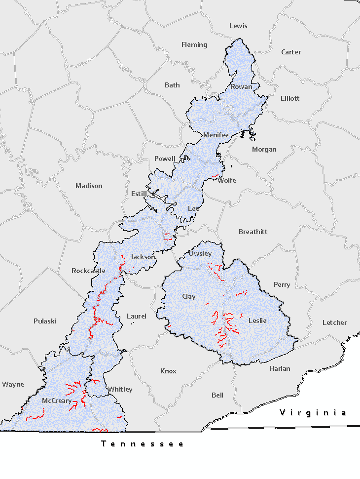
As part of this analysis I need to create buffers around streams a specific distance upstream from another stream buffer polygon layer that overlaps with a stream line. There are 15,000+ different stream segments (blue lines) and about 150 existing stream buffer polygons (red lines) I'm working with here.
Essentially, I'm trying to use these existing 150 stream buffers and extend them upstream 1/4 mile. This has to include any lower stream order branches that split within that distance.
I have done some research that led me to the idea this workflow will involve the Flow Direction tool and potentially some stream network analysis.
However, I've never done an analysis like this before and I'm not sure how to stitch these different tools together to get the output I'm looking for. I'm hoping someone here might be able to help.

