5

I am a new QGIS user just learning the product. As part of our works we take depth soundings around river bends. I have worked out how to do basic contours with colour bands in the background using TIN interpolation.

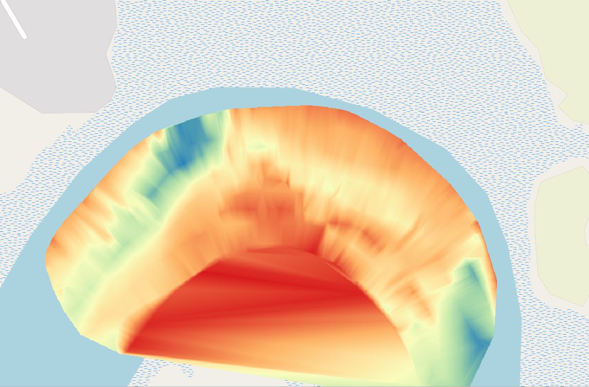
This works for straight sections of the river, however for areas where there are bends on the river, the interpolation does not keep within the boundaries of that bend, and interpolates straight across. I am looking for a way to keep the interpolation within the bounds of the river.

The process was as follow:

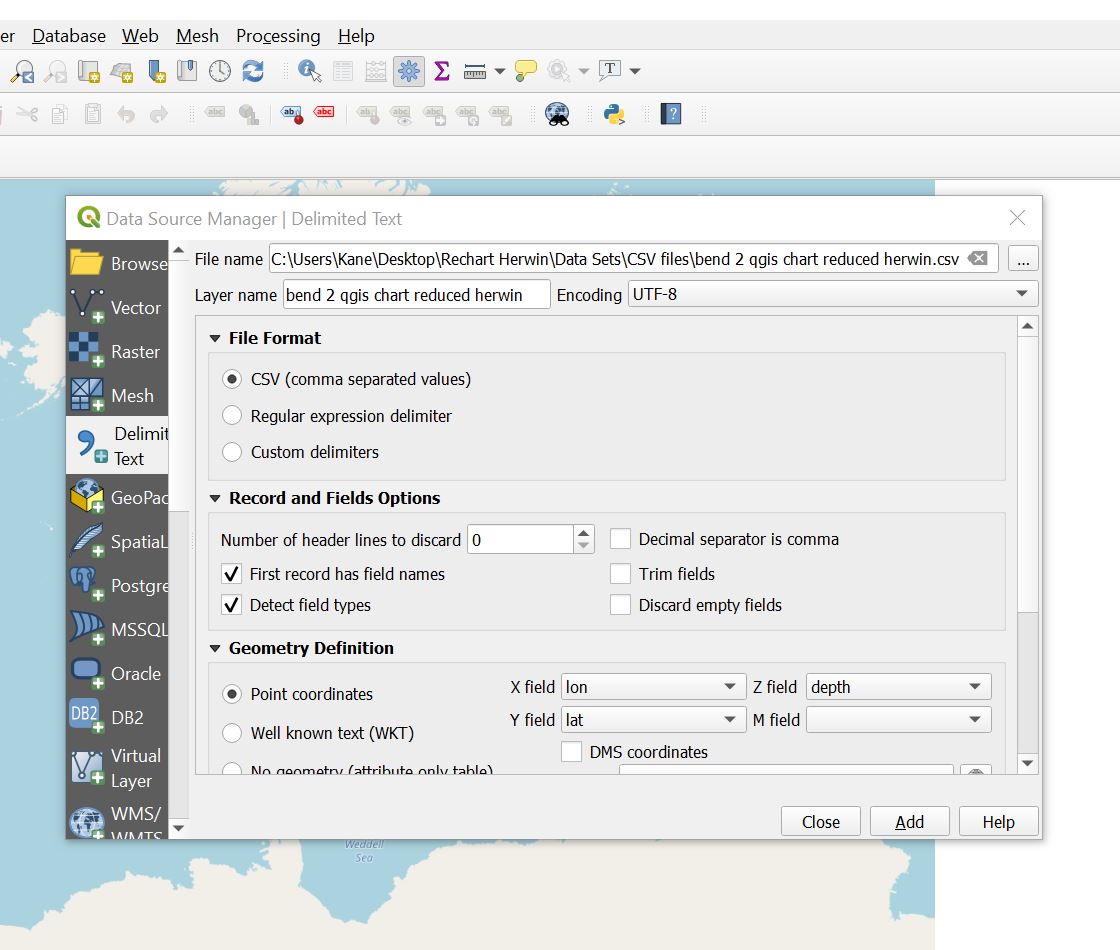
  1. Enter the cooirdinates and depth, lat,long, depth, as CSV file

csv

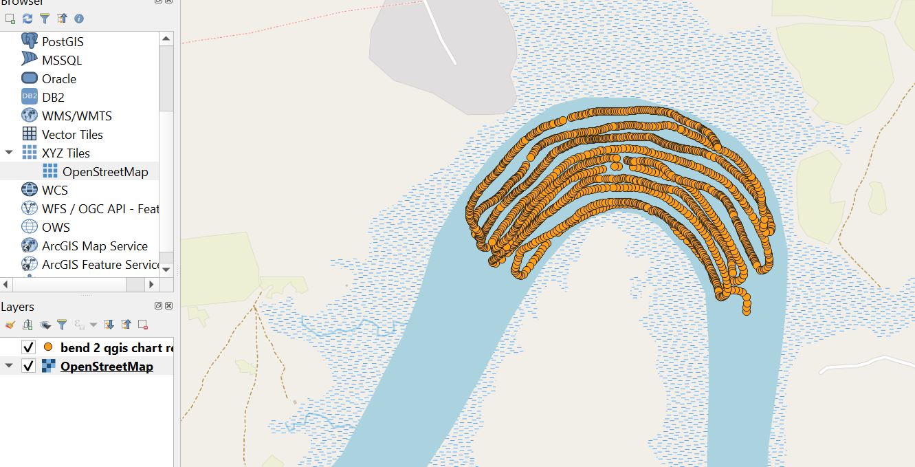
  1. Open Street Map as Layer, where the points of the soundings show. Would after this go into layer properties of the CSV file, symbology, and reduce the size to zero, to get the dots to disappear

open street map

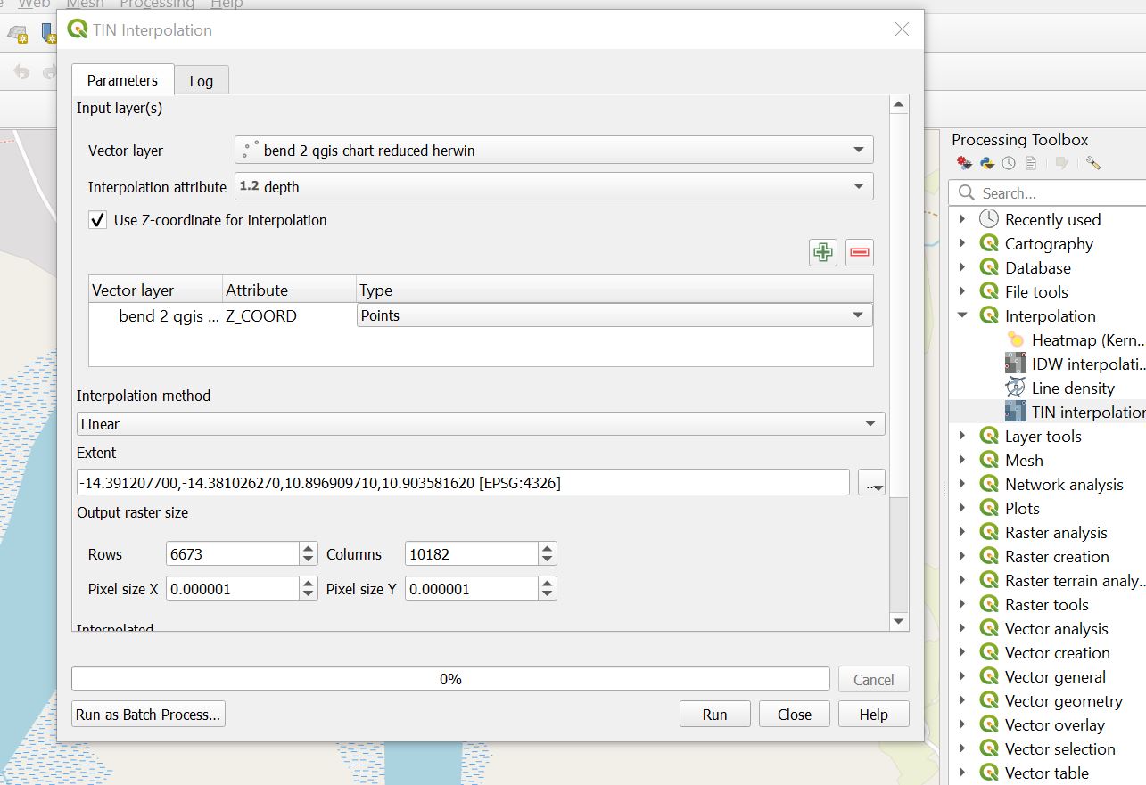
  1. Do a TIN Interpolation, from the Interpolation group, on the toolbox menu

TIN interpolation

The resulting product as follows. As can be seen, it is not interpolating within the river boundaries. From this point can then extract basic contours, with the same result, not staying within the river boundaries. I understand QGIS can be vast, and there may be a simple way to do this, or I may require to do some further training to learn how to do this. Any advice?

TIN visual

4
  • 3
    You need a polygon mask to clip the interpolated raster layer. You can make it from OSM geometries, or with a convex hull from your points layer. Can you share a sample of hypothetical points layer data source? Commented Jul 26, 2021 at 22:00
  • Thanks very helpful, i will look into how to do this. Sure, can share the raw file, its on the Rio Nunez in Guinea
    – kanekane
    Commented Jul 27, 2021 at 20:50
  • Attempted to attach the csv file to the above message, not sure how to do this ?
    – kanekane
    Commented Jul 27, 2021 at 20:57
  • File can be found here dropbox.com/s/yzhpkyv91a5j933/…
    – kanekane
    Commented Jul 27, 2021 at 22:38

1 Answer 1

1

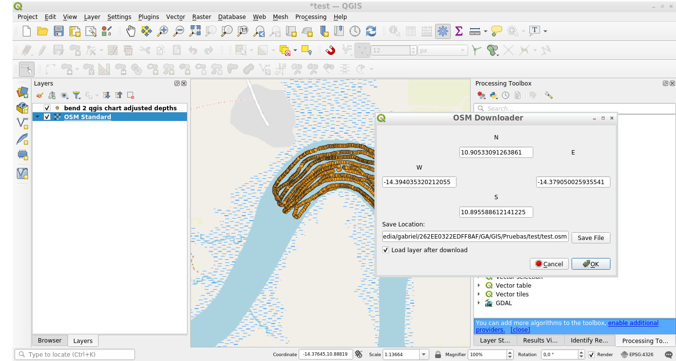
Download OSM data from a rectangle selection using the OSM Downloader plugin:

1


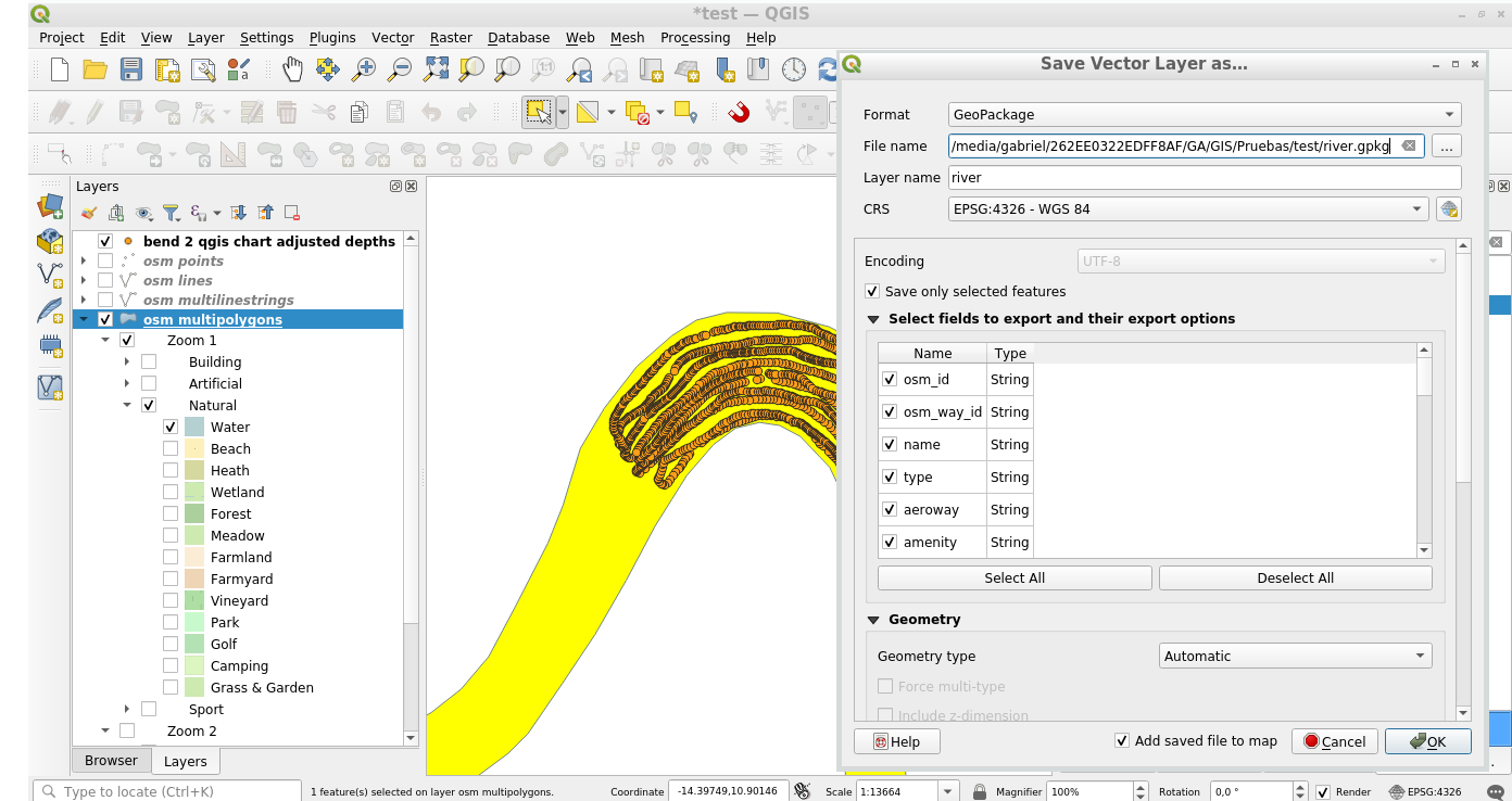
Turn off all features from the osm layers, except of the Natural - Water tag from osm multipolygons layer. Select the river geometry and export the selected features to a new datasource:

2


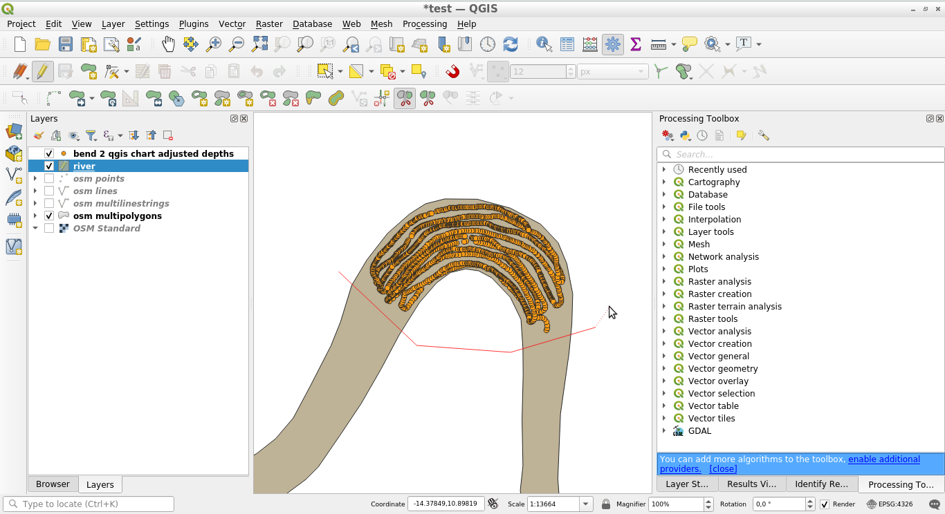
Use the Split features from the Advanced digitizing toolbar to split the river around your area of interest:

3


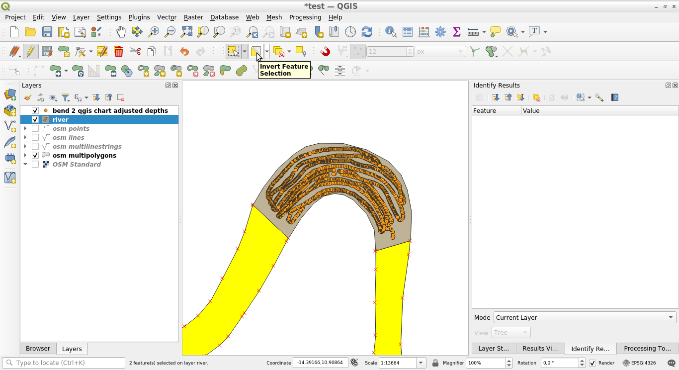
Select the recent created feature, invert the selection and erase all other selected features of the layer:

4


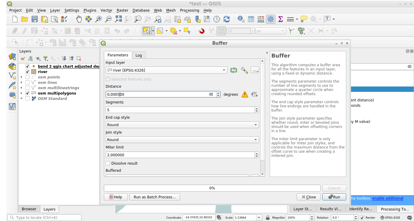
Create a 0.0005 degrees (I don't like to do that, but I don't want to reproject the layer) buffer to the river:

5


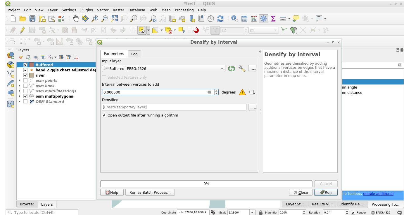
Densify by interval the buffered layer, with an interval of 0.0005 degrees (Idem, degrees are not a distance, but let it be):

6


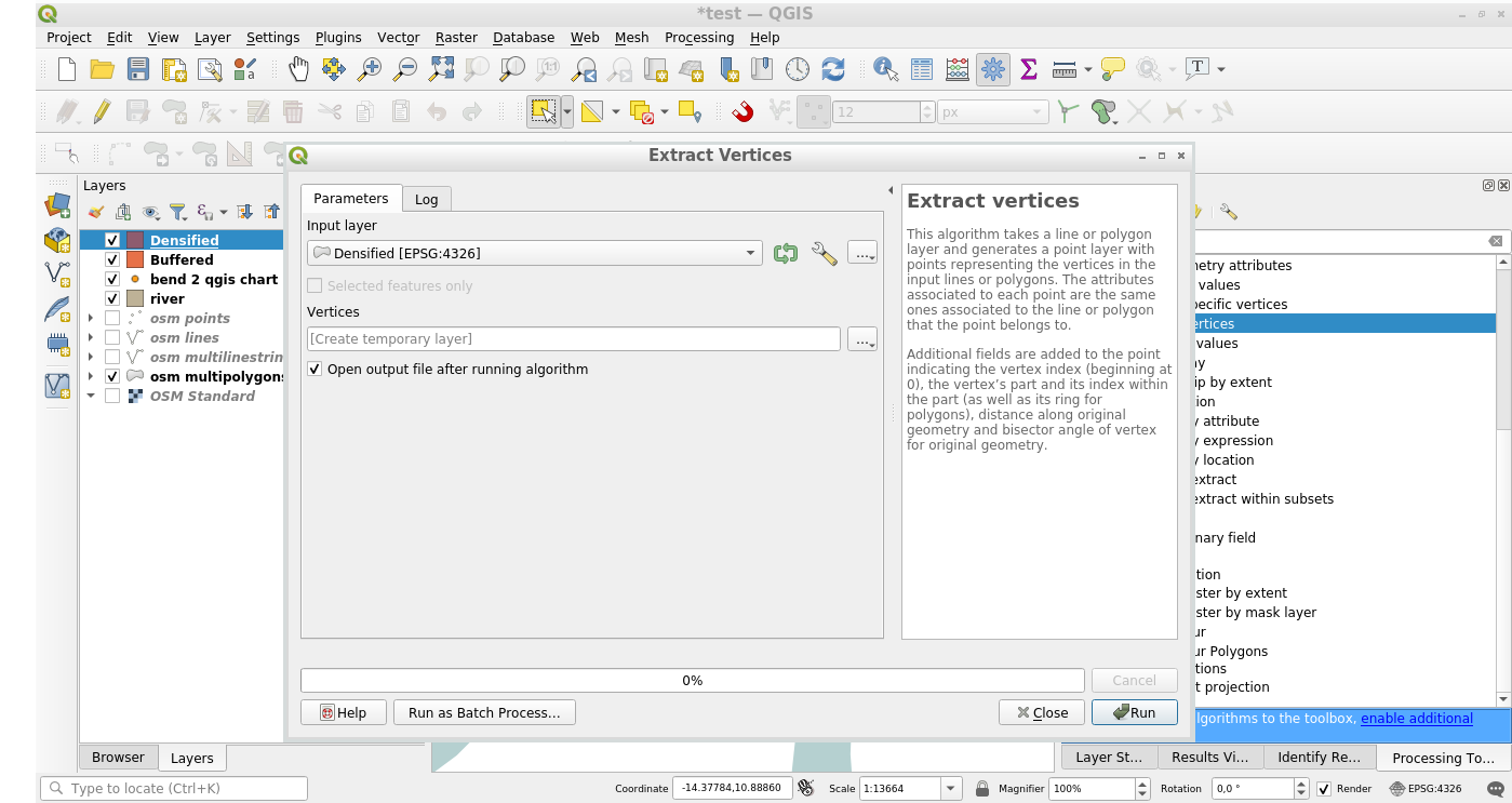
Extract the vertices of the densified layer:

7


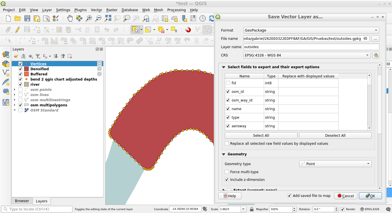
And save them, including a Z dimension in the destination datasource, and excluding the fid field (because it is not unique right now):

8


The Z value of the outsides will be set to zero, I agree with that. You can Set other Z value for them, also you can use the geomnearest() function from refFunctions plugin to set the Z of the nearest depth point.

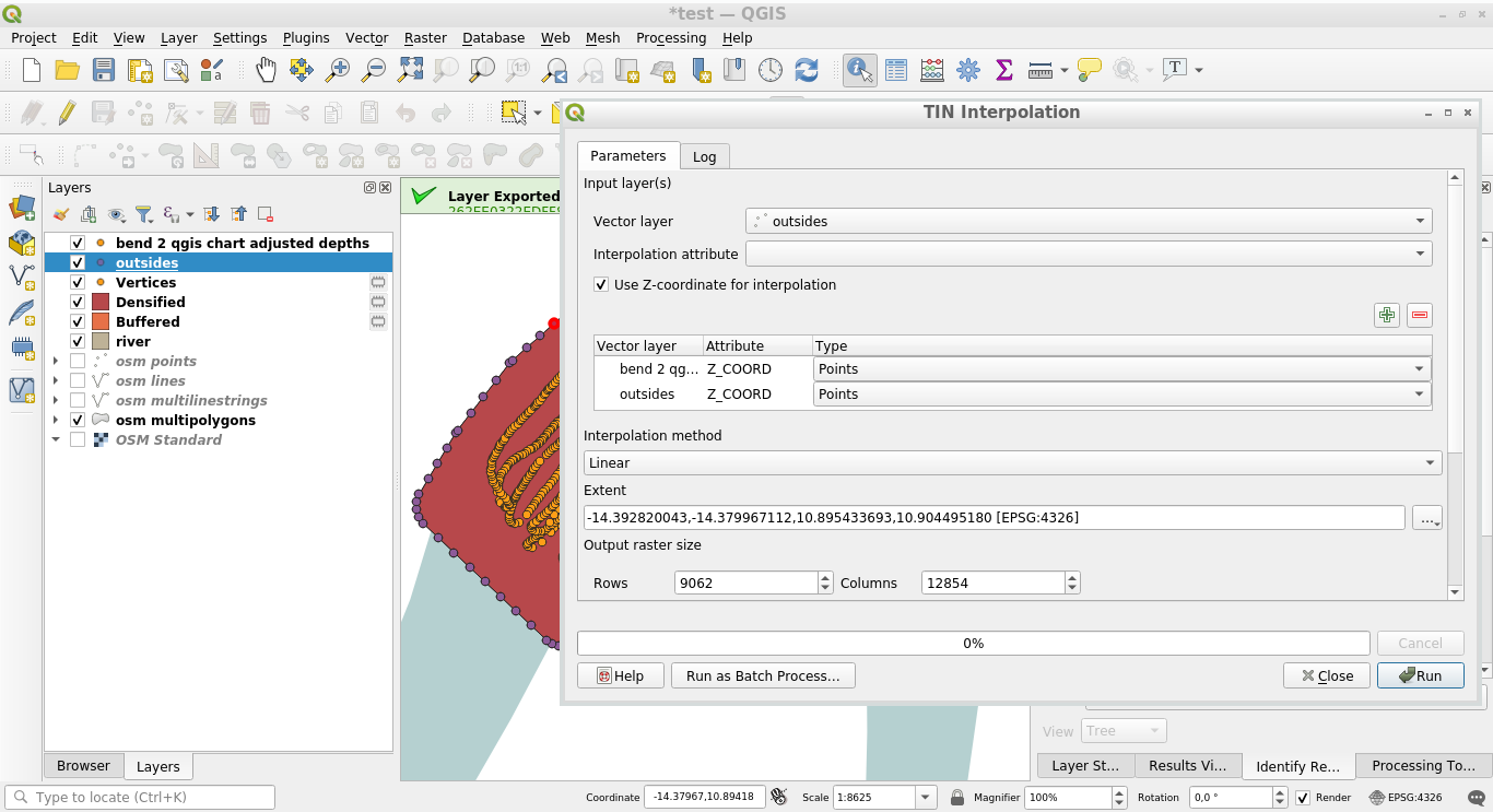
Interpolate them:

9


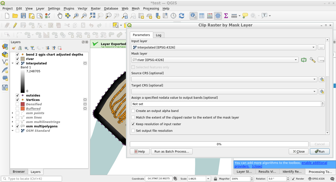
Lastly, Clip the interpolated layer by the river mask layer:

10


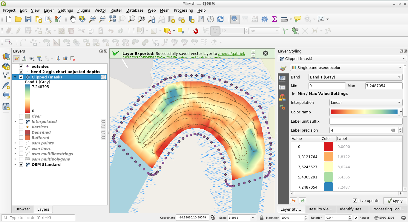
The result, is a digital depths model adjusted to the river boundaries:

11

4
  • Gabriel, thanks a lot, i had to redo this many times but eventually got something based on your approach.
    – kanekane
    Commented Aug 6, 2021 at 2:06
  • You are welcome. My answer involves an extrapolation to the river boundary, because the river boundary is easy to extract from OSM. but other approaches may be just as valid. Commented Aug 6, 2021 at 2:18
  • Yes understand that, this method worked well for what we were looking to achieve, and has given me 'the bug' to learn a lot more about QGIS, really interesting stuff.
    – kanekane
    Commented Aug 6, 2021 at 17:27
  • just out of interest here's what came up with, can be seen at this dropbox link: rb.gy/xme4qq
    – kanekane
    Commented Aug 6, 2021 at 17:35

Your Answer

By clicking “Post Your Answer”, you agree to our terms of service and acknowledge you have read our privacy policy.

Not the answer you're looking for? Browse other questions tagged or ask your own question.