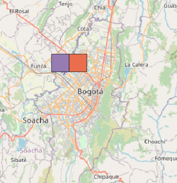
Using the spatial reference +proj=isea and comparing with others, in separate tables to avoid confusion in the QGIS renderization. But no visualization... is a QGIS bug? For example:
CREATE TABLE test1_b AS    -- Pure WGS84
  SELECT 1 AS gid,
         ST_SetSRID(ST_GeomFromGeoHash('d2g6b'), 4326) AS geom
;
CREATE TABLE test1_c AS    -- Same but Shere instead ellipsoid
  SELECT 1 AS gid,
       ST_Transform(
          ST_SetSRID(ST_GeomFromGeoHash('d2g6c'),4326),
          '+proj=lonlat +ellps=sphere'
       ) AS geom
;
CREATE TABLE test1_f AS   -- ISEA, that is also Shere
  SELECT 1 AS gid,
        ST_Transform(
           ST_SetSRID(ST_GeomFromGeoHash('d2g6f'),4326),
           '+proj=isea'
        ) AS geom
;
QGIS v3 only shows test1_b and test1_c:
Notes
Geohashes
d2g6b,d2g6candd2g6fare horizontal neighbors. As showed before, the ISEA projection useellps=sphere, and as showed by illustration (d2g6cbox), QGIS can plotellps=sphere... I supposed that QGIS can plotd2g6calso, using similar infrastructure.Supposing that
d2g6fis a small box contained into an ISEA's icosahedron face... So, no risc of "coordinate jump".In the related questions, "How to use ISEA projection?" and "DGGS projections with PostGIS or pgLatLon", no clues about visualization.
Double transform also not works, is not valid to transform ISEA back to any simple SRID.
Dump to text seems good:
select st_astext(geom) from test1_fresults the WKT below
 POLYGON((
  -9457665.085273389 722136.153457215,
  -9460296.69550779  726590.233366592,
  -9456290.810885958 728872.6605645764,
  -9453658.792895738 724419.0107246666,
  -9457665.085273389 722136.153457215
))
(edit)
Seems that "no inverse → no visualization"
As Even Rouault commented here,
the reason is much likely that only the forward method
(geographic coordinates → projected coordinates) is implemented,
whereas QGIS also requires the inverse method to be implemented.

