You have issues with the collection you're working on because your RVI formula is not correct. By using the 'system:index' of following image in your error message:
S1A_IW_GRDH_1SDV_20210503T125534_20210503T125559_037724_0473B3_F384
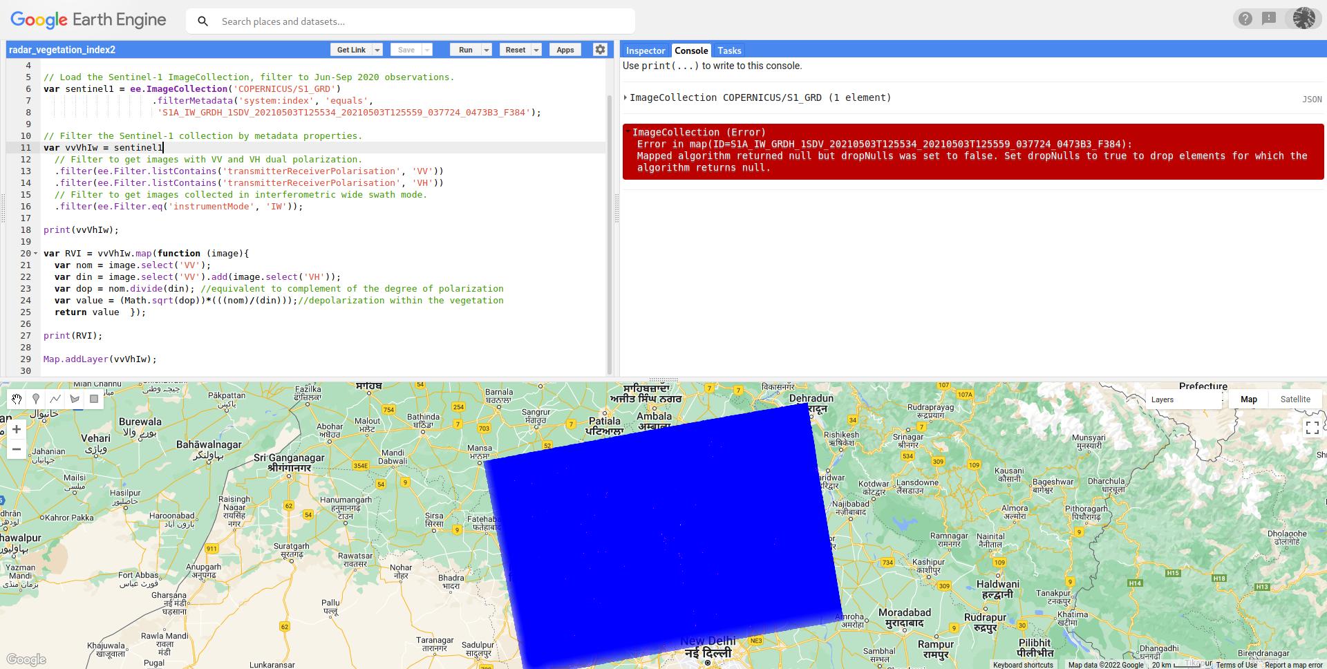
I could find out that your roi is probably situated in some area in India. So, your original code lines in following code reproduces your error message.
var pt = ee.Geometry.Point (76.8576, 29.5632);

Map.centerObject(pt, 8);

// Load the Sentinel-1 ImageCollection, filter to Jun-Sep 2020 observations.
var sentinel1 = ee.ImageCollection('COPERNICUS/S1_GRD')
                    .filterMetadata('system:index', 'equals',
                     'S1A_IW_GRDH_1SDV_20210503T125534_20210503T125559_037724_0473B3_F384');

// Filter the Sentinel-1 collection by metadata properties.
var vvVhIw = sentinel1
  // Filter to get images with VV and VH dual polarization.
  .filter(ee.Filter.listContains('transmitterReceiverPolarisation', 'VV'))
  .filter(ee.Filter.listContains('transmitterReceiverPolarisation', 'VH'))
  // Filter to get images collected in interferometric wide swath mode.
  .filter(ee.Filter.eq('instrumentMode', 'IW'));

print(vvVhIw);

var RVI = vvVhIw.map(function (image){
  var nom = image.select('VV');
  var din = image.select('VV').add(image.select('VH'));
  var dop = nom.divide(din); //equivalent to complement of the degree of polarization
  var value = (Math.sqrt(dop))*(((nom)/(din)));//depolarization within the vegetation
  return value  });

print(RVI);

Map.addLayer(vvVhIw);
This can be observed in following image:

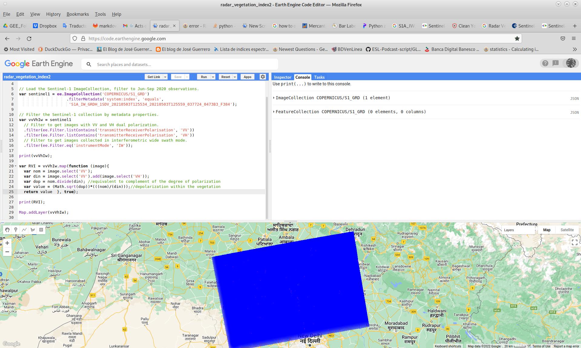
This kind of error can be solved by using suggestion in error message but, obtained collection is empty; observed in following image.

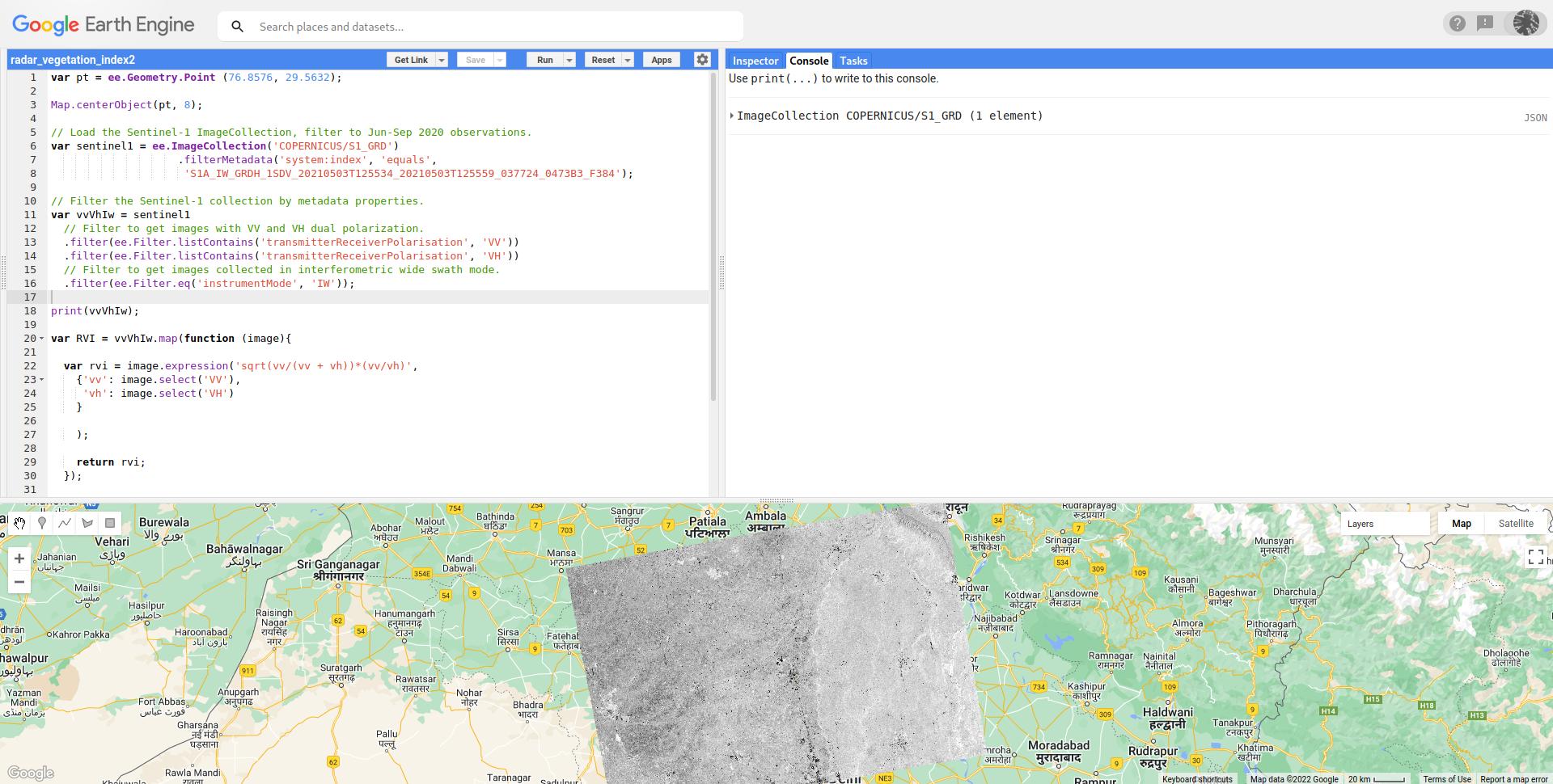
So, following code, where formula is corrected (by using a more comprehensive expression), produces a result without any issues.
var pt = ee.Geometry.Point (76.8576, 29.5632);

Map.centerObject(pt, 8);

// Load the Sentinel-1 ImageCollection, filter to Jun-Sep 2020 observations.
var sentinel1 = ee.ImageCollection('COPERNICUS/S1_GRD')
                    .filterMetadata('system:index', 'equals',
                     'S1A_IW_GRDH_1SDV_20210503T125534_20210503T125559_037724_0473B3_F384');

// Filter the Sentinel-1 collection by metadata properties.
var vvVhIw = sentinel1
  // Filter to get images with VV and VH dual polarization.
  .filter(ee.Filter.listContains('transmitterReceiverPolarisation', 'VV'))
  .filter(ee.Filter.listContains('transmitterReceiverPolarisation', 'VH'))
  // Filter to get images collected in interferometric wide swath mode.
  .filter(ee.Filter.eq('instrumentMode', 'IW'));

print(vvVhIw);

var RVI = vvVhIw.map(function (image){

  var rvi = image.expression('sqrt(vv/(vv + vh))*(vv/vh)',
    {'vv': image.select('VV'),
     'vh': image.select('VH')
    }

    );

    return rvi;
  });

var imageVisParam = {"opacity":1,
                     "bands":["VV"],
                     "min":0.01548,
                     "max":0.46221,
                     "gamma":1};

Map.addLayer(RVI.first(), imageVisParam, 'RVI');
It can be observed in following picture after running above code in GEE code editor. All RVI values ranged between 0-1.


