0

I am aiming to download parcel boundaries of the German state Mecklenburg-Vorpommern. I found this geoportal, where this data seems to be available:

https://www.geoportal-mv.de/portal/Geowebdienste/CapabilitiesViewer?url=https%3A%2F%2Fwww.geodaten-mv.de%2Fdienste%2Finspire_cp_alkis_download

where a WFS link is listed:

https://www.geodaten-mv.de/dienste/inspire_cp_alkis_download?SERVICE=WFS&REQUEST=GetCapabilities&VERSION=2.0.0

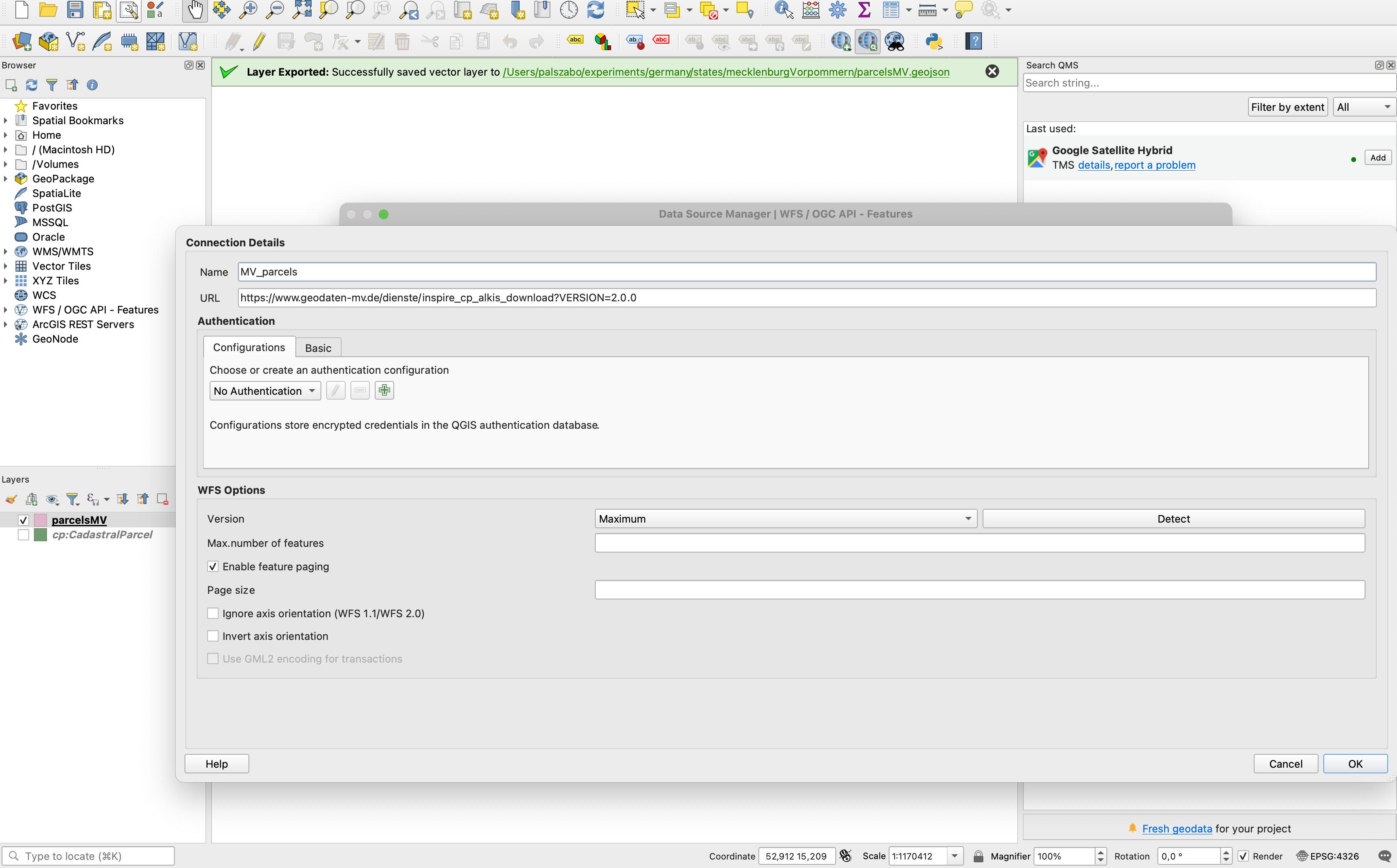
I open this WFS link in QGIS:

enter image description here

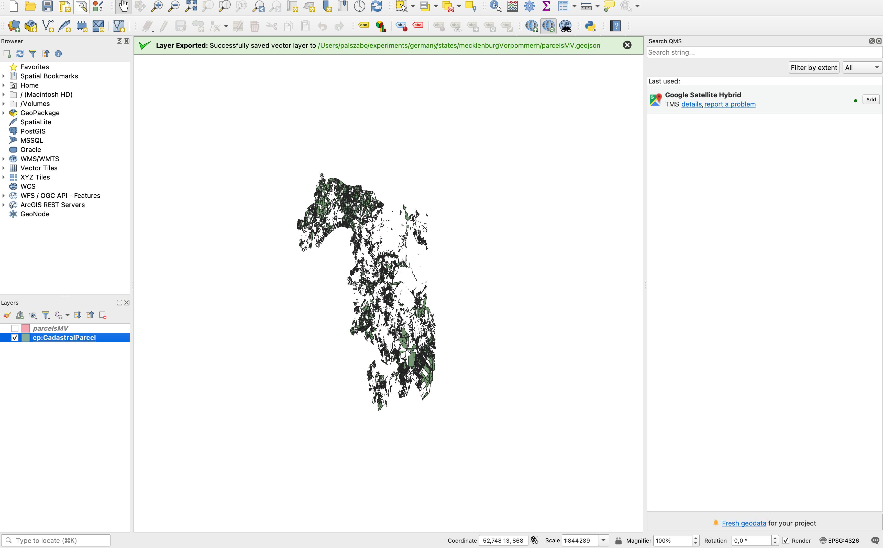
It seems to be the case that only part of the state's parcels are loaded onto canvas:

enter image description here

Nevertheless I right click cp:CadastralParcel, then Export, then Save Features As..., then I export the data to GeoJSON. I open the resulting parcelsMV.geojson then with GeoPandas:

df = gpd.read_file("parcelsMV.geojson")

and notice that the resulting GeoDataFrame only contains 30000 rows. A suspiciously round number, and probably there are way many more parcels than this. Not only a fraction of the parcels actually make it to canvas, a lot of parcels don't seem to be exported to GeoJSON.

How can I access the parcel data of Mecklenburg-Vorpommern in vector (preferably GeoJSON) format?

5
  • Have you made sure all parcels had been loaded before exporting?
    – Erik
    Commented Aug 2, 2022 at 13:54
  • No, but they seem to stop loading. I was hoping the export happens from the source (WFS server) and not from the data which had been already loaded. That's probably a wrong assumption.
    – zabop
    Commented Aug 2, 2022 at 13:58
  • Feature paging seems to be selected already but try to define also the page size, for example 10000.
    – user30184
    Commented Aug 2, 2022 at 14:14
  • why not just use them as a WFS layer? then you get real time updates as things change
    – Ian Turton
    Commented Aug 2, 2022 at 14:55
  • I need them into a database to be able to quickly list a subset of them and do some more calculations on each parcel. I also don't want to rely on a server not in my control to work.
    – zabop
    Commented Aug 3, 2022 at 7:27

1 Answer 1

2

By requesting data with a browser https://www.geodaten-mv.de/dienste/inspire_cp_alkis_download?SERVICE=WFS&REQUEST=GetFeature&VERSION=2.0.0&TypeNames=cp:CadastralParcel

it is possible to see from the beginning of the GML file that the server indeed has a feature count limit:

<wfs:FeatureCollection timeStamp="2022-08-02T16:18:51.288+02:00" numberReturned="30000" numberMatched="1945488"

For getting all 1.9 million parcel the WFS client must request 65 pages, 30000 features on each, and combine the result. QGIS should be able to do it but for some reason it looks like now it does not know that it must use paging. Configure the page size and hope that it is enough.

GeoJSON with 1.9 million parcels may be quite heavy to use. I would save the result into GeoPackage that supports spatial index. I would also consider to add a normal index on field "nationalCadastralReference" if that is an ID that could be used for searching a certain parcel.

1
  • Thank you. I will look into how paging works.
    – zabop
    Commented Aug 3, 2022 at 7:27

Your Answer

By clicking “Post Your Answer”, you agree to our terms of service and acknowledge you have read our privacy policy.

Not the answer you're looking for? Browse other questions tagged or ask your own question.