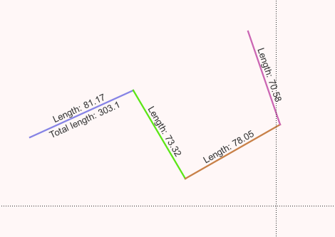
I am tracking progress made each day along a path, so that I can show in QGIS each day's progress in a different colour with a label showing the day number and distance covered.
However in this case each line segment is a separate feature (required in order to label and colour the line segments differently using categories) so I am not sure how to apply a global label that contains the total distance of all the segments combined.
It is also difficult because using the LineString geometry and having a separate feature for each segment means they don't exactly start at the same point as the previous segment finished, depending on how accurate my mouse clicks are or how willing I am to copy and paste coordinates when editing the vertices.
Is there a way to record this geometry such that it can be treated as a single feature with only one long line, but also to colour and label the individual segments differently, based on an arbitrary value like the day the work was performed?
I do not mind having to change the geometry of the layer to make this work, but I don't want to have to do any double data entry or otherwise synchronise between two copies of the data each time I add a new segment.
I looked at the MultiLine geometry but this looks like I can have unconnected line segments all sharing a single label which is the opposite of what I'm after - I need only connected line segments each of which has a different label, but where I can provide a global label (and length measurement) to the entire line as well.
Is there any way to achieve this?


