2

I have received some data from a third party that includes some point and line features that have no location information. I have the coordinates which I would like to use to provide that location information to the features.

Now I know how to add these to the line features (just select it and "Continue Feature" from the Edit Vertices toolbar), however this method doesn't work for point features.

How can I add location information to point features that don't display on the map?

2 Answers 2

2

ArcMap has a button called the "Replace Geometry" tool, which can be found on the Advanced Editing toolbar. Select the feature from the Attribute table then use this Replace Geometry tool to add location info to the feature.

  1. Make sure the layer containing the null geometry is in the map. On the Editor toolbar, click the Editor menu and click Start Editing, if not already in an edit session.
  2. Select the row in the table containing null geometry. Make sure to select only one row at a time.
  3. Click the Replace Geometry tool. If the feature selected has valid geometry already, a message is received indicating this.
  4. Click the map to define the feature's shape. To create a point, click the map where the feature should be placed. If the selected feature is a line or polygon, the segment construction method can be changed using the Editor toolbar and palette. Finish the sketch when the shape has been defined.

from Create valid geometry for a feature with null geometry (Esri) (note I have removed the first four steps from the linked docs as they are no longer relevant in current/recent versions of ArcMap).

Once you have created the point, you can double-click on the selected point, right-click and choose "Move to..." to move that point to your known coordinates.


See also:
Moving a vertex to an exact x,y location (absolute x,y)
Create geometry for a feature with null geometry in ArcGIS Pro (Esri)

3
  • Why Make Xy event layer is not enough?
    – FelixIP
    Commented Dec 4, 2023 at 18:08
  • @FelixIP I have the features in a geodatabase already, without coordinates. I have the coordinates separately (in PDF or email). Make XY on the coordinates will create new features, not modify the existing (but lacking location) records.
    – Midavalo
    Commented Dec 7, 2023 at 14:18
  • @FelixIP If you think there's a way to do it with Make XY please add an answer, as it might be better than the solution I've come up with
    – Midavalo
    Commented Dec 7, 2023 at 14:19
1

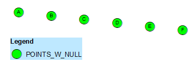
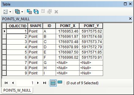
Situation: I have 6 points on the map, but 9 records in their table:

enter image description here

enter image description here

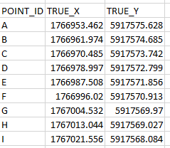
I can type in missing coordinates or join ID field to a table with correct coordinates (XY event layer or standalone table):

enter image description here

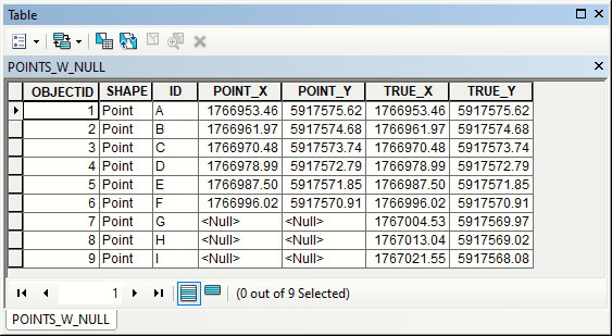
to get this:

enter image description here

Use field calculator on field Shape:

arcpy.Point( !TRUE_X!, !TRUE_Y!)

to create valid points:

enter image description here

Null geometries! Surprise from Client?

Your Answer

By clicking “Post Your Answer”, you agree to our terms of service and acknowledge you have read our privacy policy.

Not the answer you're looking for? Browse other questions tagged or ask your own question.