I'm trying to automate the process of adding a point to the downstream end of each polygon in a layer in ArcGIS Pro (Running V3.2.0 on Windows 11). I have a layer with the stream network along with a DEM, flow direction, and flow accumulation raster in the project. My eventual goal is to delineate the watershed above each one of my polygon features, but to do that I need to create pour points at the downstream end of each polygon. I've tried a few things, to no avail:
- Converting the polygon layer to points (Feature to Polygon tool) - the resulting center point layer doesn't overlap the stream network/flow accumulation paths because it's just the geometric center of each polygon - all polygons overlap the flow accumulation paths, but their centroids don't necessarily.
- Intersecting the polygon layer and stream network layer - this creates a multipoint feature class with points at each intersection between a polygon and the stream network, which is close to what I need, but I only want one point per polygon at the downstream end, not every intersection between the polygon and the stream network.
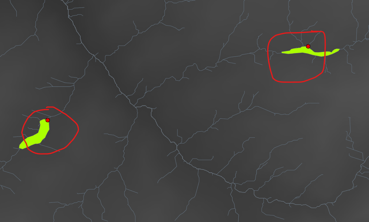
- Converting the multipoint layer described above into a point layer (Multipart to singlepart tool) and then deleting entries with duplicate polygon info (Delete Identical tool). This produces one point per polygon, but not always at the downstream end of the polygon - see the screenshot below for an example. The circled example on the left is what I'm going for, the one on the right is an example of a point not at the downstream end of the polygon.
- Manually adding pour points for each polygon - this works, but is very time consuming as there are ~75 polygons in the project, so I'd like to avoid doing this if possible.
How do I automate this process so that I don't have to go through and create pour points for each polygon individually?

