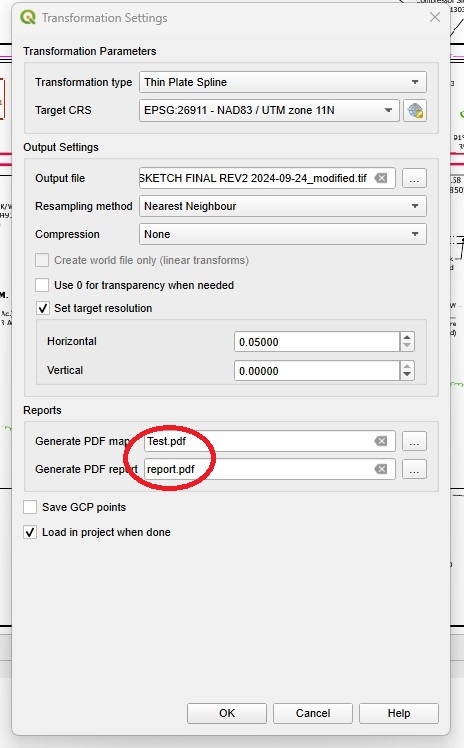
Is there no way to erase/suppress or turn off the red adjustment residual error lines when you use georeferencing in QGIS? I have tried every combination of settings and adjustment algorithms and still get very long red residual lines even though no such error appears in my residual table. Is there no way to suppress their creation or shut them off? What purpose do they visually serve when you can also create an output report for this? I am trying to create a georeferenced pdf as an output.
1 Answer
As stated in the docs, after all GCPs have been collected and all transformation settings are defined, just press the "Start georeferencing" button to create the new georeferenced raster.
Then you can import such new georeferenced raster layer in your map (if not already automatically imported) and either:
- create a new print layout and export it as PDF
or
- export the map view as PDF
or
- export the raster layer as Geospatial PDF.
(This option is not actually available, due to a bug in QGIS, as reported in a comment by Mikeoramma)
or
- use the "Translate (convert format)" GDAL processing algorithm to export the raster layer to the PDF format
-
-
As for bullet 3 above, I have never had a raster layer be exportable to geospatial pdf. I have attached the error message above. Commented Sep 26 at 16:55
-
I have and they do work. Problem is if your pdf is adjusted to a local grid it will be oriented to whatever grid north is with no way to reorient it square again. Commented Sep 26 at 21:11
-
You need to just set the same CRS as the raster CRS for the project or for the map in the layout. Commented Sep 26 at 21:17
-
If you are on the edge of a UTM zone there will still be a noticeable angle on grid north orientation. Commented Sep 26 at 21:21


