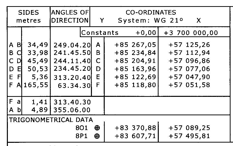
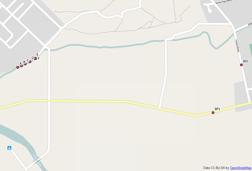
I have a land survey document for a piece of land, it contains absolute coordinates that I would like to locate on google maps, but I don't know how to correctly interpret the data.

What does the "System: WG 21°" mean and how do I convert these coordinates to decimal notation for google maps?
The land is located in South Africa.
My Attempt:
I considered that the constants were somehow the baseline values, and tried adding the constants to each coordinate value, but the result doesn't match decimal notation. In any case, in South Africa, the latitude is negative and the longitude is positive. Both latitude and longitude are positive in this case, which makes me think that they're not latitudes or longitudes at all, but rather the result of a more complicated transform. The transform is probably indicated by the WG21 (hence the question), which is where I am currently stuck.


Cape / Lo 21°. Would that fit?Cape / Lo 21°mean?