One of my services defines geofences for a mobile app. The geofences consists of a lat/lon pair and radius in meters, in JSON, e.g.:
{
    "geofenceId":"geofence_b39da38cff7be4b4693cbc31b2394bbb",
    "latitude":32.083611,
    "longitude":34.806111,
    "radius":15000.0
}
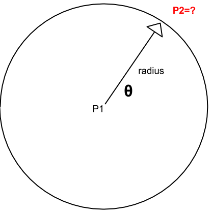
I would like to display these geofences in KML. Alas, KML files don't feature circles, so I have to approximate using a polygon with n vertices. Each vertex location is the head of a vector originating at the centre of the circle, whose length is the circle radius and has a given heading:

What's the Pythonic way to calculate P2 from P1, θ and radius?
Update: I've found some obvious solutions (like this), which assume that the earth is a perfect sphere. I calculated a circle with a radius of 15 Kilometers and 72 points. For each point, I've calculated the exact vincenty distance from the center. The minimum and maximum are:
14941.7356806
15014.5884245
The error is significant - a few dozen meters. I would like to find a solution that uses a better approximation.
Second Update:
I am trying to calculate ray tracing, which is (P1_lat, P1_lon, radius, heading) -> (P2_lat, P2_lon). This is different from the distance between two given points, which can be easily done with geopy's vincenty formula.
