I am working for the Town of Yadkinville, NC and would like to know how to create a layer of directional flow arrows for sewer lines to be able to turn them on and off at will?
2 Answers
Most of the sewer pipes I've seen have the directional arrow at the end of the line, but I had users that wanted the directional arrows along the entire line, at a reasonable interval.
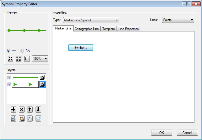
It was a 2-layer symbol, with a cartograhic line, and then a Marker line symbol with an interval of 13.

Also, I just used 2 different feature layers of the same featureclass: 1 with the arrows and 1 without (sometimes I would tie each to different a scale range).
here's the symbol on a 9.3 layer (don't have time to sort out a style file). You should be able to add it, set the data source and go from there to tweak the symbol.
When you created your sewer network as long as it was built with an eye to topology you can symbolize with directional arrows. Meaning, when editting, click for the first point of your line which will be uphill, then the second point to complete your line with the downhill. Flow will be from uphill to downhill. Creating the lines with flows in line is the most important step.
You can create your directional symbology from the properies of the line feature class. Symbology tab, click the line symbol, Edit Symbol, select 'Cartographic Line Symbol' from the drop down, select the Line Properties tab. You can choose which end of the line you want your flow arrows on (or the middle).
This is all assuming you are using ESRI products and are trying to do this on the desktop....
