53

I once found a great but simple webpage that has a drop-down with several text-based GIS formats such as GeoJSON and WKT, and a text box to copy/paste your data. The feature is then drawn on a world map. You can continue to add shapes on the same map.

Does anyone know the page, or any page where I can paste WKT and GeoJSON to see them displayed on a map?

0

15 Answers 15

67

Look at Are there any online WKT editors?

GeoJSON and WKT

GeoJSON

WKT

3
  • That first link for OpenLayers is the exact page I was looking for!! Thanks so much - I'm not sure why I couldn't find it.
    – JPhi
    Commented Oct 2, 2014 at 3:07
  • 1
    Love the OSM Playground!
    – Campa
    Commented Jan 7, 2019 at 14:51
  • Is it possible to specify the WKT as URL parameter, in order to share a shape with someone? Commented Feb 13, 2023 at 14:43
7

I created this little utility for a co-worker to plot multiple WKT or GeoJSON geometries on a Leaflet map. You can fork it and tailor it to your needs.

http://jsfiddle.net/asnyder14/9dxbcr4f/embedded/result/

3
  • 1
    Fantastic tool, thanks! (if'd be great it could accept more than WKT object at once... ;))
    – jjmontes
    Commented Oct 1, 2015 at 22:52
  • Exist a way for know when a point is inside Polygon
    – jose920405
    Commented Mar 10, 2017 at 14:41
  • 1
    @jjmontes Easy enough: jsfiddle.net/eyal0/z4px7g30/12
    – Eyal
    Commented Feb 4, 2021 at 17:14
6

wkt:
https://arthur-e.github.io/Wicket/sandbox-gmaps3.html
https://clydedacruz.github.io/openstreetmap-wkt-playground/
https://geometrymapper.com

geojson:
http://geojsonlint.com/

csv:
https://www.becsv.com/csv-viewer.php

.shapefile/geojson/csv:
https://mapshaper.org/
https://www.sunearthtools.com/tools/gps-view.php

svgviewer:
https://www.w3schools.com/graphics/tryit.asp?filename=trysvg_path

svg handling:
https://github.com/substack/svg-linearize
https://github.com/davidmcclure/svg-to-wkt
https://www.w3.org/TR/SVG/paths.html
https://stackoverflow.com/questions/5736398/how-to-calculate-the-svg-path-for-an-arc-of-a-circle

geojson on leaflet:
Adding GeoJSON layer on leaflet?

converters:
CSV to GeoJSON: http://csv.togeojson.com/
CSV to GeoJSON: http://www.convertcsv.com/csv-to-geojson.htm
JSON to CSV: https://json-csv.com/
JSON to CSV: http://www.convertcsv.com/geojson-to-csv.htm
WKT to GeoJSON (printed in console): https://geometrymapper.com

examples:
wkt: https://en.wikipedia.org/wiki/Well-known_text#/media/File:SFA_Polygon.svg
csv: https://github.com/naturalatlas/geocsv-info/blob/master/example.csv
geojson: https://www.mapbox.com/mapbox-gl-js/example/geojson-polygon/
svg path: https://jsbin.com/quhujowota/1/edit?html,js,output
svg path: https://codepen.io/anon/pen/XogNoZ

1
2

WKT visualizer on 3D Earth

https://asapelkin.github.io/wkt_3d_viewer

(repo with examples and readme https://github.com/asapelkin/wkt_3d_viewer)

2

GeoJSON Viewer (from URL) gives a simple, quick map from a GeoJSON URL.

1

In case anyone comes across this question and needs to convert to/from Esri (ArcGIS) json, geoJson, or WKT, I created a small application called geometry-inspector. It is much like the listed applications in the accepted answer, but with the improvement that it supports Esri's json format.

Hope it helps someone!

1

Created a WKT <-> GeoJSON converter based on Wicket http://jhnotes.com/wkt/

0

mapshaper worked well for huge GeoJson file but unfortunately it plots on white background instead of map.

0

For bash, I use my own script: https://gist.github.com/rajanski/4d2595c1fd4e35c19b4e1a02b4ed579f Pro: Geojson data doesnt leave local machine, good for confidential stuff.

0

Github/Gists can handle GeoJSON: https://help.github.com/en/articles/mapping-geojson-files-on-github

0

For WKT there's also https://wktmap.com/ which supports different projections.

0

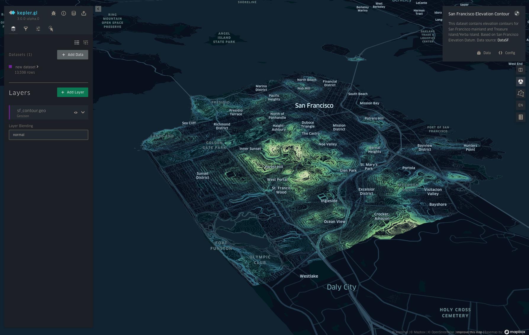
Kepler.gl https://kepler.gl/demo

I can recommend the Kepler.gl demo where you can add your data in the following formats:

CSV, Json, GeoJSON or saved map Json.

As data privacy is a concern when using online viewers, they state:

*kepler.gl is a client-side application with no server backend. Data lives only on your machine/browser. No information or map data is sent to any server.

Screenshot: enter image description here

0

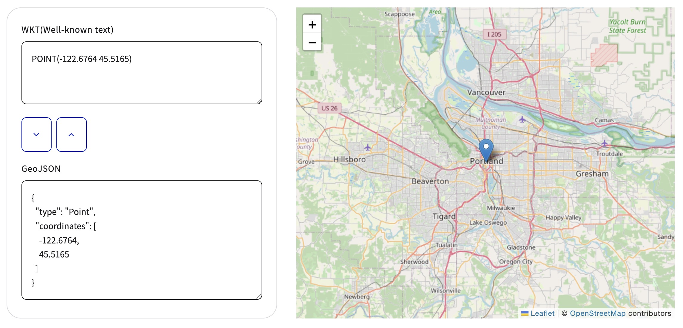
WKT <-> GeoJSON converter and Map Viewer:
WKT & GeoJSON Map Viewer enter image description here

0

New Site ZeCompadre - WKT Plotter

-1

geometrymapper is what you're looking for. This Online Mapping Tool is capable of plotting WKT and GeoJson in different coordinate systems and colors. Really recommend it. (mirror https://vannieuwenhovej.github.io/wkt-geometry-plotter)

1

Your Answer

By clicking “Post Your Answer”, you agree to our terms of service and acknowledge you have read our privacy policy.

Not the answer you're looking for? Browse other questions tagged or ask your own question.