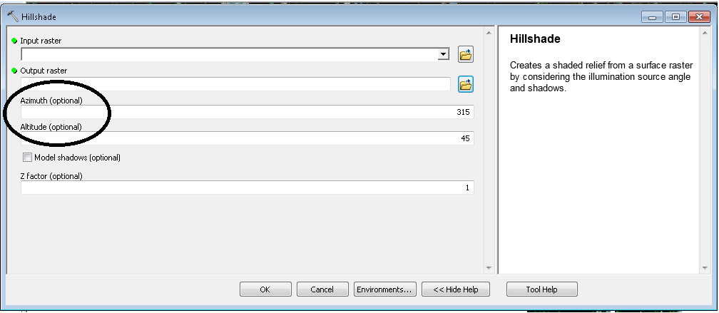
I would like to automaticaly identify shadows on Landsat scene in mountaineus area using Hillshade Tool (ArcGIS 10.1). I have
- 1 Landsat image from one date
- DEM (SRTM) from the same area
To create Hillshade raster (ArcGIS-> Tools-> Spatial analysis -> Surface -> Hillshade) I have to insert DEM and two characteristics of actual sun position:

I have to input Azimuth and Altitude, relevant to actual sun position. In ESRI (http://resources.arcgis.com/en/help/main/10.1/index.html#//009z000000z2000000) help I can find this information:
- The azimuth is the angular direction of the sun, measured from north in clockwise degrees from 0 to 360. An azimuth of 90º is east. The default azimuth is 315º (NW).
- The altitude is the slope or angle of the illumination source above the horizon. The units are in degrees, from 0 (on the horizon) to 90 (overhead). The default is 45 degrees.
In different help (http://landtrustgis.org/technology/advanced/shaded%20relief) I can find information that I have to "Play with these values until you find a combination that yields reasonable, legible, and attractive results (a good starting point is altitude=45, azimuth=315)."
My question is, if it is possible to use Hillshade tool to exclude hillshades from Landsat scene?
For my Landsat image I have a specific DOY (Day of Year), can´t I directly convert this DOY information in Azimuth and Altitude values?
I suppose these values are relevant to the time of day but I think I can find this information somewhere on NASA web site (hour of Landsat data acquisition, not only the date).
Find shadows on Landsat image using DEM hillshade (by ArcGIS Hillshade Tool)

