6

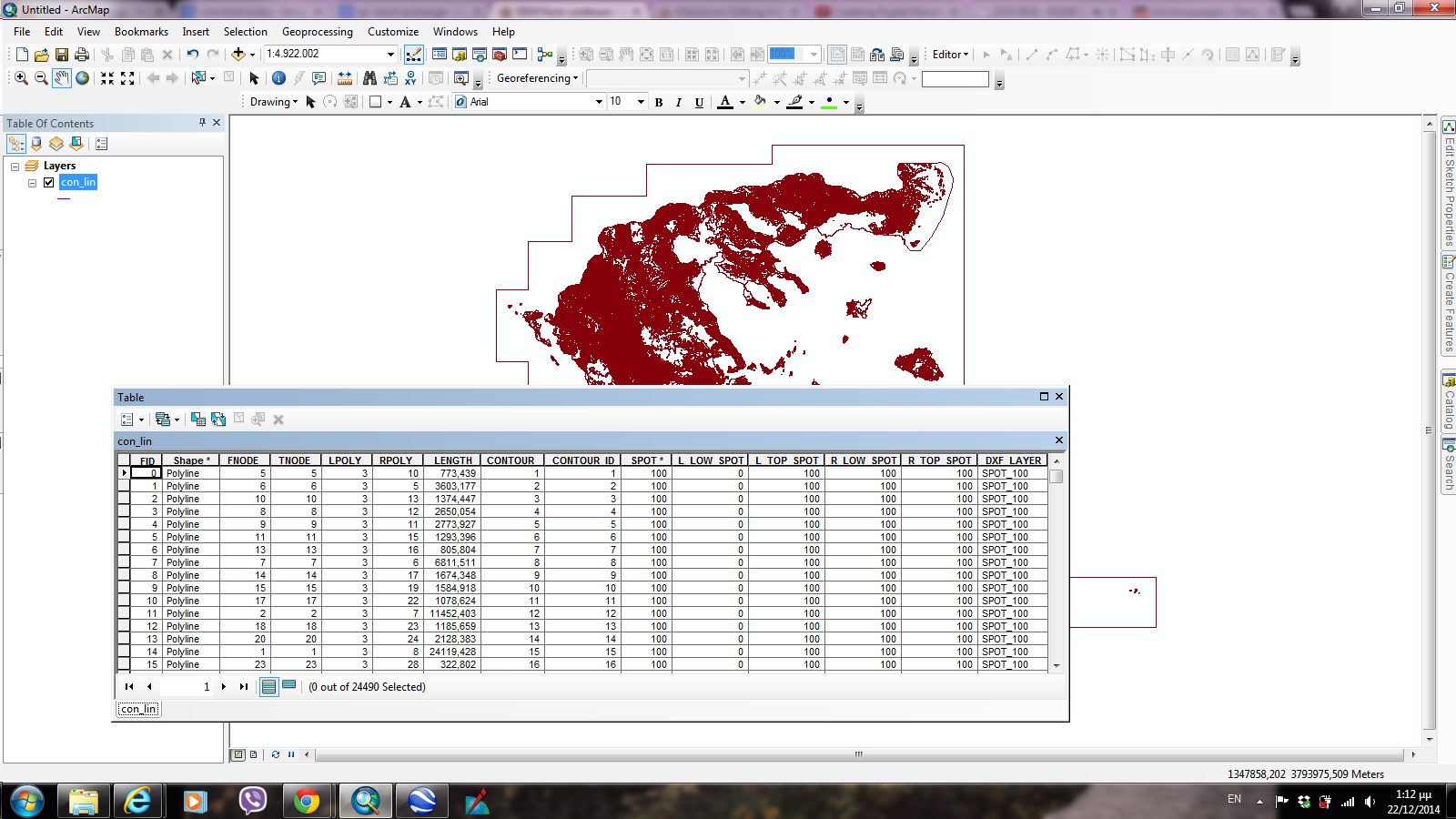
I have problem to create a DEM from contours. I know it is very simple but I can not make it work. I tried everything but nothing has happended! The shapefiles I've got are a con_lin and a con_pol like thw images
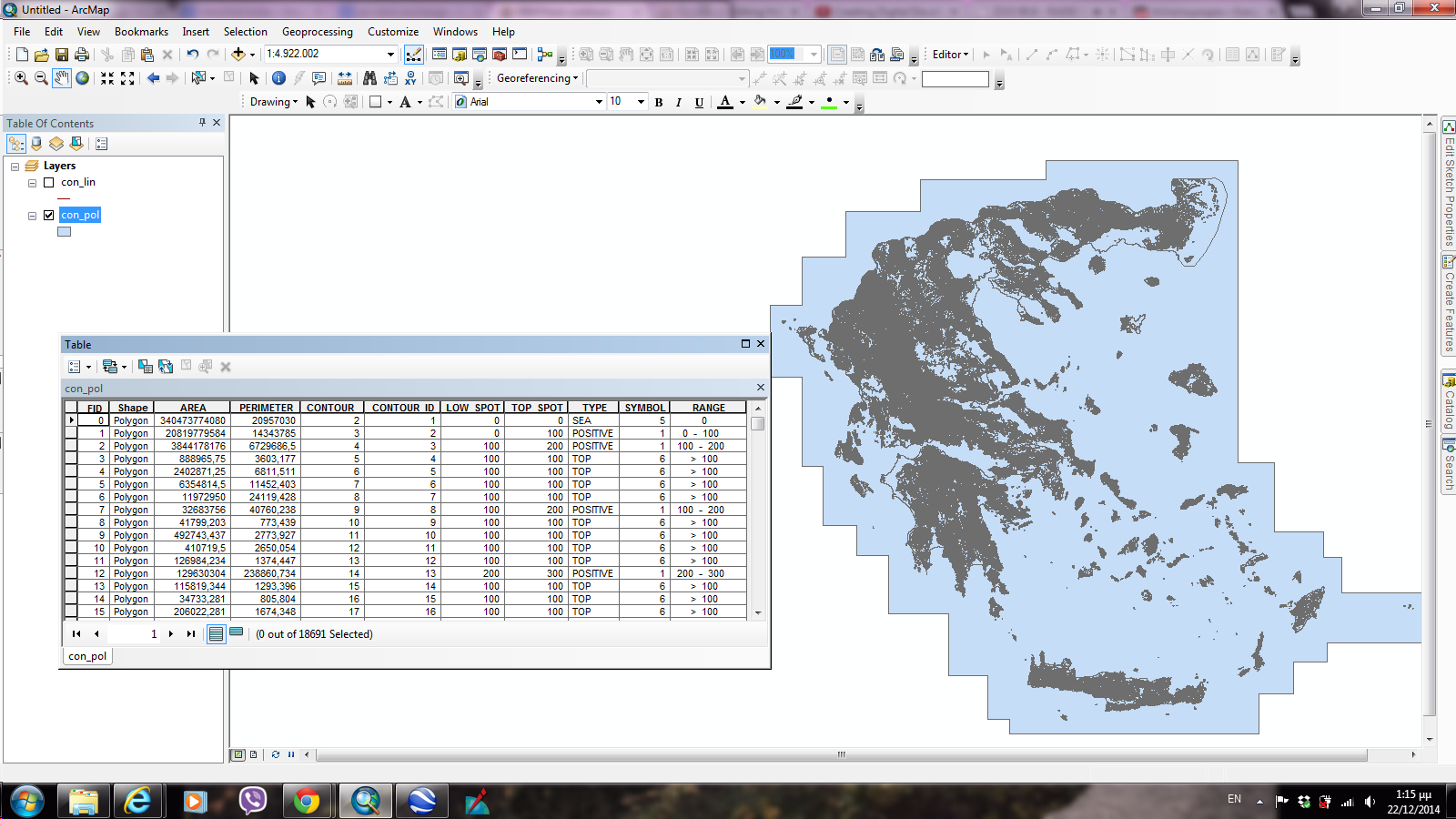
con|_pol attribute table

con_lin attribute table

What should i have to do? I think Topo to Raster needs a shp with point but I havn't got one.

5
  • 1
    Topo to raster works perfectly with lines. In fact, that's the default input. However, it looks like you also try to include polygons, those would have to be taken care of differently (provided you actually want them). It also looks like you have a line that just is surrounding your data, you should probably remove it before you do any calculations. It is hard to tell what could be the problem, but including a screenshot of the function as it was when you tried to run it would help. Make sure to include all of it (there's more than is first visible, scroll down).
    – Martin
    Commented Dec 22, 2014 at 11:47
  • 3
    I looked a little closer on your data. It seems as they are missing the elevation attribute!? Without it you have a whole bunch of, literally, completely useless lines. If you converted these lines from a dxf or dwg, you should probably revisit that step and see if you can do the conversion with elevation values retained. And first of all check in CAD that there actually exist any, and stored in a format that is likely to transfer to ArcMap easily (e.g. 3D-polylines are a bit trickier, but still doable in i.e. FME).
    – Martin
    Commented Dec 22, 2014 at 12:02
  • I followed your advice and I removed the line that was surrounding my data from ths shp con_lin and the other. Actually, I 've got these files from others so I didn't take the risk to make any change. Also I think that the elevation is the field of SPOT because I did the TIN and the result was pretty successful.I saw a video that lead me to conclude that i need point (as elevation point), line (as contour)and polygon (as BOUNDARY).But i don't know how to do the same with these fields!!!!
    – Danai
    Commented Dec 22, 2014 at 12:44
  • If you need points: Feature Vertices To Points, then you can interpolate as you want (TIN, IDW, etc). But you need to keep the elevation attribute as @Martin says.
    – Pau
    Commented Dec 22, 2014 at 13:01
  • From the looks of it, your polygons contain the same data as your lines. I'd recommend trying only with lines instead. Or you could try converting to points as suggested above, although it'll cause some data loss. Also, bear in mind that interpolation "adds" and recomputes data, the result is not like a LiDAR scan.
    – Martin
    Commented Dec 22, 2014 at 13:18

1 Answer 1

2

If you want create DEM in ArcGIS you can do it in two ways:

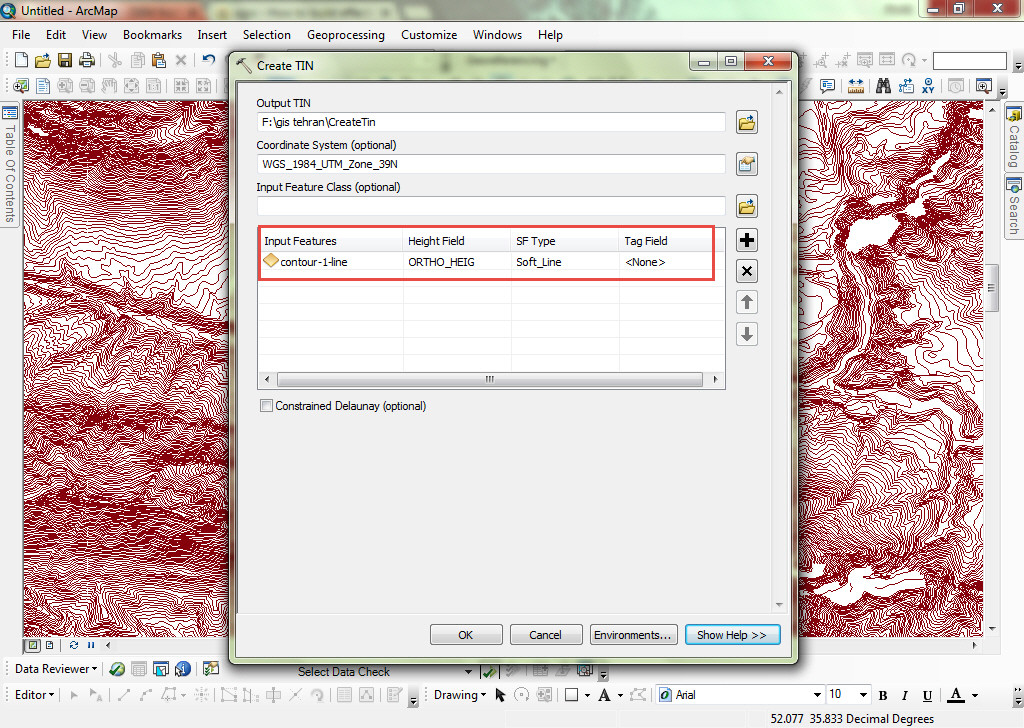
Step one in ArcToolbox: choose Create TIN tool and configure it like in the image below:

enter image description here

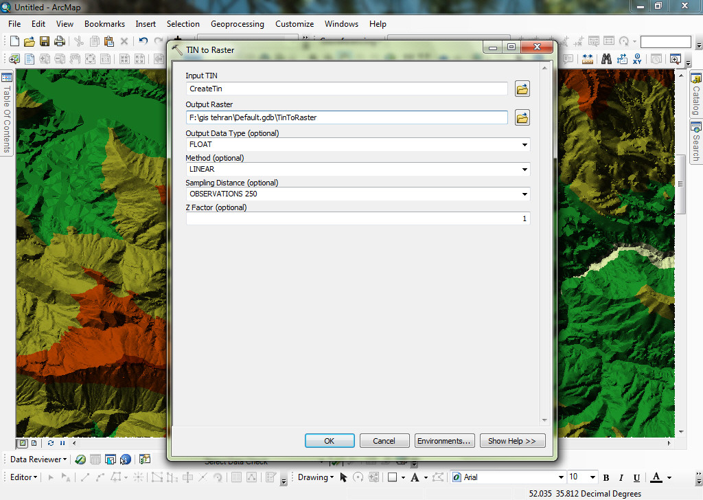
Then, convert the created TIN to raster. In ArcToolbox set the TIN to raster tool like the following:

enter image description here

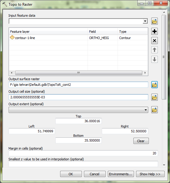
Another option is to create a DEM directly with the Topo to Raster tool:

enter image description here

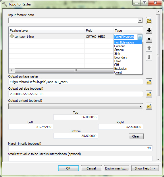
Then, set the Type field equal to "PointElevation":

enter image description here

Note:
1. Ortho_HEIG in this sample is elevation values in contour layer attributes table.
2. For best result remove null or NoValue records in contour layer.

Your Answer

By clicking “Post Your Answer”, you agree to our terms of service and acknowledge you have read our privacy policy.

Not the answer you're looking for? Browse other questions tagged or ask your own question.