With the wonderful genetics passed from by grandfather via my mother, I'm acquired the blue/ purple-green/brown color blind trait.
How will this affect my capability in properly doing/ interpreting my own or other peoples mapping ?
With the wonderful genetics passed from by grandfather via my mother, I'm acquired the blue/ purple-green/brown color blind trait.
How will this affect my capability in properly doing/ interpreting my own or other peoples mapping ?
Why do you feel that this will barriar you from doing the GPS or GIS work ? I am hearing impaired and I do have a colorblind ? It takes a while for you to make some adjust to your needs. For me to communicate people, I use videophone to talk to other people. I have worked GIS for many years....That has not stopped me from what I love doing this work.
Here is the information about some of people who are colorblind to GIS maps
If you're going to be using GIS for analysis, application development, etc., color blindness would not make a difference. If you're going to be doing a lot of map design, color blindness will have to be taken into account in your work, but I don't think that it should hold you back in your career. I do not specifically know of GIS professionals who are color blind, though that could be just because it hasn't come up in conversation, and I would assume that there are some out there.
Regarding interpreting maps that other people have designed, you will have to make do with some maps that have not been optimized for the color blind, but you also have the opportunity to educate colleagues about the issue. For one early project I designed a map using a diverging red-green color ramp, only to find out that one of my co-PIs was red-green color blind. He said the map looked like mud to him. So I redesigned it using a different color ramp.
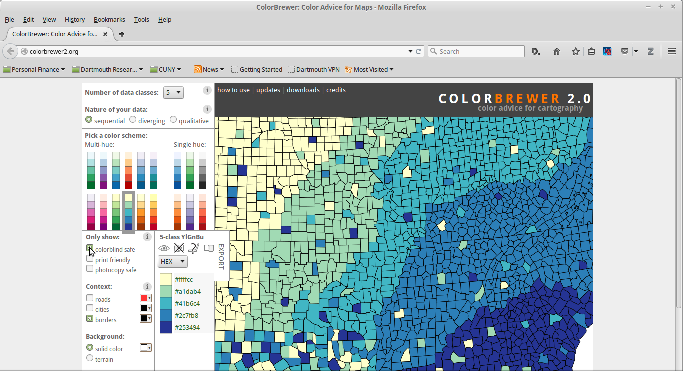
In terms of your own map design, anything you design where you can tell the colors apart should also be interpretable by someone who was not color blind, though I don't know how it will impact the aesthetics. But, for all GIS professionals, if you have not gone to art school and do not have an in-depth understanding of color theory (I haven't and don't), then you should rely on the work of Cynthia Brewer and make use of her ColorBrewer. Her color ramps have become the de facto standard in the industry, and have been incorporated into R, QGIS, and ArcGIS (and probably others as well). The ColorBrewer website allows you to specifically choose palettes that are "color blind friendly" (notice the checkbox in the middle left of the screenshot below). This is useful for those of us who are not color blind to be able to choose ramps that are accessible to the color blind, but would also allow you to choose color palettes that are attractive and informative even if they are not color blind friendly.

I am a GIS developer and have only red-green color blindness. I work with WebGIS-Applications. It is only rarely a problem during my work. As Lee Hachadoorian pointed out, there is always the ColorBrewer. Sometimes I Email my customers the link to it and ask them to select the color scheme they like best.
Some customers also have the same problem and they are happy that I understand their problems. One of the gets a color scheme ranging from blue to red instead of green to red for showing activity of plants or their health status.
Another possibility that I use quite frequently is to send a Customer a link to a Color-table and ask them: "Which shade of red or green would you like?", e.g. using: https://web.njit.edu/~walsh/rgb.html