3

I have an AutoCAD .dwg file that was assembled from scanned maps and is georeferenced.

I would like to export it to use as a raster in ArcGIS.
What file format should I use, that can be opened in ArcGIS and will maintain the spatial information?
How can I do the conversion?

I have Autocad and Raster Design. I also have the original images, which are .tif files The "CAD to geodatabase" tool does not work for this.

5
  • do you have autocad map or just autocad? do you have raster design (autodesk). without both of these you are going to be very limited in what can be done. Also in order for someone to help you will need the original images that are referenced in the dwg. If you can see them in autocad that is good. go into the reference manager and look at the path to those images. answers to these will help someone know the direction to answer.
    – Brad Nesom
    Commented Feb 5, 2015 at 17:30
  • I have Autocad and Raster Design. I also have the original images, which are .tif files.
    – dichotomy
    Commented Feb 5, 2015 at 19:57
  • without map3d or civil3d I don't thin your raster design will have the option to export with crs.
    – Brad Nesom
    Commented Feb 5, 2015 at 20:12
  • I have included the easy way with map3d and the hard way with esri.
    – Brad Nesom
    Commented Feb 5, 2015 at 21:59
  • let me know if neither of these solution don't work for you. Also you might search this website for answers if you have trouble with the coordinate system in regards to georeferencing
    – Brad Nesom
    Commented Feb 5, 2015 at 22:10

3 Answers 3

2

If the original images are in an autocad drawing and they are in the correct position, angle and scale.

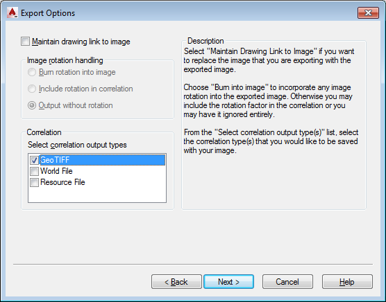
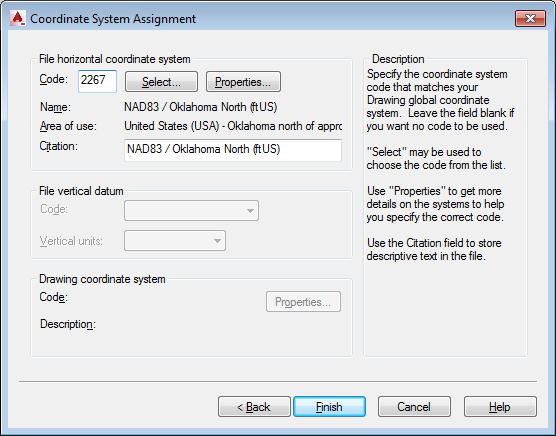
You can use raster design to export the image with georeferencing. Not sure if this functionality is available in raster without having map3d or civil 3d installed with it.
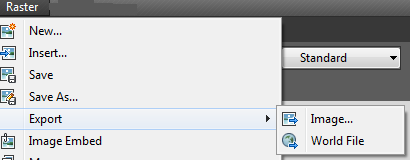
export
I suggest using tif format as geotiff will be most usable in autocad and arcmap.
My MO is packbits/tiled/geotiff.
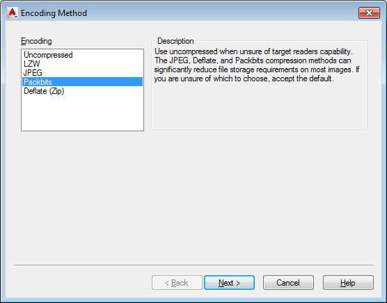
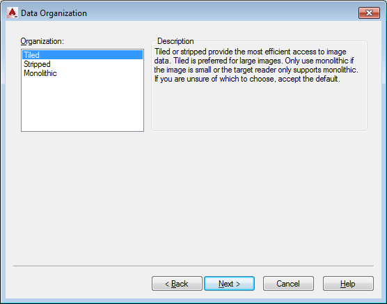
image2
image3
image4
image5

If you don't have the geotiff option in raster design.
the esri method is there but I don't like it as well.
insert the image into an arcmap (no layout view) dataframe (use the add data butoon).
zoom to the area the image "should cover".
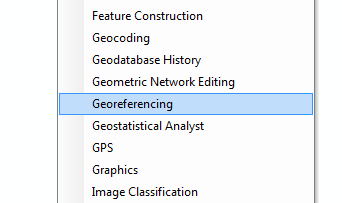
open the georeferencing tool bar.
tools
tools7
With some reference data (some known points on both the data and the image, hopefully in the [projection] coordinate system of the image)
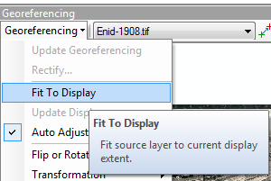
click the fit to display button. (you may have to resize the display and click again several times).
tools8
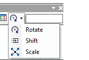
Then use the
shift
rotate
scale
tools9
buttons to get the image exactly where you want it. (this is cluncky compared to map3d).

Note that you may need to utilize the control points tools if you can't match the existing image projection closely to a CRS (utilizing only move , rotate, and scale). this will squeeze the image into a crs.
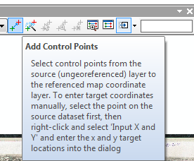
tools10

and autoregistration sounds great huh?!

You should take care with this and not save over your original. If you have to use this I suggest using the esri help for a tutorial on the subject. But remember to use the outside edge and go in a clockwise direction for your control points.
When the image looks like you want (in the correct location, rotation, scale) use the update reference button to write the new georeference data into the file.
Or alternatively use rectify to write an entirely new image using an algorithm to resize the cells to your new unit and crs.
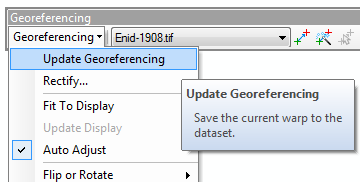
tools11

1
  • Thanks, Brad Nesom! I was able to get the files into GIS by exporting to Geotiff. I have to export each tif one at a time, and I have to project them once I get into GIS, but it still beats manual georeferencing.
    – dichotomy
    Commented Feb 16, 2015 at 15:12
1

You can use FME to convert from DWG TO Geotiff format and then make use of it in ArcGIS

0

You might also consider using Novapoint TopoPlanner to grab imagery from well known map providers (such as Google, Bing, et.al.) and import it directly to AutoCAD, along with accompanying georeference ("world") file suitable for ESRI or other GIS platforms.

Your Answer

By clicking “Post Your Answer”, you agree to our terms of service and acknowledge you have read our privacy policy.

Not the answer you're looking for? Browse other questions tagged or ask your own question.