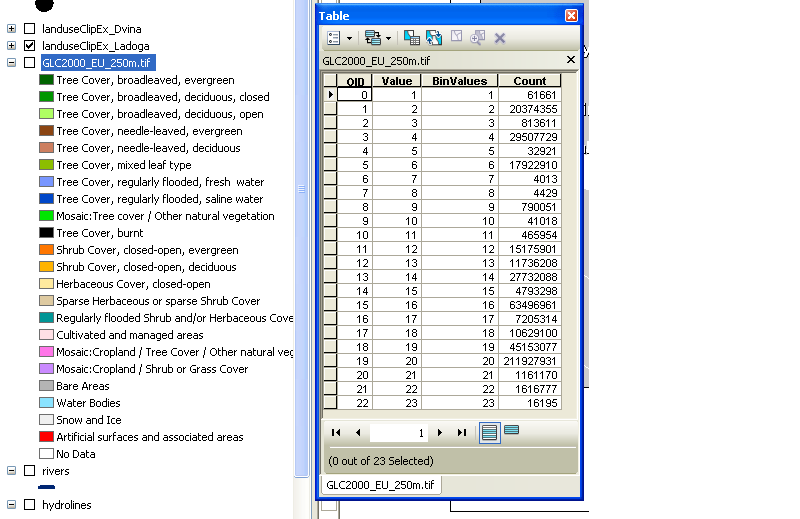
A layer (lyr) file is saved symbology. It does not 'get' it's information from anywhere, it is the information. At some point someone went through and symbolized each unique value in the raster to a certain color and labeled it with the LUC class. Once they had that symbology and labeling set up, they saved it out as a lyr file which allows you to load the same raster data in and view it the same way. They've used a lyr file instead of a colormap because the latter can't store legend values/labels, just pixel values mapped to color values.
A lyr file itself is binary, so you can't read anything out of it. There are two possible sources for the information you seek. Sometimes a separate raster attribute table (or just a generic table) is provided which gives the key between the coded raster values and their labels/other attributes. It may be provided within a gdb (I've seen this with BLM PLSS data, but not in your case) or available as a separate download somewhere on the site. The information might (should, really) also be contained within metadata.
Your other alternative is to create such a lookup table yourself by copy/pasting the labels, since I'm not aware of any way to export that data in a tabular/text format. I'm not entirely clear why you say you need the info to create a legend, since you can create one using the data already properly symbolized by the lyr file - unless you just want a text table for something other than a map.
Related: What is layer file (*.lyr) in ArcGIS Desktop?

