2

I am trying to project a set of coordinates (points) from an Excel spreadsheet, on top of a shapefile (map) with an unknown coordinate system.

The Excel file was created by first creating a map with some points in Google Earth and then exported it into a .kml file and then created the Excel.

The shapefile was given to me ready for the project I am doing. Basically I am trying to map-match the two files and then join-relate them to get some additional information for my project.

Here is what I did step by step:

  1. Open ArcMap (V.10.1) and right clicked 'Layers' and defined a Geographic Coordinate System 'WGS 1984'

  2. Imported the "vista_nicosia_links.shp" and received a warning for Unknown Spatial Reference
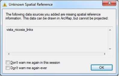
enter image description here

  1. Exported the file into a shapefile using 'the same coordinate system as the Data frame' option.

  2. Now in the Properties -> Source tab I can see the Geographic Coordinate System to be GCS_WGS_1984 and the 'Extend' info have 7 digits on the left of the comma.
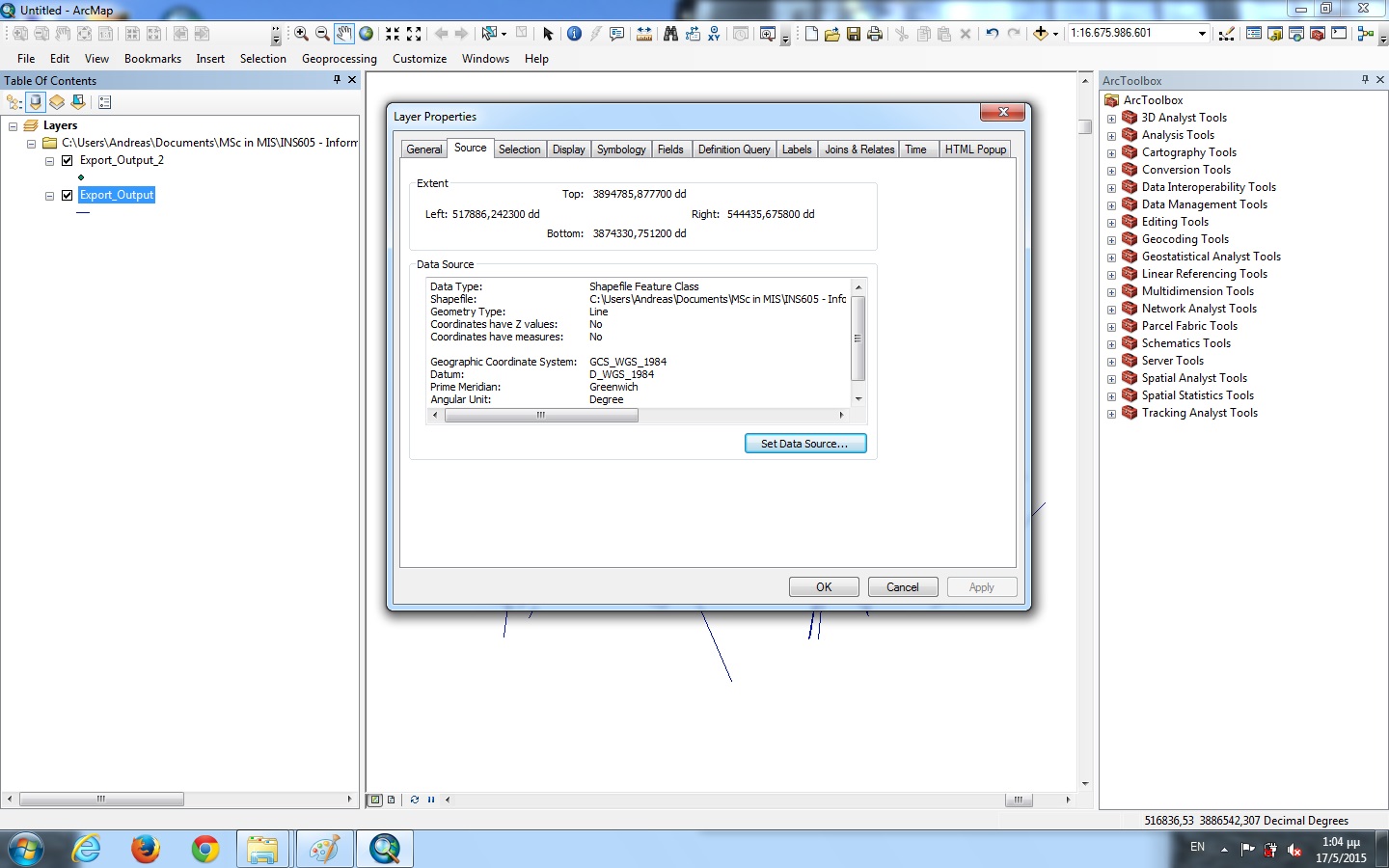
enter image description here

  1. I closed and re-opened ArcMap and performed actions of Step 1

  2. Then I added X,Y data from the Excel file and then right-click -> display X,Y data and specified the X and Y field. In the description of Input Coordinate System it was by default GCS_WGS_1984.

  3. I exported the data into a .shp file using 'the same coordinate system as the Data frame' option.

  4. I re-opened ArcMap and repeated actions in step 1 and imported the two shapefiles I created in steps 3 and 7

  5. The two shapefiles are displayed in entirely different positions the one far away from the other. I noticed that in right click -> Properties -> Source tab-> 'Extent' area of the Export_Output I see that there are 7 digits on the left of the comma (step 3), where as in Export_Output_2 I see only 2 digits on the left of the comma
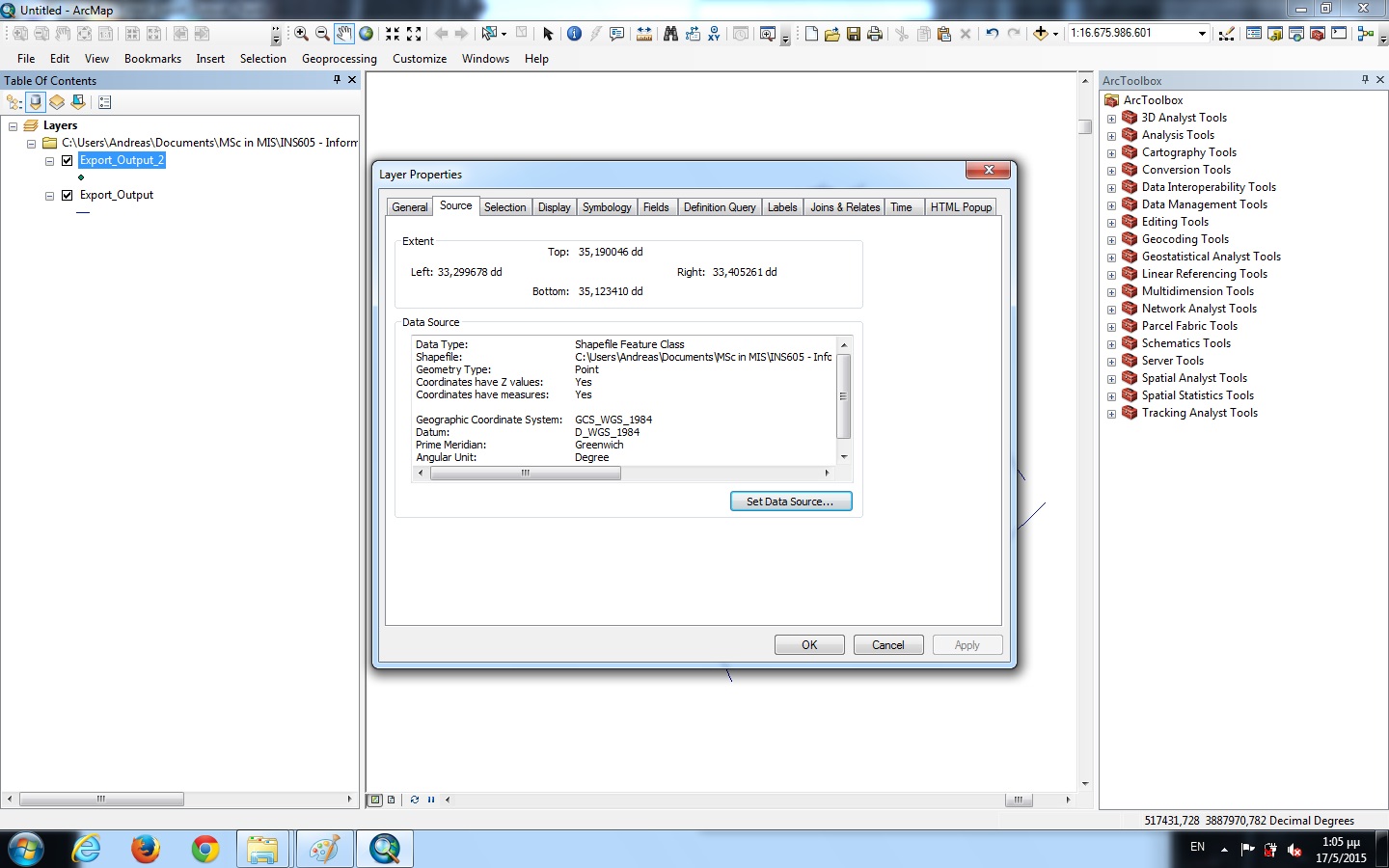
enter image description here

  1. Then I tried to project both shapefiles (one at a time) from "ArcToolbox -> Data Management Tools -> Projections and Transformations -> Define Projection" into Projected Coordinate system 'WGS 1984 World Mercator' but nothing seems to change or happening. They are both re-projected at the same (initial) positions.
2
  • +1 just because you were very thorough in describing exactly what steps you took, which a lot of people with this same question never do. See the first link in my comment on Jan's answer for your main problem. Your step 3 is the same thing as using the Define tool (or editing the properties in Catalog). I believe you're working with the points right, but to fix the shapefile issue you need to figure out what the correct CRS/projection to use is (second link on answer). Note that Projecting from the wrong CRS to another will really screw things up because it will actually change the values.
    – Chris W
    Commented May 17, 2015 at 20:03
  • ok i found the correct Geographic Coordinate System and managed (at last!!) to project my data successfully :)! Thanks for the help :)!!! Commented May 19, 2015 at 15:27

1 Answer 1

3

It seems the first dataset (vista_nicosia_links.shp) is using a different projection, most likely UTM (the zone depending on your data's location - for Nicosia, it is most likely UTM Zone 36 North).

To match the coordinates properly, you have to correctly determine and define the shapefile's coordinate system (using Define Projection or changing the properties in ArcCatalog)

You may also need to project the points dataset to UTM (or whatever correct coordinate system), using Project or just exporting it under that coordinate system depending on what projection you are going to use the data in.

4
  • 1
    Project won't do you any good unless you know what the correct CRS of the data is and it's set to that. In which case you wouldn't Project it, you'd Define it. gis.stackexchange.com/questions/20572 @andreas if your vista shapefile doesn't have a .prj file (which the warning box you got indicates) you need to determine what coordinate system it is in by either going back to the source, checking the metadata, or brute forcing (gis.stackexchange.com/questions/7839). Jan may be right about it being UTM36N, but you would have to Define, not Project, it to that CRS.
    – Chris W
    Commented May 17, 2015 at 19:54
  • @ChrisW yes, Define Projection is the way to go. Thanks for the reminder. Commented May 18, 2015 at 11:19
  • ok i found the correct Geographic Coordinate System and managed (at last!!) to project my data successfully :)! Thanks for the help :)!!! Commented May 19, 2015 at 15:27
  • If so, please mark the question as answered or submit your answer so that others can learn from what you've accomplished. Commented May 19, 2015 at 18:15

Your Answer

By clicking “Post Your Answer”, you agree to our terms of service and acknowledge you have read our privacy policy.

Not the answer you're looking for? Browse other questions tagged or ask your own question.