4

I am a novice to ArcMap 10.

I have this 2000 survey points shapefile and I was told to, I guess is dislocate, generate new survey points, each new should be 500m west and 500m south from the original point.

How can I do that in ArcMap 10?

I remember there used to be a move button, but I cannot find it now.

2 Answers 2

9

You can do it with field calculator using Python parser:

Create a copy of your file

Open table, select shape field, switch to advanced mode type:

def pMove(shp):
 pM=arcpy.Point()
 p=shp.firstPoint
 pM.X=p.X-500
 pM.Y=p.Y-500
 return pM

in the box below type:

pMove(!Shape!)

This is good place to learn about field calculator http://help.arcgis.com/EN/arcgisdesktop/10.0/help/index.html#//005s0000002m000000

0
7

If you are happy to eyeball it, the easiest way is just to turn on Editor mode:

Start Editing

Then select all your points and drag them towards the southwest roughly 500.0*sqrt(2)=707.1m.
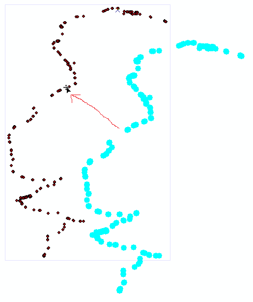
Drag


Alternatively if you want to move all points precisely 500.0m South and 500.0m West:

  • Take an existing point, copy and paste it.
  • Select the copied point and right-click > Edit Vertices, right-click > Move. Type in 500.0 by 500.0.

Move Point

This extra point will be used as an anchor point. Select all your points and, with your mouse on the original point, drag it and Snap it to the anchor point.
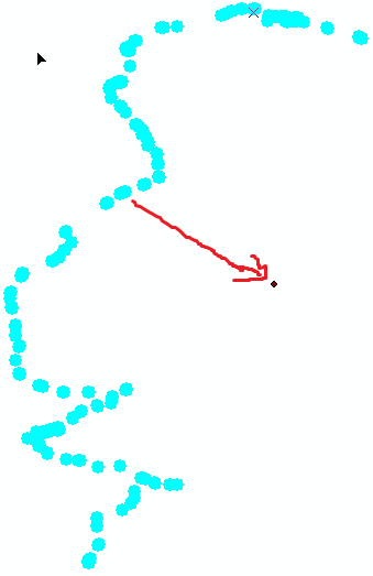
Anchor

Snapping behavior is controlled by a separate toolbar.

Snapping

You can delete the extraneous anchor point when you're done. This should get you pretty precise.

0

Your Answer

By clicking “Post Your Answer”, you agree to our terms of service and acknowledge you have read our privacy policy.

Not the answer you're looking for? Browse other questions tagged or ask your own question.