0

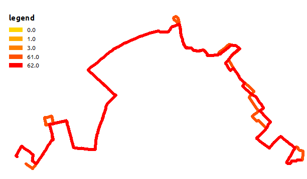
I use symbol levels to represent different overlaying lines by importance from a field value. The red lines are more important and yellow less. That's what I get in ArcMap:

arcmap rendering

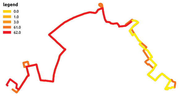
And now that's what I get after an Illustrator export:

enter image description here

Symbol levels are not respected as yellow and orange lines overlay red lines.

I use ArcMap 10.2 (I don't know if the problem is still in 10.3).

I observed that this problem happens randomly. PDF and EPS exports are not concerned by this issue.

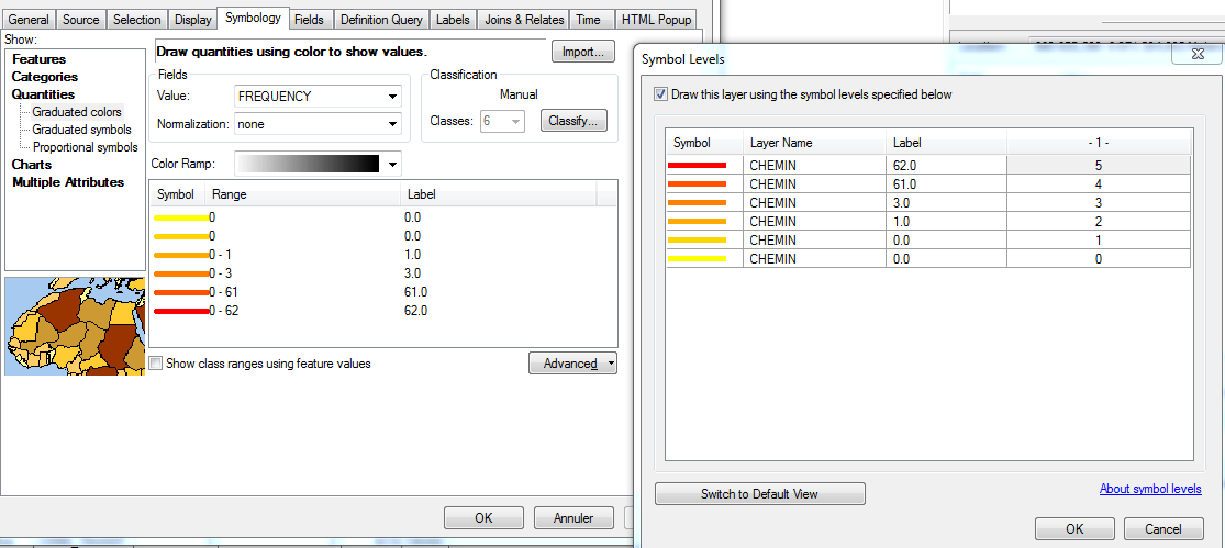
Here are the symbology and symbol levels properties for the layer:

enter image description here

2
  • Have you tried with setting CMYK( not RGB), Vectorise Markers with bitmap Marker/Fills and checking Convert Marker Symbols to Polygons in arc map export option?
    – Learner
    Commented Sep 22, 2015 at 8:25
  • I use these parameters except 'Convert marker symbols to polygons' is unchecked as I need to get characters in Illustrator for another usage. I just tried to check this option but the problem persists.
    – superrache
    Commented Sep 22, 2015 at 8:34

0

Your Answer

By clicking “Post Your Answer”, you agree to our terms of service and acknowledge you have read our privacy policy.